TopoQuest Logo
Do you find TopoQuest useful?
Help keep TopoQuest running and adding new maps/features by donating!
Bitcoin:  19c7KJd3qBynnjoSw5npx9KScwjBe4ifkT
Litecoin:  LXs6TkuXGGXo1vDsWCkWVdjQX94eUKd6ui
Home View Maps Find Maps Find Places Resources & Links


Brooklyn, Georgia Topographic Map

USGS Map Title: Brooklyn, GA
USGS Map MRC: 32084B6
DRG (GeoTIFF) Download: o32084b6.tif


Neighboring USGS Topographic Map Quads:


  Cusseta, GA  
32084C7
 

  Glen Alta, GA  
32084C6
 

  Buena Vista, GA  
32084C5
 

  Louvale, GA  
32084B7
 

  Brooklyn, GA  
32084B6
 

  Church Hill, GA  
32084B5
 

  Lumpkin, GA  
32084A7
 

  Richland, GA  
32084A6
 

  Preston, GA  
32084A5


Map MRC Location:

N33°
W85°
N33°
W84°
H8 H7 H6 H5 H4 H3 H2 H1
G8 G7 G6 G5 G4 G3 G2 G1
F8 F7 F6 F5 F4 F3 F2 F1
E8 E7 E6 E5 E4 E3 E2 E1
D8 D7 D6 D5 D4 D3 D2 D1
C8 C7 C6 C5 C4 C3 C2 C1
B8 B7 B6 B5 B4 B3 B2 B1
A8 A7 A6 A5 A4 A3 A2 A1
N32°
W85°
N32°
W84°

Brooklyn, GA USGS 1:24K Topographic Map Preview:
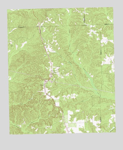
Brooklyn, GA USGS Topographic Map
Click on map above to begin viewing in our Map Viewer.

This topographic map contains these locations and features:
Feature Name Type Latitude Longitude GNIS ID View Map
BrooklynPopulated PlaceN32.1738°W84.7085°354865View Map
Brooklyn Methodist ChurchChurchN32.1827°W84.7005°347282View Map
Chamblers BranchStreamN32.1282°W84.7333°355103View Map
Christmas Branch DamDamN32.1302°W84.6266°337329View Map
Christmas Branch LakeReservoirN32.1291°W84.6284°337330View Map
Fellowship ChurchChurchN32.1754°W84.7083°347290View Map
Good Hope ChurchChurchN32.2327°W84.7102°314684View Map
Green Hill School (historical)SchoolN32.2202°W84.7483°347300View Map
Little Slaughter CreekStreamN32.1640°W84.6455°317203View Map
Pickett-Shipley CemeteryCemeteryN32.1857°W84.6394°345029View Map
Pine Grove School (historical)SchoolN32.1457°W84.7330°347335View Map
Red Hill ChurchChurchN32.1418°W84.6871°321383View Map
RenfroePopulated PlaceN32.2327°W84.7124°332831View Map
Saint Matthew Church (historical)ChurchN32.2407°W84.6605°351061View Map
Saint Phillip's CemeteryCemeteryN32.2140°W84.7460°2026223View Map
Saint Phillips ChurchChurchN32.2140°W84.7460°322306View Map
Sand BranchStreamN32.1643°W84.6471°322405View Map
Shady GrovePopulated PlaceN32.1857°W84.6980°347352View Map
Shady Grove ChurchChurchN32.1860°W84.6966°322752View Map
Slaughter Creek (historical)Populated PlaceN32.1915°W84.6880°347355View Map
Slaughter Creek CemeteryCemeteryN32.1921°W84.6888°323078View Map
Slaughter Creek Primitive Baptist Church (historical)ChurchN32.1913°W84.6888°347356View Map
Van Cleve LakeReservoirN32.1563°W84.6654°342306View Map
Van Cleve Lake DamDamN32.1568°W84.6633°342305View Map

Note: Coordinates in the location and feature list above are referenced to NAD83 datum.


Copyright (C) 2008-2025 Ryan Niemi / Sunset Dynamics ... All Rights Reserved