TopoQuest Logo
Do you find TopoQuest useful?
Help keep TopoQuest running and adding new maps/features by donating!
Bitcoin:  19c7KJd3qBynnjoSw5npx9KScwjBe4ifkT
Litecoin:  LXs6TkuXGGXo1vDsWCkWVdjQX94eUKd6ui
Home View Maps Find Maps Find Places Resources & Links


Brooklyn, Washington Topographic Map

USGS Map Title: Brooklyn, WA
USGS Map MRC: 46123G5
DRG (GeoTIFF) Download: o46123g5.tif


Neighboring USGS Topographic Map Quads:


  Central Park, WA  
46123H6
 

  Montesano, WA  
46123H5
 

  South Elma, WA  
46123H4
 

  Elkhorn Creek, WA  
46123G6
 

  Brooklyn, WA  
46123G5
 

  Blue Mountain, WA  
46123G4
 

  Raymond, WA  
46123F6
 

  East of Raymond, WA  
46123F5
 

  Dean Creek, WA  
46123F4


Map MRC Location:

N47°
W124°
N47°
W123°
H8 H7 H6 H5 H4 H3 H2 H1
G8 G7 G6 G5 G4 G3 G2 G1
F8 F7 F6 F5 F4 F3 F2 F1
E8 E7 E6 E5 E4 E3 E2 E1
D8 D7 D6 D5 D4 D3 D2 D1
C8 C7 C6 C5 C4 C3 C2 C1
B8 B7 B6 B5 B4 B3 B2 B1
A8 A7 A6 A5 A4 A3 A2 A1
N46°
W124°
N46°
W123°

Brooklyn, WA USGS 1:24K Topographic Map Preview:
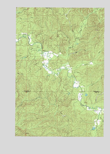
Brooklyn, WA USGS Topographic Map
Click on map above to begin viewing in our Map Viewer.

This topographic map contains these locations and features:
Feature Name Type Latitude Longitude GNIS ID View Map
Alder CreekStreamN46.8195°W123.5829°1502965View Map
Archer CreekStreamN46.7998°W123.5354°1503054View Map
Banas FieldAirportN46.7997°W123.5411°2443343View Map
Beaver CreekStreamN46.8404°W123.5954°1503257View Map
BrooklynPopulated PlaceN46.7762°W123.5099°1510840View Map
Deer CreekStreamN46.8295°W123.5535°1504409View Map
East Fork Vesta CreekStreamN46.8715°W123.5174°1504641View Map
Fall RiverStreamN46.7779°W123.5032°1504819View Map
Fir CreekStreamN46.8373°W123.5468°1504885View Map
Godes CreekStreamN46.7793°W123.5171°1505160View Map
Grays Harbor Fire District 15 North River Station 2BuildingN46.8176°W123.5808°2643294View Map
Leach CreekStreamN46.8443°W123.5407°1506119View Map
Moss CreekStreamN46.7670°W123.5099°1506813View Map
Pioneer CreekStreamN46.8159°W123.5499°1507462View Map
VestaPopulated PlaceN46.8332°W123.5888°1511396View Map
Vesta CreekStreamN46.8309°W123.5810°1509220View Map
West Fork Vesta CreekStreamN46.8715°W123.5165°1509406View Map

Note: Coordinates in the location and feature list above are referenced to NAD83 datum.


Copyright (C) 2008-2025 Ryan Niemi / Sunset Dynamics ... All Rights Reserved