TopoQuest Logo
Do you find TopoQuest useful?
Help keep TopoQuest running and adding new maps/features by donating!
Bitcoin:  19c7KJd3qBynnjoSw5npx9KScwjBe4ifkT
Litecoin:  LXs6TkuXGGXo1vDsWCkWVdjQX94eUKd6ui
Home View Maps Find Maps Find Places Resources & Links


Alkali Lake, Montana Topographic Map

USGS Map Title: Alkali Lake, MT
USGS Map MRC: 46111D1
DRG (GeoTIFF) Download: o46111d1.tif


Neighboring USGS Topographic Map Quads:


  Gipsy Lake, MT  
46111E2
 

  Hanson Reservoir, MT  
46111E1
 

  White Sulphur Springs, MT  
46110E8
 

  Mount Edith, MT  
46111D2
 

  Alkali Lake, MT  
46111D1
 

  Catlin Spring, MT  
46110D8
 

  Sulphur Bar Creek, MT  
46111C2
 

  Battle Mountain, MT  
46111C1
 

  Black Butte Mountain, MT  
46110C8


Map MRC Location:

N47°
W112°
N47°
W111°
H8 H7 H6 H5 H4 H3 H2 H1
G8 G7 G6 G5 G4 G3 G2 G1
F8 F7 F6 F5 F4 F3 F2 F1
E8 E7 E6 E5 E4 E3 E2 E1
D8 D7 D6 D5 D4 D3 D2 D1
C8 C7 C6 C5 C4 C3 C2 C1
B8 B7 B6 B5 B4 B3 B2 B1
A8 A7 A6 A5 A4 A3 A2 A1
N46°
W112°
N46°
W111°

Alkali Lake, MT USGS 1:24K Topographic Map Preview:
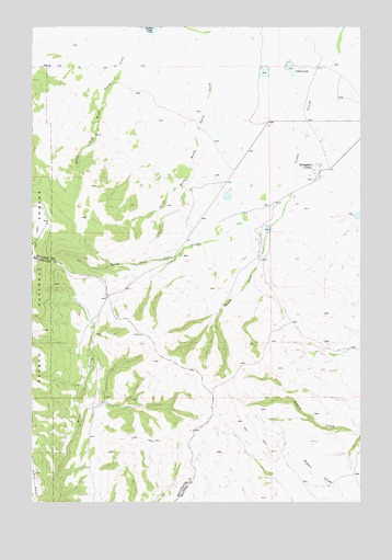
Alkali Lake, MT USGS Topographic Map
Click on map above to begin viewing in our Map Viewer.

This topographic map contains these locations and features:
Feature Name Type Latitude Longitude GNIS ID View Map
08N06E07DD__01 WellWellN46.4605°W111.0155°816372View Map
Alkali LakeReservoirN46.4889°W111.0273°794689View Map
Jackson LakeReservoirN46.4998°W111.0817°795026View Map
Jackson Lake DamDamN46.4999°W111.0791°795025View Map
MangerLocaleN46.4455°W111.0452°794691View Map
North Fork Cooks CreekStreamN46.4394°W111.0391°788121View Map
O ConnorLocaleN46.4724°W111.0605°794690View Map
Onion Head DamDamN46.4716°W111.0524°798708View Map
Screwed Up DamDamN46.4549°W111.0508°798282View Map
ShindahlLocaleN46.3991°W111.1013°794686View Map
South Fork Cooks CreekStreamN46.4394°W111.0388°790930View Map
Springdale ColonyPopulated PlaceN46.4619°W111.0163°802202View Map
Springdale Colony DamDamN46.4883°W111.0308°795024View Map
Springdale Colony SchoolSchoolN46.4619°W111.0163°1762831View Map
Springdale DamDamN46.4883°W111.0391°796224View Map
Springdale Number 2 DamDamN46.4466°W111.0274°796225View Map
Springdale Number 3 DamDamN46.4466°W111.0358°796226View Map
Springdale Number 4 DamDamN46.4499°W111.0008°796230View Map
Unity Post Office (historical)Post OfficeN46.4535°W111.0341°1762720View Map
Unity School (historical)SchoolN46.4535°W111.0341°1762729View Map

Note: Coordinates in the location and feature list above are referenced to NAD83 datum.


Copyright (C) 2008-2024 Ryan Niemi / Sunset Dynamics ... All Rights Reserved