TopoQuest Logo
Do you find TopoQuest useful?
Help keep TopoQuest running and adding new maps/features by donating!
Bitcoin:  19c7KJd3qBynnjoSw5npx9KScwjBe4ifkT
Litecoin:  LXs6TkuXGGXo1vDsWCkWVdjQX94eUKd6ui
Home View Maps Find Maps Find Places Resources & Links


Brother Ponds, New York Topographic Map

USGS Map Title: Brother Ponds, NY
USGS Map MRC: 44074C7
DRG (GeoTIFF) Download: o44074c7.tif


Neighboring USGS Topographic Map Quads:


  Albert Marsh, NY  
44074D8
 

  Stark, NY  
44074D7
 

  Carry Falls Reservoir, NY  
44074D6
 

  Tooley Pond, NY  
44074C8
 

  Brother Ponds, NY  
44074C7
 

  Childwold, NY  
44074C6
 

  Newton Falls, NY  
44074B8
 

  Cranberry Lake, NY  
44074B7


Map MRC Location:

N45°
W75°
N45°
W74°
H8 H7 H6 H5 H4 H3 H2 H1
G8 G7 G6 G5 G4 G3 G2 G1
F8 F7 F6 F5 F4 F3 F2 F1
E8 E7 E6 E5 E4 E3 E2 E1
D8 D7 D6 D5 D4 D3 D2 D1
C8 C7 C6 C5 C4 C3 C2 C1
B8 B7 B6 B5 B4 B3 B2 B1
A8 A7 A6 A5 A4 A3 A2 A1
N44°
W75°
N44°
W74°

Brother Ponds, NY USGS 1:24K Topographic Map Preview:
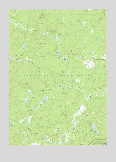
Brother Ponds, NY USGS Topographic Map
Click on map above to begin viewing in our Map Viewer.

This topographic map contains these locations and features:
Feature Name Type Latitude Longitude GNIS ID View Map
Balsam PondLakeN44.2525°W74.7546°975915View Map
Beaver PondLakeN44.3293°W74.8029°975946View Map
Brother PondsLakeN44.2891°W74.8349°976035View Map
Buckhorn RidgeRidgeN44.3459°W74.8663°976054View Map
Cary HillSummitN44.3365°W74.7963°976084View Map
Clear PondLakeN44.3347°W74.8117°976152View Map
Cook Pond OutletStreamN44.2703°W74.8721°976183View Map
Dead CreekStreamN44.2526°W74.8096°976228View Map
Dismal SwampSwampN44.3156°W74.8110°976247View Map
Egg PondLakeN44.2640°W74.7692°976287View Map
Grass PondLakeN44.2501°W74.7796°976362View Map
Hardwood IslandRidgeN44.3112°W74.8177°976410View Map
Hardwood RidgeRidgeN44.3676°W74.8341°976411View Map
Irish BrookStreamN44.2551°W74.8252°976473View Map
Irish HillSummitN44.2670°W74.8332°976474View Map
Lem PondLakeN44.3032°W74.7989°976540View Map
Little Blue MountainSummitN44.3545°W74.8188°976555View Map
Little Blue PondLakeN44.3510°W74.8137°976556View Map
Little MountainSummitN44.2998°W74.8338°976567View Map
Lone PondLakeN44.3476°W74.7587°976581View Map
Pleasant LakeLakeN44.3410°W74.8554°976832View Map
Potter MountainSummitN44.3470°W74.8294°976854View Map
Sampson PondLakeN44.2668°W74.7654°976958View Map
Sampson Pond OutletStreamN44.2812°W74.7860°976959View Map
Stony BrookStreamN44.3281°W74.8635°977072View Map
Town of ColtonCivilN44.3376°W74.7913°978854View Map
Twin Ponds OutletStreamN44.2759°W74.8502°977157View Map
Webb CreekStreamN44.3648°W74.8719°977191View Map
Wilson MountainSummitN44.3065°W74.8538°977286View Map
Windfall BrookStreamN44.2923°W74.7757°977289View Map
Wolf PondLakeN44.3042°W74.8098°977297View Map
Wolf RidgeRidgeN44.2703°W74.7716°977299View Map

Note: Coordinates in the location and feature list above are referenced to NAD83 datum.


Copyright (C) 2008-2024 Ryan Niemi / Sunset Dynamics ... All Rights Reserved