TopoQuest Logo
Do you find TopoQuest useful?
Help keep TopoQuest running and adding new maps/features by donating!
Bitcoin:  19c7KJd3qBynnjoSw5npx9KScwjBe4ifkT
Litecoin:  LXs6TkuXGGXo1vDsWCkWVdjQX94eUKd6ui
Home View Maps Find Maps Find Places Resources & Links


Bruneau, Idaho Topographic Map

USGS Map Title: Bruneau, ID
USGS Map MRC: 42115H7
DRG (GeoTIFF) Download: o42115h7.tif


Neighboring USGS Topographic Map Quads:


  Crater Rings SW, ID  
43115A8
 

  Crater Rings SE, ID  
43115A7
 

  Mountain Home South, ID  
43115A6
 

  C J Strike Dam, ID  
42115H8
 

  Bruneau, ID  
42115H7
 

  Bruneau Dunes, ID  
42115H6
 

  Little Valley, ID  
42115G8
 

  Sugar Valley, ID  
42115G7
 

  Hot Springs, ID  
42115G6


Map MRC Location:

N43°
W116°
N43°
W115°
H8 H7 H6 H5 H4 H3 H2 H1
G8 G7 G6 G5 G4 G3 G2 G1
F8 F7 F6 F5 F4 F3 F2 F1
E8 E7 E6 E5 E4 E3 E2 E1
D8 D7 D6 D5 D4 D3 D2 D1
C8 C7 C6 C5 C4 C3 C2 C1
B8 B7 B6 B5 B4 B3 B2 B1
A8 A7 A6 A5 A4 A3 A2 A1
N42°
W116°
N42°
W115°

Bruneau, ID USGS 1:24K Topographic Map Preview:
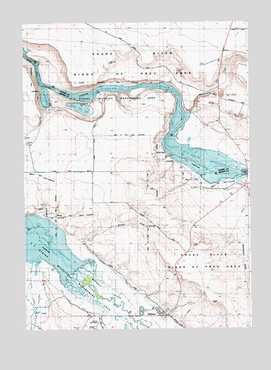
Bruneau, ID USGS Topographic Map
Click on map above to begin viewing in our Map Viewer.

This topographic map contains these locations and features:
Feature Name Type Latitude Longitude GNIS ID View Map
BruneauPopulated PlaceN42.8805°W115.7973°396181View Map
Bruneau ArmBayN42.9166°W115.8715°376393View Map
Bruneau Elementary SchoolSchoolN42.8832°W115.8045°376394View Map
Bruneau Fire DepartmentBuildingN42.8814°W115.7980°2619217View Map
Bruneau Guard StationLocaleN42.8802°W115.8351°376395View Map
Bruneau Post OfficePost OfficeN42.8818°W115.7996°2766803View Map
Cove Arm LakeLakeN42.9692°W115.8629°376399View Map
Crabb ButteSummitN42.8860°W115.7715°399442View Map
Crane Falls (historical)FallsN42.9738°W115.8306°376368View Map
Crane Falls LakeLakeN42.9653°W115.8433°376401View Map
Edgington Island (historical)IslandN42.9413°W115.7812°376374View Map
Emigrant Crossing (historical)LocaleN42.9180°W115.8748°396463View Map
Indian Cove Wildlife Habitat AreaReserveN42.9143°W115.7595°401403View Map
Jacks CreekStreamN42.9005°W115.8712°376073View Map
Little ValleyValleyN42.8943°W115.8704°373682View Map
Little Valley SchoolLocaleN42.8988°W115.8668°373684View Map
Loveridge BridgeBridgeN42.9380°W115.7515°376377View Map
Loveridge Bridge Access AreaLocaleN42.9421°W115.7504°401555View Map
Loveridge Island (historical)IslandN42.9371°W115.7673°376378View Map
Rattlesnake CreekStreamN42.9610°W115.7854°376382View Map
South Side CanalCanalN42.8813°W115.8351°375176View Map
Sugar Valley WashCanalN42.8777°W115.8715°376388View Map
Tyrrel Island (historical)IslandN42.9610°W115.7890°376390View Map
Waterhouse GulchValleyN42.9157°W115.7543°375762View Map
Weatherby SpringsSpringN42.9899°W115.8743°398325View Map
Wilkins GulchValleyN42.9116°W115.8420°375908View Map
Young Landing Area (historical)AirportN42.9546°W115.8176°397347View Map

Note: Coordinates in the location and feature list above are referenced to NAD83 datum.


Copyright (C) 2008-2024 Ryan Niemi / Sunset Dynamics ... All Rights Reserved