TopoQuest Logo
Do you find TopoQuest useful?
Help keep TopoQuest running and adding new maps/features by donating!
Bitcoin:  19c7KJd3qBynnjoSw5npx9KScwjBe4ifkT
Litecoin:  LXs6TkuXGGXo1vDsWCkWVdjQX94eUKd6ui
Home View Maps Find Maps Find Places Resources & Links


Bryan, Wyoming Topographic Map

USGS Map Title: Bryan, WY
USGS Map MRC: 41109E6
DRG (GeoTIFF) Download: o41109e6.tif


Neighboring USGS Topographic Map Quads:


  Blue Point, WY  
41109F7
 

  Stevens Flat, WY  
41109F6
 

  Austin Ranch, WY  
41109F5
 

  Little America, WY  
41109E7
 

  Bryan, WY  
41109E6
 

  Peru, WY  
41109E5
 

  Antelope Knoll NE, WY  
41109D7
 

  Massacre Hill, WY  
41109D6
 

  Blacks Fork Bridge, WY  
41109D5


Map MRC Location:

N42°
W110°
N42°
W109°
H8 H7 H6 H5 H4 H3 H2 H1
G8 G7 G6 G5 G4 G3 G2 G1
F8 F7 F6 F5 F4 F3 F2 F1
E8 E7 E6 E5 E4 E3 E2 E1
D8 D7 D6 D5 D4 D3 D2 D1
C8 C7 C6 C5 C4 C3 C2 C1
B8 B7 B6 B5 B4 B3 B2 B1
A8 A7 A6 A5 A4 A3 A2 A1
N41°
W110°
N41°
W109°

Bryan, WY USGS 1:24K Topographic Map Preview:
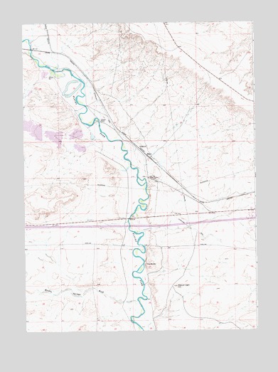
Bryan, WY USGS Topographic Map
Click on map above to begin viewing in our Map Viewer.

This topographic map contains these locations and features:
Feature Name Type Latitude Longitude GNIS ID View Map
Alchem Trona MineMineN41.5986°W109.7407°1747015View Map
Allied Number 4 Tailings Pond DamDamN41.5383°W109.7090°1608223View Map
Allied Trona MineMineN41.6202°W109.7049°1747018View Map
Beacon Light HillSummitN41.5180°W109.6682°1585233View Map
BryanPopulated PlaceN41.5705°W109.6821°1597233View Map
Bryan CemeteryCemeteryN41.5752°W109.6865°2774469View Map
Diamond Alkali Company Number Three MineMineN41.5400°W109.6279°1747016View Map
FMC Wyoming Corporation Fire BrigadeBuildingN41.5454°W109.6955°2673567View Map
Lone Tree Stage StationLocaleN41.5622°W109.6826°1590963View Map
Meadow Springs WashValleyN41.5108°W109.6885°1596861View Map
Number 2 DamDamN41.5850°W109.7424°1608180View Map
Number 2 Evaporation ReservoirReservoirN41.5811°W109.7427°1608181View Map
Number 3 DamDamN41.5816°W109.7390°1608182View Map
Number 3 Evaporation ReservoirReservoirN41.5789°W109.7329°1608183View Map
Number 4 DamDamN41.5750°W109.7190°1608184View Map
Number 5a DamDamN41.5750°W109.7274°1608400View Map
Number 5a ReservoirReservoirN41.5750°W109.7274°1608401View Map
Pierotto RanchLocaleN41.5850°W109.7085°1592745View Map
Potash Company of America Number Two MineMineN41.5519°W109.6646°1747017View Map
Sewage LagoonReservoirN41.6044°W109.7384°1608177View Map
Sewage Lagoon DamDamN41.6033°W109.7374°1608176View Map
Solid Waste Disposal Cell E ReservoirReservoirN41.5841°W109.7499°1608427View Map
Solid Waste Disposal Cell H ReservoirReservoirN41.5841°W109.7499°1608431View Map
The BluffsCliffN41.5283°W109.6826°1595404View Map

Note: Coordinates in the location and feature list above are referenced to NAD83 datum.


Copyright (C) 2008-2025 Ryan Niemi / Sunset Dynamics ... All Rights Reserved