TopoQuest Logo
Do you find TopoQuest useful?
Help keep TopoQuest running and adding new maps/features by donating!
Bitcoin:  19c7KJd3qBynnjoSw5npx9KScwjBe4ifkT
Litecoin:  LXs6TkuXGGXo1vDsWCkWVdjQX94eUKd6ui
Home View Maps Find Maps Find Places Resources & Links


Abernathy, Texas Topographic Map

USGS Map Title: Abernathy, TX
USGS Map MRC: 33101G7
DRG (GeoTIFF) Download: o33101g7.tif


Neighboring USGS Topographic Map Quads:


  Cotton Center, TX  
33101H8
 

  Underwood, TX  
33101H7
 

  Julia Lake, TX  
33101H6
 

  Abernathy SW, TX  
33101G8
 

  Abernathy, TX  
33101G7
 

  Heckville, TX  
33101G6
 

  Shallowater, TX  
33101F8
 

  New Deal, TX  
33101F7
 

  Idalou, TX  
33101F6


Map MRC Location:

N34°
W102°
N34°
W101°
H8 H7 H6 H5 H4 H3 H2 H1
G8 G7 G6 G5 G4 G3 G2 G1
F8 F7 F6 F5 F4 F3 F2 F1
E8 E7 E6 E5 E4 E3 E2 E1
D8 D7 D6 D5 D4 D3 D2 D1
C8 C7 C6 C5 C4 C3 C2 C1
B8 B7 B6 B5 B4 B3 B2 B1
A8 A7 A6 A5 A4 A3 A2 A1
N33°
W102°
N33°
W101°

Abernathy, TX USGS 1:24K Topographic Map Preview:
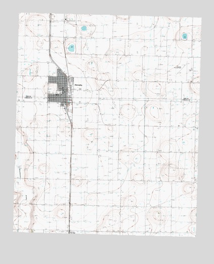
Abernathy, TX USGS Topographic Map
Click on map above to begin viewing in our Map Viewer.

This topographic map contains these locations and features:
Feature Name Type Latitude Longitude GNIS ID View Map
AbernathyPopulated PlaceN33.8323°W101.8429°1350851View Map
Abernathy CemeteryCemeteryN33.8476°W101.8637°2773385View Map
Abernathy City HallBuildingN33.8319°W101.8436°2753480View Map
Abernathy Elementary SchoolSchoolN33.8298°W101.8457°2005406View Map
Abernathy Emergency Medical ServicesBuildingN33.8315°W101.8441°2655913View Map
Abernathy High SchoolSchoolN33.8305°W101.8453°2005407View Map
Abernathy Middle SchoolSchoolN33.8312°W101.8454°2005408View Map
Abernathy Municipal AirportAirportN33.8449°W101.7579°1386108View Map
Abernathy Police DepartmentBuildingN33.8319°W101.8436°2750354View Map
Abernathy Post OfficePost OfficeN33.8316°W101.8436°2731477View Map
Abernathy Volunteer Fire DepartmentBuildingN33.8321°W101.8439°2552030View Map
Center ChurchChurchN33.7842°W101.7516°1354188View Map
Church of ChristChurchN33.8326°W101.8446°2022469View Map
City of AbernathyCivilN33.8254°W101.8545°2409656View Map
Cravens Oil FieldOilfieldN33.7667°W101.8729°1355315View Map
First Baptist ChurchChurchN33.8254°W101.8527°2022554View Map
First Church of the NazareneChurchN33.8284°W101.8446°2022493View Map
North Side Baptist ChurchChurchN33.8406°W101.8449°2019473View Map
Strip CemeteryCemeteryN33.8551°W101.7731°1369288View Map

Note: Coordinates in the location and feature list above are referenced to NAD83 datum.


Copyright (C) 2008-2025 Ryan Niemi / Sunset Dynamics ... All Rights Reserved