TopoQuest Logo
Do you find TopoQuest useful?
Help keep TopoQuest running and adding new maps/features by donating!
Bitcoin:  19c7KJd3qBynnjoSw5npx9KScwjBe4ifkT
Litecoin:  LXs6TkuXGGXo1vDsWCkWVdjQX94eUKd6ui
Home View Maps Find Maps Find Places Resources & Links


Buckhorn Lakes, Colorado Topographic Map

USGS Map Title: Buckhorn Lakes, CO
USGS Map MRC: 38107C6
DRG (GeoTIFF) Download: o38107c6.tif


Neighboring USGS Topographic Map Quads:


  Montrose East, CO  
38107D7
 

  Cerro Summit, CO  
38107D6
 

  Cimarron, CO  
38107D5
 

  Colona, CO  
38107C7
 

  Buckhorn Lakes, CO  
38107C6
 

  Washboard Rock, CO  
38107C5
 

  Ridgway, CO  
38107B7
 

  Dallas, CO  
38107B6
 

  Courthouse Mountain, CO  
38107B5


Map MRC Location:

N39°
W108°
N39°
W107°
H8 H7 H6 H5 H4 H3 H2 H1
G8 G7 G6 G5 G4 G3 G2 G1
F8 F7 F6 F5 F4 F3 F2 F1
E8 E7 E6 E5 E4 E3 E2 E1
D8 D7 D6 D5 D4 D3 D2 D1
C8 C7 C6 C5 C4 C3 C2 C1
B8 B7 B6 B5 B4 B3 B2 B1
A8 A7 A6 A5 A4 A3 A2 A1
N38°
W108°
N38°
W107°

Buckhorn Lakes, CO USGS 1:24K Topographic Map Preview:
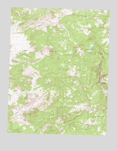
Buckhorn Lakes, CO USGS Topographic Map
Click on map above to begin viewing in our Map Viewer.

This topographic map contains these locations and features:
Feature Name Type Latitude Longitude GNIS ID View Map
Billy Creek State Wildlife AreaParkN38.2655°W107.7159°169384View Map
Brook CreekStreamN38.2905°W107.7264°188257View Map
Brow CreekStreamN38.2933°W107.7084°188253View Map
Buckhorn Lake Number 1ReservoirN38.3402°W107.6532°200813View Map
Buckhorn Lake Number 1 DamDamN38.3400°W107.6539°200812View Map
Buckhorn Lake Number 2ReservoirN38.3350°W107.6473°200815View Map
Buckhorn Lake Number 2 DamDamN38.3350°W107.6473°200814View Map
Buckhorn LakesLakeN38.3389°W107.6464°188262View Map
Buckhorn Lakes ParkParkN38.3361°W107.6478°188261View Map
Castle RockPillarN38.3094°W107.6331°188254View Map
Chaffe Gulch Dentention Number 6 DamDamN38.2733°W107.7223°200451View Map
Chaffe Gulch Dentention Number 6 ReservoirReservoirN38.2741°W107.7214°200452View Map
Comerer RanchLocaleN38.2930°W107.7095°188248View Map
Coons ReservoirReservoirN38.2675°W107.6342°188249View Map
Jutten CabinLocaleN38.3236°W107.6723°188260View Map
Jutten LakesLakeN38.3158°W107.6576°188258View Map
KKXK-FM (Montrose)TowerN38.3378°W107.6403°204906View Map
Onion LakesLakeN38.3242°W107.6556°188259View Map
Sawtooth RocksPillarN38.3314°W107.6353°188263View Map
Slagle PassGapN38.2880°W107.6295°188256View Map
Storm KingSummitN38.3153°W107.6373°188255View Map
Tyler MineMineN38.2753°W107.6448°188250View Map

Note: Coordinates in the location and feature list above are referenced to NAD83 datum.


Copyright (C) 2008-2024 Ryan Niemi / Sunset Dynamics ... All Rights Reserved