TopoQuest Logo
Do you find TopoQuest useful?
Help keep TopoQuest running and adding new maps/features by donating!
Bitcoin:  19c7KJd3qBynnjoSw5npx9KScwjBe4ifkT
Litecoin:  LXs6TkuXGGXo1vDsWCkWVdjQX94eUKd6ui
Home View Maps Find Maps Find Places Resources & Links


Buffalo Lake, Minnesota Topographic Map

USGS Map Title: Buffalo Lake, MN
USGS Map MRC: 44094F5
DRG (GeoTIFF) Download: o44094f5.tif


Neighboring USGS Topographic Map Quads:


  Churchill, MN  
44094G6
 

  Lake Allie, MN  
44094G5
 

  Heatwole, MN  
44094G4
 

  Hector, MN  
44094F6
 

  Buffalo Lake, MN  
44094F5
 

  Stewart, MN  
44094F4
 

  Fairfax, MN  
44094E6
 

  Gibbon, MN  
44094E5
 

  Winthrop SW, MN  
44094E4


Map MRC Location:

N45°
W95°
N45°
W94°
H8 H7 H6 H5 H4 H3 H2 H1
G8 G7 G6 G5 G4 G3 G2 G1
F8 F7 F6 F5 F4 F3 F2 F1
E8 E7 E6 E5 E4 E3 E2 E1
D8 D7 D6 D5 D4 D3 D2 D1
C8 C7 C6 C5 C4 C3 C2 C1
B8 B7 B6 B5 B4 B3 B2 B1
A8 A7 A6 A5 A4 A3 A2 A1
N44°
W95°
N44°
W94°

Buffalo Lake, MN USGS 1:24K Topographic Map Preview:
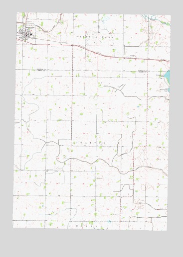
Buffalo Lake, MN USGS Topographic Map
Click on map above to begin viewing in our Map Viewer.

This topographic map contains these locations and features:
Feature Name Type Latitude Longitude GNIS ID View Map
Brack CemeteryCemeteryN44.6547°W94.5569°640410View Map
Buck LakebedFlatN44.7069°W94.5405°640586View Map
Buffalo LakeLocaleN44.7361°W94.6178°2065492View Map
Buffalo LakePopulated PlaceN44.7372°W94.6169°640614View Map
Buffalo Lake AmbulanceBuildingN44.7382°W94.6165°2721234View Map
Buffalo Lake CemeteryCemeteryN44.7361°W94.6103°2065500View Map
Buffalo Lake Fire DepartmentBuildingN44.7382°W94.6165°2065497View Map
Buffalo Lake Hector Elementary SchoolSchoolN44.7372°W94.6133°2065499View Map
Buffalo Lake Nursing HomeHospitalN44.7383°W94.6244°2065498View Map
Buffalo Lake Police DepartmentBuildingN44.7382°W94.6165°2065496View Map
Buffalo Lake Post OfficePost OfficeN44.7367°W94.6167°2065494View Map
City of Buffalo LakeCivilN44.7371°W94.6181°2393458View Map
County Ditch Number FifteenCanalN44.7466°W94.6200°641695View Map
County Ditch Number NineCanalN44.6402°W94.5164°642360View Map
County Ditch Number TenCanalN44.6736°W94.5292°641567View Map
County Ditch Number ThirtyoneCanalN44.6283°W94.5308°641948View Map
Evangelical CemeteryCemeteryN44.7447°W94.6172°643433View Map
Judicial Ditch Number ElevenCanalN44.6758°W94.5950°645786View Map
Judicial Ditch Number TwentyfourCanalN44.7025°W94.5044°645866View Map
Knopke-Brown CemeteryCemeteryN44.7097°W94.5689°2065086View Map
Oakdale Country ClubLocaleN44.7372°W94.6167°2065495View Map
Township of GraftonCivilN44.6732°W94.5636°664306View Map
United Brethren CemeteryCemeteryN44.6586°W94.5989°653520View Map
Zion United Methodist ChurchChurchN44.7386°W94.6186°2065493View Map

Note: Coordinates in the location and feature list above are referenced to NAD83 datum.


Copyright (C) 2008-2025 Ryan Niemi / Sunset Dynamics ... All Rights Reserved