TopoQuest Logo
Do you find TopoQuest useful?
Help keep TopoQuest running and adding new maps/features by donating!
Bitcoin:  19c7KJd3qBynnjoSw5npx9KScwjBe4ifkT
Litecoin:  LXs6TkuXGGXo1vDsWCkWVdjQX94eUKd6ui
Home View Maps Find Maps Find Places Resources & Links


Buffalo NE, Wyoming Topographic Map

USGS Map Title: Buffalo NE, WY
USGS Map MRC: 44106D5
DRG (GeoTIFF) Download: o44106d5.tif


Neighboring USGS Topographic Map Quads:


  Horse Hill, WY  
44106E6
 

  Ucross, WY  
44106E5
 

  Julio Draw, WY  
44106E4
 

  Lake De Smet East, WY  
44106D6
 

  Buffalo NE, WY  
44106D5
 

  Fredrick Draw, WY  
44106D4
 

  Buffalo, WY  
44106C6
 

  Buffalo SE, WY  
44106C5
 

  Pine Gulch, WY  
44106C4


Map MRC Location:

N45°
W107°
N45°
W106°
H8 H7 H6 H5 H4 H3 H2 H1
G8 G7 G6 G5 G4 G3 G2 G1
F8 F7 F6 F5 F4 F3 F2 F1
E8 E7 E6 E5 E4 E3 E2 E1
D8 D7 D6 D5 D4 D3 D2 D1
C8 C7 C6 C5 C4 C3 C2 C1
B8 B7 B6 B5 B4 B3 B2 B1
A8 A7 A6 A5 A4 A3 A2 A1
N44°
W107°
N44°
W106°

Buffalo NE, WY USGS 1:24K Topographic Map Preview:
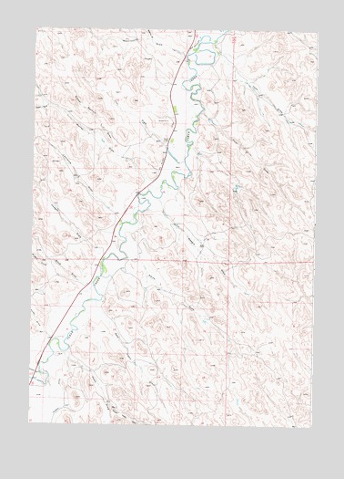
Buffalo NE, WY USGS Topographic Map
Click on map above to begin viewing in our Map Viewer.

This topographic map contains these locations and features:
Feature Name Type Latitude Longitude GNIS ID View Map
Bond DrawValleyN44.4200°W106.6025°1585767View Map
Charles MineMineN44.4719°W106.5509°1704074View Map
Cook DrawValleyN44.4916°W106.5431°1586945View Map
Des Moines DitchCanalN44.4653°W106.5659°1587546View Map
East Healy DrawValleyN44.4086°W106.5909°1588109View Map
Four DrawValleyN44.4630°W106.5675°1588673View Map
Four H DamDamN44.4683°W106.5473°1607182View Map
Four H DrawValleyN44.4736°W106.5517°1588674View Map
Four H ReservoirReservoirN44.4683°W106.5473°1607183View Map
Haley DrawValleyN44.4044°W106.6198°1589243View Map
Healy DamDamN44.4166°W106.6039°1608412View Map
Healy DrawValleyN44.3955°W106.6081°1589452View Map
Healy ReservoirReservoirN44.4166°W106.6039°1608413View Map
Hodges DrawValleyN44.4286°W106.5945°1589598View Map
Karl DamDamN44.4666°W106.5489°1606992View Map
Karl DamDamN44.4650°W106.5489°1607042View Map
Karl ReservoirReservoirN44.4608°W106.5518°1606993View Map
Kumor DrawValleyN44.3914°W106.6212°1590425View Map
Lawrence DrawValleyN44.4428°W106.5900°1590592View Map
Murray DrawValleyN44.4530°W106.5753°1591924View Map
North Healy DrawValleyN44.3814°W106.5895°1592227View Map
Regina DrawValleyN44.4969°W106.5742°1593370View Map
School Section DrawValleyN44.4625°W106.5906°1594012View Map
Smith DrawValleyN44.4258°W106.5764°1594482View Map
Steven Number 2 DamDamN44.4600°W106.5673°1606668View Map
Stevens Number 2 ReservoirReservoirN44.4600°W106.5673°1606669View Map
Waegle DrawValleyN44.4430°W106.5681°1595962View Map
Walters DamDamN44.4150°W106.5289°1607040View Map
Walters ReservoirReservoirN44.4150°W106.5289°1607041View Map
Watt DrawValleyN44.4916°W106.5592°1596090View Map
West Fork Murray DrawValleyN44.4758°W106.6189°1596206View Map
Wright DrawValleyN44.4261°W106.6173°1596635View Map

Note: Coordinates in the location and feature list above are referenced to NAD83 datum.


Copyright (C) 2008-2024 Ryan Niemi / Sunset Dynamics ... All Rights Reserved