TopoQuest Logo
Do you find TopoQuest useful?
Help keep TopoQuest running and adding new maps/features by donating!
Bitcoin:  19c7KJd3qBynnjoSw5npx9KScwjBe4ifkT
Litecoin:  LXs6TkuXGGXo1vDsWCkWVdjQX94eUKd6ui
Home View Maps Find Maps Find Places Resources & Links


Burgess Junction, Wyoming Topographic Map

USGS Map Title: Burgess Junction, WY
USGS Map MRC: 44107G5
DRG (GeoTIFF) Download: o44107g5.tif


Neighboring USGS Topographic Map Quads:


  Bull Elk Park, WY  
44107H6
 

  West Pass, WY  
44107H5
 

  Columbus Peak, WY  
44107H4
 

  Ice Creek, WY  
44107G6
 

  Burgess Junction, WY  
44107G5
 

  Skull Ridge, WY  
44107G4
 

  Hidden Tepee Creek, WY  
44107F6
 

  Granite Pass, WY  
44107F5
 

  Woodrock, WY  
44107F4


Map MRC Location:

N45°
W108°
N45°
W107°
H8 H7 H6 H5 H4 H3 H2 H1
G8 G7 G6 G5 G4 G3 G2 G1
F8 F7 F6 F5 F4 F3 F2 F1
E8 E7 E6 E5 E4 E3 E2 E1
D8 D7 D6 D5 D4 D3 D2 D1
C8 C7 C6 C5 C4 C3 C2 C1
B8 B7 B6 B5 B4 B3 B2 B1
A8 A7 A6 A5 A4 A3 A2 A1
N44°
W108°
N44°
W107°

Burgess Junction, WY USGS 1:24K Topographic Map Preview:
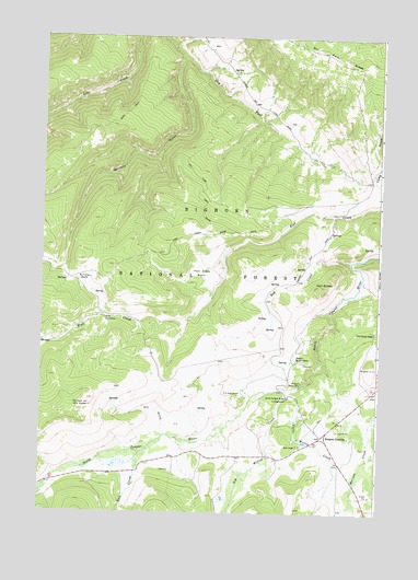
Burgess Junction, WY USGS Topographic Map
Click on map above to begin viewing in our Map Viewer.

This topographic map contains these locations and features:
Feature Name Type Latitude Longitude GNIS ID View Map
Bear LodgeLocaleN44.7680°W107.5287°1585267View Map
Big Willow CreekStreamN44.7822°W107.5337°1598177View Map
Bull CreekStreamN44.7636°W107.5895°1598488View Map
Bull ParkFlatN44.8236°W107.5673°1597178View Map
Burgess JunctionPopulated PlaceN44.7700°W107.5198°1597238View Map
Burgess Junction RescueBuildingN44.7675°W107.5295°2673698View Map
Burgess Picnic AreaParkN44.7836°W107.5287°1586145View Map
Burgess Ranger StationLocaleN44.7905°W107.5304°1586146View Map
Dry Fork RidgeRidgeN44.8675°W107.5081°1599355View Map
Dry Fork TrailTrailN44.8389°W107.5684°1587844View Map
Dry GulchValleyN44.7716°W107.5795°1587847View Map
Fool Creek BasinBasinN44.8130°W107.5659°1588610View Map
Garden of the GodsBasinN44.7783°W107.6065°1588805View Map
Garland GulchValleyN44.8700°W107.5731°1599910View Map
Hay CreekStreamN44.8164°W107.5109°1589395View Map
Hideout CreekStreamN44.7555°W107.6245°1600324View Map
Little Willow CreekStreamN44.7819°W107.5326°1601058View Map
North Tongue River CampgroundLocaleN44.7800°W107.5337°1592294View Map
P K Cow CampLocaleN44.7816°W107.5506°1592529View Map
Schuler ParkFlatN44.8102°W107.6093°1594036View Map
Twin ButtesSummitN44.8077°W107.5209°1595780View Map
Twin Buttes LodgeLocaleN44.7977°W107.5018°1595783View Map
Wolfe Cow CampLocaleN44.8014°W107.6015°1596585View Map

Note: Coordinates in the location and feature list above are referenced to NAD83 datum.


Copyright (C) 2008-2025 Ryan Niemi / Sunset Dynamics ... All Rights Reserved