TopoQuest Logo
Do you find TopoQuest useful?
Help keep TopoQuest running and adding new maps/features by donating!
Bitcoin:  19c7KJd3qBynnjoSw5npx9KScwjBe4ifkT
Litecoin:  LXs6TkuXGGXo1vDsWCkWVdjQX94eUKd6ui
Home View Maps Find Maps Find Places Resources & Links


Burlington, Wyoming Topographic Map

USGS Map Title: Burlington, WY
USGS Map MRC: 44108D4
DRG (GeoTIFF) Download: o44108d4.tif


Neighboring USGS Topographic Map Quads:


  Gilmore Hill SE, WY  
44108E5
 

  Emblem, WY  
44108E4
 

  Emblem SE, WY  
44108E3
 

  Y U Bench NE, WY  
44108D5
 

  Burlington, WY  
44108D4
 

  Otto, WY  
44108D3
 

  Tatman Mountain, WY  
44108C5
 

  Sheep Mountain, WY  
44108C4
 

  Wardel Reservoir, WY  
44108C3


Map MRC Location:

N45°
W109°
N45°
W108°
H8 H7 H6 H5 H4 H3 H2 H1
G8 G7 G6 G5 G4 G3 G2 G1
F8 F7 F6 F5 F4 F3 F2 F1
E8 E7 E6 E5 E4 E3 E2 E1
D8 D7 D6 D5 D4 D3 D2 D1
C8 C7 C6 C5 C4 C3 C2 C1
B8 B7 B6 B5 B4 B3 B2 B1
A8 A7 A6 A5 A4 A3 A2 A1
N44°
W109°
N44°
W108°

Burlington, WY USGS 1:24K Topographic Map Preview:
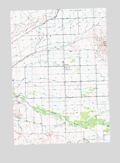
Burlington, WY USGS Topographic Map
Click on map above to begin viewing in our Map Viewer.

This topographic map contains these locations and features:
Feature Name Type Latitude Longitude GNIS ID View Map
42 LateralCanalN44.4886°W108.4429°1596709View Map
Avent SchoolSchoolN44.4208°W108.4943°1585005View Map
Bahr LateralCanalN44.4102°W108.4554°1585052View Map
Bank LateralCanalN44.4177°W108.4590°1585095View Map
Beck and Allen LateralCanalN44.4397°W108.4259°1585339View Map
Big Horn County Fire Protection District 4 BurlingtonBuildingN44.4478°W108.4321°2673673View Map
Black Diamond AirportAirportN44.4500°W108.3847°2443882View Map
Brown and Croxell DitchCanalN44.3858°W108.3954°1584674View Map
BurlingtonPopulated PlaceN44.4472°W108.4323°1597239View Map
Burlington CemeteryCemeteryN44.4608°W108.4207°1586156View Map
Burlington Elementary SchoolSchoolN44.4509°W108.4334°1795411View Map
Burlington High SchoolSchoolN44.4512°W108.4334°1795409View Map
Burlington Junior High SchoolSchoolN44.4511°W108.4339°1795410View Map
Burlington Post OfficePost OfficeN44.4447°W108.4313°2765599View Map
Emblem BenchBenchN44.4783°W108.4357°1588281View Map
Emblem CemeteryCemeteryN44.4841°W108.3904°1588282View Map
German DitchCanalN44.3863°W108.4873°1588868View Map
Maller DitchCanalN44.4011°W108.4898°1591190View Map
McNiven LateralCanalN44.4322°W108.4354°1591383View Map
Pearce LateralCanalN44.4252°W108.4234°1592639View Map
Riley LateralCanalN44.4233°W108.4659°1593467View Map
Saint Joe CanalCanalN44.3752°W108.4032°1593782View Map
Table MountainSummitN44.4669°W108.3773°1596847View Map
Tatman CanalCanalN44.4036°W108.4671°1595311View Map
Town LateralCanalN44.4469°W108.4234°1595654View Map
Town of BurlingtonCivilN44.4471°W108.4320°2411745View Map
Willow CreekStreamN44.3908°W108.4201°1597019View Map

Note: Coordinates in the location and feature list above are referenced to NAD83 datum.


Copyright (C) 2008-2025 Ryan Niemi / Sunset Dynamics ... All Rights Reserved