TopoQuest Logo
Do you find TopoQuest useful?
Help keep TopoQuest running and adding new maps/features by donating!
Bitcoin:  19c7KJd3qBynnjoSw5npx9KScwjBe4ifkT
Litecoin:  LXs6TkuXGGXo1vDsWCkWVdjQX94eUKd6ui
Home View Maps Find Maps Find Places Resources & Links


Burnett Creek, Montana Topographic Map

USGS Map Title: Burnett Creek, MT
USGS Map MRC: 48106F8
DRG (GeoTIFF) Download: o48106f8.tif


Neighboring USGS Topographic Map Quads:


  Snake Creek School, MT  
48107G1
 

  Antelope Pass, MT  
48106G8
 

  Last Chance Reservoir, MT  
48106G7
 

  Papoose Hills, MT  
48107F1
 

  Burnett Creek, MT  
48106F8
 

  Gay Dam, MT  
48106F7
 

  Jones Coulee, MT  
48107E1
 

  Miller Springs, MT  
48106E8
 

  Laundry Hill, MT  
48106E7


Map MRC Location:

N49°
W107°
N49°
W106°
H8 H7 H6 H5 H4 H3 H2 H1
G8 G7 G6 G5 G4 G3 G2 G1
F8 F7 F6 F5 F4 F3 F2 F1
E8 E7 E6 E5 E4 E3 E2 E1
D8 D7 D6 D5 D4 D3 D2 D1
C8 C7 C6 C5 C4 C3 C2 C1
B8 B7 B6 B5 B4 B3 B2 B1
A8 A7 A6 A5 A4 A3 A2 A1
N48°
W107°
N48°
W106°

Burnett Creek, MT USGS 1:24K Topographic Map Preview:
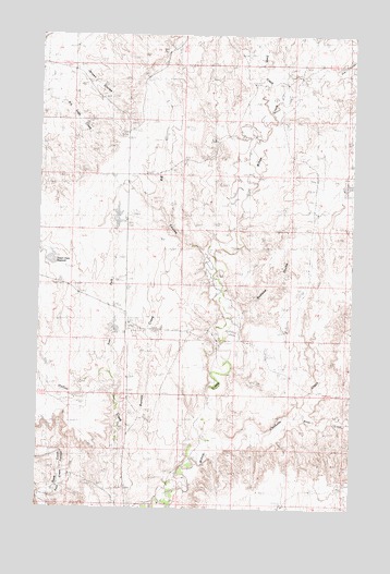
Burnett Creek, MT USGS Topographic Map
Click on map above to begin viewing in our Map Viewer.

This topographic map contains these locations and features:
Feature Name Type Latitude Longitude GNIS ID View Map
Badland CouleeValleyN48.6767°W106.9239°799933View Map
Barr (historical)Populated PlaceN48.7334°W106.9839°1675527View Map
Barr Post Office (historical)Post OfficeN48.7334°W106.9839°1675526View Map
Big CouleeValleyN48.6931°W106.9334°799932View Map
Bitter CreekStreamN48.6431°W106.9328°768908View Map
Burnett CreekStreamN48.6267°W106.9503°799935View Map
Chisholm CreekStreamN48.6433°W106.9331°799903View Map
Collins DamDamN48.6900°W106.9689°796210View Map
Corral DamDamN48.7000°W106.9656°796119View Map
Cow CouleeValleyN48.7395°W106.8828°799910View Map
Deep CreekStreamN48.7295°W106.9089°768009View Map
Desert Claim ReservoirReservoirN48.6907°W106.9957°799934View Map
East Fork Collins CreekStreamN48.6608°W106.9717°799936View Map
Hose DamDamN48.6250°W106.8973°795849View Map
West Fork Bitter CreekStreamN48.6784°W106.8831°778224View Map
Willow Creek School (historical)SchoolN48.6478°W106.9376°1677222View Map

Note: Coordinates in the location and feature list above are referenced to NAD83 datum.


Copyright (C) 2008-2024 Ryan Niemi / Sunset Dynamics ... All Rights Reserved