TopoQuest Logo
Do you find TopoQuest useful?
Help keep TopoQuest running and adding new maps/features by donating!
Bitcoin:  19c7KJd3qBynnjoSw5npx9KScwjBe4ifkT
Litecoin:  LXs6TkuXGGXo1vDsWCkWVdjQX94eUKd6ui
Home View Maps Find Maps Find Places Resources & Links


Burns, Tennessee Topographic Map

USGS Map Title: Burns, TN
USGS Map MRC: 36087A3
DRG (GeoTIFF) Download: o36087a3.tif


Neighboring USGS Topographic Map Quads:


  Vanleer, TN  
36087B4
 

  Charlotte, TN  
36087B3
 

  Harpeth Valley, TN  
36087B2
 

  Dickson, TN  
36087A4
 

  Burns, TN  
36087A3
 

  White Bluff, TN  
36087A2
 

  Texas Hollow, TN  
35087H4
 

  Lyles, TN  
35087H3
 

  Craigfield, TN  
35087H2


Map MRC Location:

N37°
W88°
N37°
W87°
H8 H7 H6 H5 H4 H3 H2 H1
G8 G7 G6 G5 G4 G3 G2 G1
F8 F7 F6 F5 F4 F3 F2 F1
E8 E7 E6 E5 E4 E3 E2 E1
D8 D7 D6 D5 D4 D3 D2 D1
C8 C7 C6 C5 C4 C3 C2 C1
B8 B7 B6 B5 B4 B3 B2 B1
A8 A7 A6 A5 A4 A3 A2 A1
N36°
W88°
N36°
W87°

Burns, TN USGS 1:24K Topographic Map Preview:
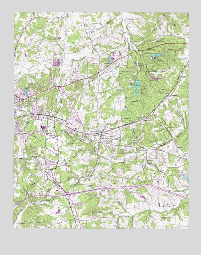
Burns, TN USGS Topographic Map
Click on map above to begin viewing in our Map Viewer.

This topographic map contains these locations and features:
Feature Name Type Latitude Longitude GNIS ID View Map
Acorn HillPopulated PlaceN36.1114°W87.2708°1313296View Map
Acorn Hill ChurchChurchN36.1101°W87.2722°1304760View Map
Acorn LakeReservoirN36.1003°W87.2732°1302365View Map
Acorn Lake DamDamN36.1001°W87.2767°1302364View Map
Adcock CemeteryCemeteryN36.0492°W87.3314°1275475View Map
Bakers School (historical)SchoolN36.0753°W87.2592°1324003View Map
BakersworksPopulated PlaceN36.0773°W87.2633°1304935View Map
Billy Richardson BranchStreamN36.0437°W87.3153°1277476View Map
Blue Spring BranchStreamN36.0065°W87.2997°1277795View Map
Broadway Drive-InLocaleN36.0908°W87.3119°2647743View Map
Brown CemeteryCemeteryN36.0009°W87.2600°1278550View Map
Brown HillSummitN36.0462°W87.2556°1278581View Map
BurnsPopulated PlaceN36.0534°W87.3125°1305550View Map
Burns Elementary SchoolSchoolN36.0520°W87.3117°1324018View Map
Burns Fire DepartmentBuildingN36.0511°W87.3135°2653682View Map
Burns Police DepartmentBuildingN36.0517°W87.3136°2766034View Map
Burns Post OfficePost OfficeN36.0487°W87.3061°1652284View Map
Burns-White Bluff Division (historical)CensusN36.0798°W87.2597°1648673View Map
Camp Ground ChurchChurchN36.0914°W87.2914°1305630View Map
Cathey HollowValleyN36.0530°W87.2614°1279896View Map
City of DicksonCivilN36.0638°W87.3662°2404227View Map
ColesburgPopulated PlaceN36.0626°W87.3456°1306035View Map
Colesburg Church of ChristChurchN36.0626°W87.3447°1324040View Map
Colesburg School (historical)SchoolN36.0626°W87.3458°1324041View Map
Commissioner District 10CivilN36.0932°W87.3197°2464306View Map
Commissioner District 11CivilN36.0622°W87.3472°2464337View Map
Commissioner District 6CivilN36.0020°W87.2609°2464526View Map
Commissioner District 7CivilN36.0087°W87.3699°2464603View Map
Cox CemeteryCemeteryN36.0920°W87.3522°1281488View Map
Craig Lake Dam Number TwoDamN36.0117°W87.3433°1302299View Map
Craig Lake Number TwoReservoirN36.0101°W87.3430°1302298View Map
Creech HollowValleyN36.1071°W87.2910°1281592View Map
Creech Hollow LakeReservoirN36.0869°W87.2738°1302356View Map
Creech Hollow Lake DamDamN36.0884°W87.2767°1302357View Map
Daniel CemeteryCemeteryN36.0739°W87.3208°1282023View Map
Dickson County Industrial ParkLocaleN36.0556°W87.3500°1324055View Map
Dickson Fire Department Station 2BuildingN36.0302°W87.3447°2654158View Map
Dugan CemeteryCemeteryN36.0364°W87.3406°1283090View Map
Duke QuarryMineN36.0967°W87.3439°1324064View Map
Dukes Mill (historical)LocaleN36.1023°W87.3042°1324065View Map
East SidePopulated PlaceN36.0320°W87.2675°1647704View Map
East Side High School (historical)SchoolN36.0340°W87.2647°1324066View Map
Eastside Baptist ChurchChurchN36.0340°W87.2647°1324067View Map
Fairview Baptist ChurchChurchN36.0053°W87.3300°1306434View Map
Fairview School (historical)SchoolN36.1092°W87.3392°1324074View Map
Faith Freewill Baptist ChurchChurchN36.0626°W87.3458°1324075View Map
First Call Ambulance Service DicksonBuildingN36.0629°W87.3729°2697389View Map
Fulgum CemeteryCemeteryN36.0512°W87.2908°1306468View Map
Gentry ParkParkN36.0387°W87.2758°1285287View Map
Gentrys BranchStreamN36.0465°W87.2786°1647705View Map
Gillian Chapel CemeteryCemeteryN36.1112°W87.2536°1306483View Map
Gilliland Chapel (historical)ChurchN36.1109°W87.2531°1324092View Map
Glass HollowValleyN36.0048°W87.3702°1285491View Map
Grassy SpringSpringN36.1097°W87.3445°1285913View Map
Gum BranchStreamN36.0409°W87.3122°1286397View Map
Haley BranchStreamN36.0078°W87.2900°1286533View Map
Hall CemeteryCemeteryN36.0756°W87.2939°1286574View Map
Hall SpringSpringN36.0737°W87.2909°1286599View Map
Happy Valley School (historical)SchoolN36.1037°W87.2820°1324100View Map
Haynie BranchStreamN36.1017°W87.2845°1287238View Map
Herbertson School (historical)SchoolN36.0309°W87.3614°1324104View Map
Hogin CemeteryCemeteryN36.0162°W87.2814°1288002View Map
Hoover QuarryMineN36.0987°W87.3414°1324108View Map
Interchange 172CrossingN36.0195°W87.3370°1313333View Map
Jackson CemeteryCemeteryN36.0951°W87.2853°1289205View Map
Jackson HollowValleyN36.0939°W87.2866°1289226View Map
John Duke LakeReservoirN36.1010°W87.3041°1302367View Map
John Duke Lake DamDamN36.1017°W87.3033°1302366View Map
Johnson BranchStreamN36.0845°W87.3442°1289530View Map
Johnson CemeteryCemeteryN36.0517°W87.3003°1289562View Map
Jordon HollowValleyN36.0459°W87.2787°1289848View Map
Kaiser HollowValleyN36.0173°W87.3528°1289900View Map
Ladd CemeteryCemeteryN36.0742°W87.2842°1290457View Map
Lake WoodhavenReservoirN36.0774°W87.2885°1275040View Map
Langford HollowValleyN36.0148°W87.3647°1306665View Map
Laurel Furnace (historical)LocaleN36.0931°W87.2872°1324127View Map
Laurel Furnace MinesMineN36.0951°W87.2928°1324128View Map
Luther CemeteryCemeteryN36.0064°W87.2611°1292309View Map
Luther HollowValleyN36.0830°W87.2881°1292310View Map
Luther LakeReservoirN36.0784°W87.3661°1292312View Map
Luther Lake Dam Number OneDamN36.0801°W87.3667°1302348View Map
Luther Lake Number FourReservoirN36.0336°W87.2690°1302329View Map
Luther Lake Number Four DamDamN36.0334°W87.2700°1302328View Map
Luther Lake Number TwoReservoirN36.0284°W87.2517°1302323View Map
Luther Lake Number Two DamDamN36.0284°W87.2517°1302322View Map
Marvins Chapel (historical)ChurchN36.0509°W87.2914°1324136View Map
McNair CutGapN36.0631°W87.2831°1306738View Map
Meek CemeteryCemeteryN36.0217°W87.2617°1293536View Map
Montgomery Bell Ore BanksMineN36.0203°W87.3183°1324140View Map
Montgomery Bell State ParkParkN36.0901°W87.2733°1294193View Map
Old Ball Station (historical)LocaleN36.0567°W87.3320°1324160View Map
Paine HollowValleyN36.0464°W87.2802°1296655View Map
Parker HollowValleyN36.0142°W87.3639°1296830View Map
PomonaPopulated PlaceN36.0337°W87.3478°1306909View Map
Pomona Baptist ChurchChurchN36.0365°W87.3550°1324172View Map
Pomona Church of ChristChurchN36.0323°W87.3506°1324173View Map
Price CemeteryCemeteryN36.1095°W87.2581°1298502View Map
Pump SpringSpringN36.0528°W87.3301°1298670View Map
Reeders CrossingPopulated PlaceN36.0653°W87.2767°1299158View Map
Richardson BranchStreamN36.1045°W87.2989°1299330View Map
Richardson CemeteryCemeteryN36.0642°W87.2964°1299336View Map
Richardson CemeteryCemeteryN36.1212°W87.2931°1299337View Map
Spicer BranchStreamN36.0956°W87.3406°1270995View Map
Spicer HollowValleyN36.0577°W87.2526°1270996View Map
The Punch BowlBasinN36.0067°W87.2661°1272432View Map
Thompson CemeteryCemeteryN36.0584°W87.2650°1272524View Map
Thompson CemeteryCemeteryN36.0959°W87.3108°1272526View Map
TidwellPopulated PlaceN36.0120°W87.3350°1304101View Map
Tidwell School (historical)SchoolN36.0126°W87.3339°1324229View Map
Town of BurnsCivilN36.0501°W87.2978°2405348View Map
Twin LakeLakeN36.0998°W87.3061°1273119View Map
WDKN-AM (Dickson)TowerN36.1087°W87.3706°1639943View Map
Welch CemeteryCemeteryN36.0501°W87.2742°1274071View Map
Wildcat HollowValleyN36.1010°W87.2828°1274552View Map
Will Hall CreekStreamN36.1134°W87.2939°1304595View Map
Wolfden BranchStreamN36.1006°W87.3233°1647711View Map
Woodhaven Lake DamDamN36.0858°W87.2869°1307186View Map
WTNQ-FM (Dickson)TowerN36.1087°W87.3706°1640097View Map

Note: Coordinates in the location and feature list above are referenced to NAD83 datum.


Copyright (C) 2008-2025 Ryan Niemi / Sunset Dynamics ... All Rights Reserved