TopoQuest Logo
Do you find TopoQuest useful?
Help keep TopoQuest running and adding new maps/features by donating!
Bitcoin:  19c7KJd3qBynnjoSw5npx9KScwjBe4ifkT
Litecoin:  LXs6TkuXGGXo1vDsWCkWVdjQX94eUKd6ui
Home View Maps Find Maps Find Places Resources & Links


Allison, Colorado Topographic Map

USGS Map Title: Allison, CO
USGS Map MRC: 37107A4
DRG (GeoTIFF) Download: o37107a4.tif


Neighboring USGS Topographic Map Quads:


  Bayfield, CO  
37107B5
 

  Pargin Mountain, CO  
37107B4
 

  Chimney Rock, CO  
37107B3
 

  Tiffany, CO  
37107A5
 

  Allison, CO  
37107A4
 

  Carracas, CO  
37107A3
 

  Burnt Mesa, NM  
36107H5
 

  Bancos Mesa NW, NM  
36107H4
 

  Bancos Mesa, NM  
36107H3


Map MRC Location:

N38°
W108°
N38°
W107°
H8 H7 H6 H5 H4 H3 H2 H1
G8 G7 G6 G5 G4 G3 G2 G1
F8 F7 F6 F5 F4 F3 F2 F1
E8 E7 E6 E5 E4 E3 E2 E1
D8 D7 D6 D5 D4 D3 D2 D1
C8 C7 C6 C5 C4 C3 C2 C1
B8 B7 B6 B5 B4 B3 B2 B1
A8 A7 A6 A5 A4 A3 A2 A1
N37°
W108°
N37°
W107°

Allison, CO USGS 1:24K Topographic Map Preview:
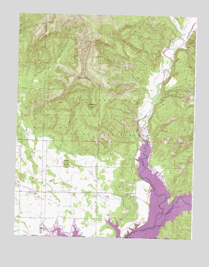
Allison, CO USGS Topographic Map
Click on map above to begin viewing in our Map Viewer.

This topographic map contains these locations and features:
Feature Name Type Latitude Longitude GNIS ID View Map
AllisonPopulated PlaceN37.0244°W107.4881°204734View Map
ArbolesPopulated PlaceN37.0281°W107.4192°184512View Map
Arboles Census Designated PlaceCensusN37.0202°W107.4221°2407753View Map
Arboles Post OfficePost OfficeN37.0232°W107.4192°2736062View Map
Black Horse CanyonValleyN37.0786°W107.4054°184513View Map
Darlington DitchCanalN37.0306°W107.4314°184511View Map
Gallegos CanyonValleyN37.1094°W107.3845°184506View Map
Haystack MountainSummitN37.0417°W107.4648°184508View Map
Ignacio CreekStreamN37.1139°W107.3823°184424View Map
Los Pinos Fire Protection District Station 5 ArbolesBuildingN37.0240°W107.4146°2666994View Map
Miller DitchCanalN37.0239°W107.4589°203020View Map
Navajo Landing Strip (historical)AirportN37.0014°W107.4234°204245View Map
Navajo ReservoirReservoirN37.0179°W107.3864°938725View Map
North Pine River LateralCanalN37.0472°W107.4639°203016View Map
Payan CanyonValleyN37.0812°W107.3999°184505View Map
Piedra PeakSummitN37.0889°W107.4561°184510View Map
Piedra Peak Number 2SummitN37.0737°W107.4472°184509View Map
Piedra RiverStreamN37.0067°W107.4017°184069View Map
Pine Tree CanyonValleyN37.0959°W107.4018°184514View Map
Scoggin ArroyoStreamN37.0206°W107.4634°184507View Map

Note: Coordinates in the location and feature list above are referenced to NAD83 datum.


Copyright (C) 2008-2025 Ryan Niemi / Sunset Dynamics ... All Rights Reserved