TopoQuest Logo
Do you find TopoQuest useful?
Help keep TopoQuest running and adding new maps/features by donating!
Bitcoin:  19c7KJd3qBynnjoSw5npx9KScwjBe4ifkT
Litecoin:  LXs6TkuXGGXo1vDsWCkWVdjQX94eUKd6ui
Home View Maps Find Maps Find Places Resources & Links


Butte, Nebraska Topographic Map

USGS Map Title: Butte, NE
USGS Map MRC: 42098H7
DRG (GeoTIFF) Download: o42098h7.tif


Neighboring USGS Topographic Map Quads:


  Bonesteel, SD  
43098A8
 

  South Scalp Creek, SD  
43098A7
 

  Lake Andes SW, SD  
43098A6
 

  Butte NW, NE  
42098H8
 

  Butte, NE  
42098H7
 

  Spencer North, NE  
42098H6
 

  Butte SW, NE  
42098G8
 

  Butte SE, NE  
42098G7
 

  Spencer South, NE  
42098G6


Map MRC Location:

N43°
W99°
N43°
W98°
H8 H7 H6 H5 H4 H3 H2 H1
G8 G7 G6 G5 G4 G3 G2 G1
F8 F7 F6 F5 F4 F3 F2 F1
E8 E7 E6 E5 E4 E3 E2 E1
D8 D7 D6 D5 D4 D3 D2 D1
C8 C7 C6 C5 C4 C3 C2 C1
B8 B7 B6 B5 B4 B3 B2 B1
A8 A7 A6 A5 A4 A3 A2 A1
N42°
W99°
N42°
W98°

Butte, NE USGS 1:24K Topographic Map Preview:
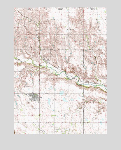
Butte, NE USGS Topographic Map
Click on map above to begin viewing in our Map Viewer.

This topographic map contains these locations and features:
Feature Name Type Latitude Longitude GNIS ID View Map
AnokaPopulated PlaceN42.9469°W98.8309°827002View Map
Anoka (historical)LocaleN42.9469°W98.8309°1845084View Map
Anoka Post Office (historical)Post OfficeN42.9469°W98.8309°1845083View Map
Boyd CountyCivilN42.8997°W98.7665°835829View Map
Boyd County Ambulance ServiceBuildingN42.9134°W98.8480°2553738View Map
Boyd County CourthouseBuildingN42.9117°W98.8484°1845102View Map
Boyd County Sheriff's OfficeBuildingN42.9117°W98.8487°1845101View Map
ButtePopulated PlaceN42.9114°W98.8493°827820View Map
Butte CemeteryCemeteryN42.9236°W98.8590°827821View Map
Butte City ParkParkN42.9114°W98.8493°1845089View Map
Butte Fire DepartmentBuildingN42.9134°W98.8480°1845096View Map
Butte Golf CourseLocaleN42.9114°W98.8493°1845090View Map
Butte Medical CenterHospitalN42.9114°W98.8493°1845095View Map
Butte Medical ClinicHospitalN42.9125°W98.8490°1845098View Map
Butte Nursing HomeHospitalN42.9114°W98.8493°1845094View Map
Butte Post OfficePost OfficeN42.9128°W98.8494°1845099View Map
Butte Public SchoolsSchoolN42.9106°W98.8456°1845100View Map
Community Bible ChurchChurchN42.9114°W98.8493°1845093View Map
Dizzy CreekStreamN42.9353°W98.8193°828740View Map
Dry CreekStreamN42.9417°W98.8309°828796View Map
Full Gospel ChurchChurchN42.9114°W98.8493°1845092View Map
Harvey ButtesSummitN42.9019°W98.8504°829842View Map
Immanuel CemeteryCemeteryN42.9005°W98.8501°830239View Map
Lampman Dam Number 1DamN42.8919°W98.7656°1770072View Map
Lampman Reservoir Number 1ReservoirN42.8912°W98.7656°1770073View Map
Lechtenberg-Lampman DamDamN42.9074°W98.7814°1769874View Map
Lechtenberg-Lampman ReservoirReservoirN42.9054°W98.7835°1769875View Map
Lutheran CemeteryCemeteryN42.9522°W98.8354°830966View Map
Old Settlers CemeteryCemeteryN42.9729°W98.8010°831861View Map
Reiman DamDamN42.9092°W98.7702°1769970View Map
Reiman ReservoirReservoirN42.9100°W98.7716°1769971View Map
Reiser DamDamN42.9353°W98.8027°1770006View Map
Reiser ReservoirReservoirN42.9357°W98.8029°1770007View Map
Saints Peter and Paul Catholic ChurchChurchN42.9114°W98.8493°1845091View Map
Saints Peter and Paul CemeteryCemeteryN42.9222°W98.8598°833119View Map
Tobacco CreekStreamN42.9225°W98.7548°834124View Map
Township of ButteCivilN42.9150°W98.8328°837901View Map
Village of AnokaCivilN42.9460°W98.8285°2397965View Map
Village of ButteCivilN42.9125°W98.8479°2397514View Map

Note: Coordinates in the location and feature list above are referenced to NAD83 datum.


Copyright (C) 2008-2024 Ryan Niemi / Sunset Dynamics ... All Rights Reserved