TopoQuest Logo
Do you find TopoQuest useful?
Help keep TopoQuest running and adding new maps/features by donating!
Bitcoin:  19c7KJd3qBynnjoSw5npx9KScwjBe4ifkT
Litecoin:  LXs6TkuXGGXo1vDsWCkWVdjQX94eUKd6ui
Home View Maps Find Maps Find Places Resources & Links


Cabery, Illinois Topographic Map

USGS Map Title: Cabery, IL
USGS Map MRC: 40088H2
DRG (GeoTIFF) Download: o40088h2.tif


Neighboring USGS Topographic Map Quads:


  Campus, IL  
41088A3
 

  Buckingham, IL  
41088A2
 

  Herscher, IL  
41088A1
 

  Cullom, IL  
40088H3
 

  Cabery, IL  
40088H2
 

  Piper City NE, IL  
40088H1
 

  Chatsworth North, IL  
40088G3
 

  Piper City, IL  
40088G2
 

  La Hogue, IL  
40088G1


Map MRC Location:

N41°
W89°
N41°
W88°
H8 H7 H6 H5 H4 H3 H2 H1
G8 G7 G6 G5 G4 G3 G2 G1
F8 F7 F6 F5 F4 F3 F2 F1
E8 E7 E6 E5 E4 E3 E2 E1
D8 D7 D6 D5 D4 D3 D2 D1
C8 C7 C6 C5 C4 C3 C2 C1
B8 B7 B6 B5 B4 B3 B2 B1
A8 A7 A6 A5 A4 A3 A2 A1
N40°
W89°
N40°
W88°

Cabery, IL USGS 1:24K Topographic Map Preview:
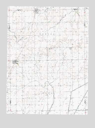
Cabery, IL USGS Topographic Map
Click on map above to begin viewing in our Map Viewer.

This topographic map contains these locations and features:
Feature Name Type Latitude Longitude GNIS ID View Map
Adam School (historical)SchoolN40.9520°W88.2267°403341View Map
CaberyPopulated PlaceN40.9959°W88.2053°405326View Map
Cabery Fire Protection DistrictBuildingN40.9959°W88.2064°2682584View Map
Cabery Post OfficePost OfficeN40.9958°W88.2071°1810621View Map
Clayton School (historical)SchoolN40.9517°W88.1889°406196View Map
Columbia School (historical)SchoolN40.8953°W88.1495°406409View Map
Down School (historical)SchoolN40.9817°W88.1495°407366View Map
Drendel School (historical)SchoolN40.8934°W88.1873°407385View Map
Edgerville CemeteryCemeteryN40.9982°W88.1413°407774View Map
Eldredgeville Post Office (historical)Post OfficeN40.9970°W88.1514°1810568View Map
Floridgeville CemeteryCemeteryN40.9981°W88.1414°2011615View Map
Graham School (historical)SchoolN40.9817°W88.2267°409246View Map
Heavisides School (historical)SchoolN40.8925°W88.2256°410010View Map
Keighin School (historical)SchoolN40.9231°W88.1500°411349View Map
KemptonPopulated PlaceN40.9356°W88.2373°411391View Map
Kempton Fire Protection DistrictBuildingN40.9351°W88.2380°2681987View Map
Kempton Post OfficePost OfficeN40.9360°W88.2372°2788629View Map
Mona Township CemeteryCemeteryN40.9042°W88.1866°2011614View Map
Mount Hope CemeteryCemeteryN40.9964°W88.1957°1810664View Map
Ogilvie School (historical)SchoolN40.9820°W88.1889°414966View Map
Saint Joseph CemeteryCemeteryN40.9948°W88.2278°417434View Map
Scott School (historical)SchoolN40.9234°W88.1878°418146View Map
StellePopulated PlaceN40.9500°W88.1534°2011616View Map
Sugar Loaf Post Office (historical)Post OfficeN40.9078°W88.2062°1810602View Map
Taylor School (historical)SchoolN40.9525°W88.1512°419570View Map
Township of MonaCivilN40.8941°W88.1866°429381View Map
Township of RogersCivilN40.9670°W88.1888°429664View Map
Tri-Point Elementary SchoolSchoolN40.9361°W88.2331°1810605View Map
Village of CaberyCivilN40.9958°W88.2037°2397519View Map
Village of KemptonCivilN40.9354°W88.2354°2398335View Map

Note: Coordinates in the location and feature list above are referenced to NAD83 datum.


Copyright (C) 2008-2025 Ryan Niemi / Sunset Dynamics ... All Rights Reserved