TopoQuest Logo
Do you find TopoQuest useful?
Help keep TopoQuest running and adding new maps/features by donating!
Bitcoin:  19c7KJd3qBynnjoSw5npx9KScwjBe4ifkT
Litecoin:  LXs6TkuXGGXo1vDsWCkWVdjQX94eUKd6ui
Home View Maps Find Maps Find Places Resources & Links


Calder, Idaho Topographic Map

USGS Map Title: Calder, ID
USGS Map MRC: 47116C2
DRG (GeoTIFF) Download: o47116c2.tif


Neighboring USGS Topographic Map Quads:


  Twin Crags, ID  
47116D3
 

  Masonia, ID  
47116D2
 

  Polaris Peak, ID  
47116D1
 

  Saint Joe, ID  
47116C3
 

  Calder, ID  
47116C2
 

  Marble Creek, ID  
47116C1
 

  Crystal Peak, ID  
47116B3
 

  Huckleberry Mountain, ID  
47116B2
 

  Marble Mountain, ID  
47116B1


Map MRC Location:

N48°
W117°
N48°
W116°
H8 H7 H6 H5 H4 H3 H2 H1
G8 G7 G6 G5 G4 G3 G2 G1
F8 F7 F6 F5 F4 F3 F2 F1
E8 E7 E6 E5 E4 E3 E2 E1
D8 D7 D6 D5 D4 D3 D2 D1
C8 C7 C6 C5 C4 C3 C2 C1
B8 B7 B6 B5 B4 B3 B2 B1
A8 A7 A6 A5 A4 A3 A2 A1
N47°
W117°
N47°
W116°

Calder, ID USGS 1:24K Topographic Map Preview:
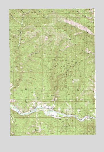
Calder, ID USGS Topographic Map
Click on map above to begin viewing in our Map Viewer.

This topographic map contains these locations and features:
Feature Name Type Latitude Longitude GNIS ID View Map
Annis CreekStreamN47.3613°W116.2313°376637View Map
Bear CreekStreamN47.2774°W116.2038°377096View Map
Billy Goat HillSummitN47.2888°W116.1907°396124View Map
Burnt ForkStreamN47.3199°W116.2349°397503View Map
CalderPopulated PlaceN47.2777°W116.1913°396209View Map
Calder Elementary-Junior High SchoolSchoolN47.2766°W116.1782°401446View Map
Calder Post OfficePost OfficeN47.2759°W116.1892°2766895View Map
Calder Work CenterLocaleN47.2669°W116.1763°399019View Map
Charley CreekStreamN47.2738°W116.2179°379200View Map
Deadman GulchValleyN47.3652°W116.1304°380335View Map
Elk CreekStreamN47.2674°W116.1510°381342View Map
Jack CreekStreamN47.2721°W116.2302°383802View Map
Mica CreekStreamN47.2685°W116.1368°386764View Map
Middle Fork Big CreekStreamN47.3621°W116.1254°386796View Map
Moose CreekStreamN47.2744°W116.2113°387181View Map
Pete Coll CreekStreamN47.2977°W116.1840°388353View Map
Pierce CreekStreamN47.3477°W116.1252°388435View Map
Saint Joe Emergency Medical Services Unit 2BuildingN47.2769°W116.1879°2642786View Map
Saint Joe Valley Fire DistrictBuildingN47.2765°W116.1889°2619129View Map
Spooky ButteSummitN47.3408°W116.1579°397196View Map
Stansbury CreekStreamN47.3694°W116.2274°391346View Map
Trout PointSummitN47.3710°W116.2135°397273View Map
West Fork Big CreekStreamN47.3624°W116.1252°393050View Map

Note: Coordinates in the location and feature list above are referenced to NAD83 datum.


Copyright (C) 2008-2025 Ryan Niemi / Sunset Dynamics ... All Rights Reserved