TopoQuest Logo
Do you find TopoQuest useful?
Help keep TopoQuest running and adding new maps/features by donating!
Bitcoin:  19c7KJd3qBynnjoSw5npx9KScwjBe4ifkT
Litecoin:  LXs6TkuXGGXo1vDsWCkWVdjQX94eUKd6ui
Home View Maps Find Maps Find Places Resources & Links


Calf Creek, Wyoming Topographic Map

USGS Map Title: Calf Creek, WY
USGS Map MRC: 44105E5
DRG (GeoTIFF) Download: o44105e5.tif


Neighboring USGS Topographic Map Quads:


  Recluse, WY  
44105F6
 

  Pitch Draw, WY  
44105F5
 

  Oliver Draw, WY  
44105F4
 

  Wildcat, WY  
44105E6
 

  Calf Creek, WY  
44105E5
 

  Weston SW, WY  
44105E4
 

  Oriva NW, WY  
44105D6
 

  Rawhide School, WY  
44105D5
 

  Moyer Springs, WY  
44105D4


Map MRC Location:

N45°
W106°
N45°
W105°
H8 H7 H6 H5 H4 H3 H2 H1
G8 G7 G6 G5 G4 G3 G2 G1
F8 F7 F6 F5 F4 F3 F2 F1
E8 E7 E6 E5 E4 E3 E2 E1
D8 D7 D6 D5 D4 D3 D2 D1
C8 C7 C6 C5 C4 C3 C2 C1
B8 B7 B6 B5 B4 B3 B2 B1
A8 A7 A6 A5 A4 A3 A2 A1
N44°
W106°
N44°
W105°

Calf Creek, WY USGS 1:24K Topographic Map Preview:
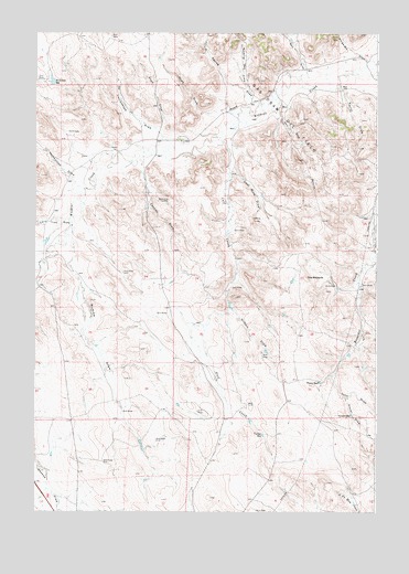
Calf Creek, WY USGS Topographic Map
Click on map above to begin viewing in our Map Viewer.

This topographic map contains these locations and features:
Feature Name Type Latitude Longitude GNIS ID View Map
Batz DrawValleyN44.6155°W105.5272°1585216View Map
Calf CreekStreamN44.5966°W105.5569°1586276View Map
Cantley DrawValleyN44.5894°W105.5864°1586341View Map
Coal Mine DrawValleyN44.5883°W105.5533°1586840View Map
Corner ReservoirReservoirN44.5201°W105.5416°1586984View Map
Cottonwood DrawValleyN44.5980°W105.5797°1587059View Map
Docking Pen DrawValleyN44.6116°W105.5483°1587678View Map
Gas Draw Oil FieldOilfieldN44.6039°W105.5344°1597035View Map
Gilbert DrawValleyN44.5528°W105.5519°1588903View Map
Grover DrawValleyN44.5294°W105.5114°1589176View Map
Grover ReservoirReservoirN44.5252°W105.5092°1589177View Map
Homestead DrawValleyN44.5872°W105.6117°1589656View Map
June DrawValleyN44.5353°W105.5164°1590255View Map
Lone Tree DrawValleyN44.5755°W105.6125°1590953View Map
Margarets DrawValleyN44.6183°W105.5039°1591213View Map
Mumma DrawValleyN44.5703°W105.6120°1591904View Map
Noah DrawValleyN44.6041°W105.5644°1592074View Map
Reis DrawValleyN44.6069°W105.5358°1593377View Map
Road DrawValleyN44.5991°W105.5750°1593501View Map
Spring DrawValleyN44.6072°W105.5431°1594907View Map
Taylor DrawValleyN44.6111°W105.5136°1595321View Map
Tharp ReservoirReservoirN44.5338°W105.5212°1595387View Map
The RockpileSummitN44.5611°W105.5253°1595467View Map
Williams ReservoirReservoirN44.6124°W105.6190°1596423View Map

Note: Coordinates in the location and feature list above are referenced to NAD83 datum.


Copyright (C) 2008-2025 Ryan Niemi / Sunset Dynamics ... All Rights Reserved