TopoQuest Logo
Do you find TopoQuest useful?
Help keep TopoQuest running and adding new maps/features by donating!
Bitcoin:  19c7KJd3qBynnjoSw5npx9KScwjBe4ifkT
Litecoin:  LXs6TkuXGGXo1vDsWCkWVdjQX94eUKd6ui
Home View Maps Find Maps Find Places Resources & Links


Calhan, Colorado Topographic Map

USGS Map Title: Calhan, CO
USGS Map MRC: 39104A3
DRG (GeoTIFF) Download: o39104a3.tif


Neighboring USGS Topographic Map Quads:


  Bijou Basin, CO  
39104B4
 

  Fondis, CO  
39104B3
 

  Ramah North, CO  
39104B2
 

  Peyton, CO  
39104A4
 

  Calhan, CO  
39104A3
 

  Ramah South, CO  
39104A2
 

  Haegler Ranch, CO  
38104H4
 

  Holcolm Hills, CO  
38104H3
 

  Rush NW, CO  
38104H2


Map MRC Location:

N40°
W105°
N40°
W104°
H8 H7 H6 H5 H4 H3 H2 H1
G8 G7 G6 G5 G4 G3 G2 G1
F8 F7 F6 F5 F4 F3 F2 F1
E8 E7 E6 E5 E4 E3 E2 E1
D8 D7 D6 D5 D4 D3 D2 D1
C8 C7 C6 C5 C4 C3 C2 C1
B8 B7 B6 B5 B4 B3 B2 B1
A8 A7 A6 A5 A4 A3 A2 A1
N39°
W105°
N39°
W104°

Calhan, CO USGS 1:24K Topographic Map Preview:
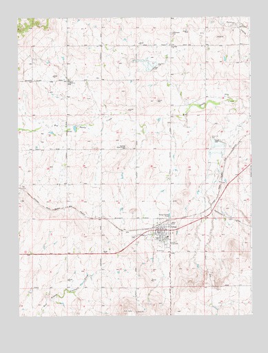
Calhan, CO USGS Topographic Map
Click on map above to begin viewing in our Map Viewer.

This topographic map contains these locations and features:
Feature Name Type Latitude Longitude GNIS ID View Map
Big Sandy Creek Watershed N-5 DamDamN39.1033°W104.3039°199186View Map
Big Sandy Creek Watershed N-5 ReservoirReservoirN39.1042°W104.3039°199187View Map
Big Sandy Creek Watershed S-6 DamDamN39.0733°W104.2689°198964View Map
Big Sandy Creek Watershed S-6 ReservoirReservoirN39.0721°W104.2676°198965View Map
CalhanPopulated PlaceN39.0355°W104.2972°193304View Map
Calhan AirportAirportN39.0504°W104.2930°204295View Map
Calhan Fire Protection DistrictBuildingN39.0377°W104.3012°2666897View Map
Calhan Memorial CemeteryCemeteryN39.0334°W104.3132°1834803View Map
Calhan Post OfficePost OfficeN39.0350°W104.3059°2736065View Map
Fairplay Community BuildingLocaleN39.0986°W104.3483°193306View Map
Lemesany Detention Number 2 DamDamN39.1183°W104.3355°199534View Map
Lemesany Detention Number 2 ReservoirReservoirN39.1183°W104.3355°199535View Map
Lenard CemeteryCemeteryN39.0900°W104.3004°193307View Map
National Slovak Society CemeteryCemeteryN39.0703°W104.3166°193305View Map
Peyton HeliportAirportN39.0422°W104.3650°204296View Map
Saint Mary's CemeteryCemeteryN39.1183°W104.2930°1834817View Map
Saint Marys ChurchChurchN39.1130°W104.2925°193303View Map
Saint Michaels CemeteryCemeteryN39.1181°W104.2923°193302View Map
Town of CalhanCivilN39.0344°W104.2991°2413149View Map

Note: Coordinates in the location and feature list above are referenced to NAD83 datum.


Copyright (C) 2008-2024 Ryan Niemi / Sunset Dynamics ... All Rights Reserved