TopoQuest Logo
Do you find TopoQuest useful?
Help keep TopoQuest running and adding new maps/features by donating!
Bitcoin:  19c7KJd3qBynnjoSw5npx9KScwjBe4ifkT
Litecoin:  LXs6TkuXGGXo1vDsWCkWVdjQX94eUKd6ui
Home View Maps Find Maps Find Places Resources & Links


Callahan, California Topographic Map

USGS Map Title: Callahan, CA
USGS Map MRC: 41122C7
DRG (GeoTIFF) Download: o41122c7.tif


Neighboring USGS Topographic Map Quads:


  Etna, CA  
41122D8
 

  McConaughy Gulch, CA  
41122D7
 

  Gazelle Mountain, CA  
41122D6
 

  Eaton Peak, CA  
41122C8
 

  Callahan, CA  
41122C7
 

  Scott Mountain, CA  
41122C6
 

  Deadman Peak, CA  
41122B8
 

  Billys Peak, CA  
41122B7
 

  Tangle Blue Lake, CA  
41122B6


Map MRC Location:

N42°
W123°
N42°
W122°
H8 H7 H6 H5 H4 H3 H2 H1
G8 G7 G6 G5 G4 G3 G2 G1
F8 F7 F6 F5 F4 F3 F2 F1
E8 E7 E6 E5 E4 E3 E2 E1
D8 D7 D6 D5 D4 D3 D2 D1
C8 C7 C6 C5 C4 C3 C2 C1
B8 B7 B6 B5 B4 B3 B2 B1
A8 A7 A6 A5 A4 A3 A2 A1
N41°
W123°
N41°
W122°

Callahan, CA USGS 1:24K Topographic Map Preview:
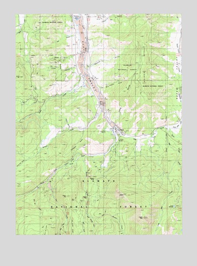
Callahan, CA USGS Topographic Map
Click on map above to begin viewing in our Map Viewer.

This topographic map contains these locations and features:
Feature Name Type Latitude Longitude GNIS ID View Map
Ankeny GulchValleyN41.3107°W122.8359°256262View Map
Big Mill CreekStreamN41.3096°W122.7597°256972View Map
Blue Jay CreekStreamN41.2763°W122.8586°257247View Map
Blue MineMineN41.2701°W122.8334°257263View Map
Bolivar LookoutLocaleN41.2596°W122.7806°1665298View Map
Bolivar LookoutLocaleN41.2724°W122.7953°277191View Map
Boulder CreekStreamN41.2940°W122.8261°257377View Map
CallahanPopulated PlaceN41.3096°W122.8014°257834View Map
Callahan CampLocaleN41.2974°W122.8009°257835View Map
Callahan Post OfficePost OfficeN41.3094°W122.8010°1657852View Map
Callahan Work CenterLocaleN41.3076°W122.7978°277189View Map
Cedar GulchValleyN41.3449°W122.8317°258135View Map
Craggy PeakSummitN41.2588°W122.7811°258861View Map
East Boulder CreekStreamN41.2596°W122.8198°259684View Map
East Fork Scott RiverStreamN41.3124°W122.8017°259749View Map
Eton MineMineN41.3285°W122.8645°1665299View Map
Facey GulchValleyN41.3701°W122.8178°260016View Map
Fox CreekStreamN41.2807°W122.8528°260322View Map
French FlatFlatN41.2929°W122.8348°260384View Map
Hayden RidgeRidgeN41.3618°W122.7823°261171View Map
Hjertager MillLocaleN41.3165°W122.8159°276635View Map
Limekiln GulchValleyN41.3335°W122.8125°262477View Map
Little Mill CreekStreamN41.2926°W122.7561°262671View Map
Long GulchValleyN41.3140°W122.8003°227567View Map
Lower Mill LakeLakeN41.2659°W122.7571°263032View Map
McKeen DivideRidgeN41.2804°W122.8167°263382View Map
McKeen MineMineN41.2704°W122.8236°263383View Map
Messner GulchValleyN41.3468°W122.8175°263472View Map
Noyes ValleyValleyN41.3176°W122.7539°264257View Map
Noyes Valley CreekStreamN41.3107°W122.7609°1657876View Map
Oak GulchValleyN41.3643°W122.8314°264287View Map
Osterried GulchValleyN41.2935°W122.8653°274656View Map
Rodney's Mobile ParkPopulated PlaceN41.3075°W122.7728°2515994View Map
Scott Valley Fire Protection District CallahanBuildingN41.3080°W122.7736°2621933View Map
Slide CreekStreamN41.2579°W122.8378°267262View Map
Smith HillSummitN41.3390°W122.8725°1659685View Map
Society Girl MineMineN41.3571°W122.8528°1665304View Map
South Fork Scott RiverStreamN41.3124°W122.8017°1654963View Map
Sugar CreekStreamN41.3438°W122.8234°267834View Map
Sugar HillSummitN41.2729°W122.8386°267835View Map
Sugar Hill MineMineN41.2660°W122.8395°1665305View Map
Taritsi GulchValleyN41.3507°W122.8292°267626View Map
Taylor CreekStreamN41.3046°W122.7770°277190View Map
Thompson GulchValleyN41.3088°W122.8256°268233View Map
Tiger ForkStreamN41.3249°W122.8548°268279View Map
Vanderpoole Mill (historical)LocaleN41.3665°W122.8723°1665307View Map
West Boulder CreekStreamN41.2621°W122.8231°268858View Map
Wildcat CreekStreamN41.3210°W122.8106°269092View Map
Wolf CreekStreamN41.2626°W122.8231°269268View Map

Note: Coordinates in the location and feature list above are referenced to NAD83 datum.


Copyright (C) 2008-2025 Ryan Niemi / Sunset Dynamics ... All Rights Reserved