TopoQuest Logo
Do you find TopoQuest useful?
Help keep TopoQuest running and adding new maps/features by donating!
Bitcoin:  19c7KJd3qBynnjoSw5npx9KScwjBe4ifkT
Litecoin:  LXs6TkuXGGXo1vDsWCkWVdjQX94eUKd6ui
Home View Maps Find Maps Find Places Resources & Links


Cambridge, Idaho Topographic Map

USGS Map Title: Cambridge, ID
USGS Map MRC: 44116E6
DRG (GeoTIFF) Download: o44116e6.tif


Neighboring USGS Topographic Map Quads:


  Advent Gulch, ID  
44116F7
 

  Rush Peak, ID  
44116F6
 

  Goodrich, ID  
44116F5
 

  Hopper Creek, ID  
44116E7
 

  Cambridge, ID  
44116E6
 

  East of Cambridge, ID  
44116E5
 

  Midvale Hill, ID  
44116D7
 

  Midvale, ID  
44116D6
 

  Hog Creek Butte, ID  
44116D5


Map MRC Location:

N45°
W117°
N45°
W116°
H8 H7 H6 H5 H4 H3 H2 H1
G8 G7 G6 G5 G4 G3 G2 G1
F8 F7 F6 F5 F4 F3 F2 F1
E8 E7 E6 E5 E4 E3 E2 E1
D8 D7 D6 D5 D4 D3 D2 D1
C8 C7 C6 C5 C4 C3 C2 C1
B8 B7 B6 B5 B4 B3 B2 B1
A8 A7 A6 A5 A4 A3 A2 A1
N44°
W117°
N44°
W116°

Cambridge, ID USGS 1:24K Topographic Map Preview:
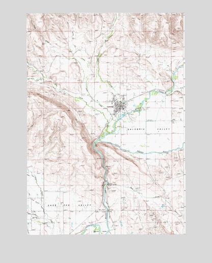
Cambridge, ID USGS Topographic Map
Click on map above to begin viewing in our Map Viewer.

This topographic map contains these locations and features:
Feature Name Type Latitude Longitude GNIS ID View Map
CambridgePopulated PlaceN44.5727°W116.6760°400338View Map
Cambridge Elementary SchoolSchoolN44.5741°W116.6824°401429View Map
Cambridge Fire Protection DistrictBuildingN44.5720°W116.6758°2619190View Map
Cambridge Junior - Senior High SchoolSchoolN44.5748°W116.6801°401428View Map
Cambridge Post OfficePost OfficeN44.5738°W116.6736°2779556View Map
Camp CreekStreamN44.5638°W116.6799°393793View Map
City of CambridgeCivilN44.5719°W116.6778°2409968View Map
Deer CreekStreamN44.5088°W116.7329°380431View Map
Dixie CreekStreamN44.5279°W116.6868°372423View Map
Hopper CreekStreamN44.5091°W116.7410°383326View Map
Little Weiser RiverStreamN44.5527°W116.6932°396809View Map
Middle Valley DitchCanalN44.5166°W116.6865°394765View Map
Pine CreekStreamN44.5579°W116.6882°388488View Map
Rush CreekStreamN44.5677°W116.6738°389730View Map
SalubriaPopulated PlaceN44.5635°W116.6663°399222View Map
Salubria ValleyValleyN44.5532°W116.6824°395914View Map
Shoe Peg ValleyValleyN44.5121°W116.7291°390343View Map
Spring CreekStreamN44.5774°W116.6999°391210View Map
West Pine CreekStreamN44.5888°W116.7374°393240View Map

Note: Coordinates in the location and feature list above are referenced to NAD83 datum.


Copyright (C) 2008-2025 Ryan Niemi / Sunset Dynamics ... All Rights Reserved