TopoQuest Logo
Do you find TopoQuest useful?
Help keep TopoQuest running and adding new maps/features by donating!
Bitcoin:  19c7KJd3qBynnjoSw5npx9KScwjBe4ifkT
Litecoin:  LXs6TkuXGGXo1vDsWCkWVdjQX94eUKd6ui
Home View Maps Find Maps Find Places Resources & Links


Cameron, Nebraska Topographic Map

USGS Map Title: Cameron, NE
USGS Map MRC: 40098H6
DRG (GeoTIFF) Download: o40098h6.tif


Neighboring USGS Topographic Map Quads:


  Rockville, NE  
41098A7
 

  Boelus, NE  
41098A6
 

  Dannebrog, NE  
41098A5
 

  Poole NE, NE  
40098H7
 

  Cameron, NE  
40098H6
 

  Shelton NE, NE  
40098H5
 

  Gibbon North, NE  
40098G7
 

  Shelton, NE  
40098G6
 

  Wood River, NE  
40098G5


Map MRC Location:

N41°
W99°
N41°
W98°
H8 H7 H6 H5 H4 H3 H2 H1
G8 G7 G6 G5 G4 G3 G2 G1
F8 F7 F6 F5 F4 F3 F2 F1
E8 E7 E6 E5 E4 E3 E2 E1
D8 D7 D6 D5 D4 D3 D2 D1
C8 C7 C6 C5 C4 C3 C2 C1
B8 B7 B6 B5 B4 B3 B2 B1
A8 A7 A6 A5 A4 A3 A2 A1
N40°
W99°
N40°
W98°

Cameron, NE USGS 1:24K Topographic Map Preview:
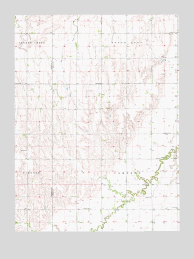
Cameron, NE USGS Topographic Map
Click on map above to begin viewing in our Map Viewer.

This topographic map contains these locations and features:
Feature Name Type Latitude Longitude GNIS ID View Map
Benton and Still DamDamN40.9736°W98.6355°1767356View Map
Benton and Still ReservoirReservoirN40.9734°W98.6381°1767357View Map
CameronPopulated PlaceN40.9172°W98.6354°835267View Map
Cameron ChurchChurchN40.9025°W98.6501°827877View Map
Cameron Post Office (historical)Post OfficeN40.9172°W98.6354°1874092View Map
City of Grand Island LandfillLocaleN40.8981°W98.7181°2646625View Map
Flash CreekStreamN40.8967°W98.6598°829321View Map
Mount Pleasant CemeteryCemeteryN40.9889°W98.6306°831477View Map
Prairie Creek Reservoir Number 4ReservoirN40.9236°W98.6694°1769791View Map
School Number 13 (historical)SchoolN40.8886°W98.6942°836213View Map
School Number 14 (historical)SchoolN40.9317°W98.6362°836235View Map
School Number 24 (historical)SchoolN40.8947°W98.6467°836437View Map
School Number 32 (historical)SchoolN40.9897°W98.6931°836575View Map
School Number 48 (historical)SchoolN40.9606°W98.6848°836775View Map
School Number 52SchoolN40.9606°W98.7498°836836View Map
School Number 59 (historical)SchoolN40.9753°W98.6367°836908View Map
School Number 61SchoolN40.9220°W98.7412°836943View Map
Swee CreekStreamN40.9975°W98.7498°833998View Map
Taylor Floodwater Retarding DamDamN40.9225°W98.6683°1769790View Map
Township of CameronCivilN40.9167°W98.6648°837902View Map
Wood River ChurchChurchN40.8883°W98.6265°834862View Map

Note: Coordinates in the location and feature list above are referenced to NAD83 datum.


Copyright (C) 2008-2025 Ryan Niemi / Sunset Dynamics ... All Rights Reserved