TopoQuest Logo
Do you find TopoQuest useful?
Help keep TopoQuest running and adding new maps/features by donating!
Bitcoin:  19c7KJd3qBynnjoSw5npx9KScwjBe4ifkT
Litecoin:  LXs6TkuXGGXo1vDsWCkWVdjQX94eUKd6ui
Home View Maps Find Maps Find Places Resources & Links


Ajo North, Arizona Topographic Map

USGS Map Title: Ajo North, AZ
USGS Map MRC: 32112D7
DRG (GeoTIFF) Download: o32112d7.tif


Neighboring USGS Topographic Map Quads:


  Midway SW, AZ  
32112E8
 

  Deadman Gap, AZ  
32112E7
 

  Hat Mountain SW, AZ  
32112E6
 

  Childs Mountain, AZ  
32112D8
 

  Ajo North, AZ  
32112D7
 

  Burro Gap, AZ  
32112D6
 

  Chico Shunie, AZ  
32112C8
 

  Ajo South, AZ  
32112C7
 

  Sikort Chuapo, AZ  
32112C6


Map MRC Location:

N33°
W113°
N33°
W112°
H8 H7 H6 H5 H4 H3 H2 H1
G8 G7 G6 G5 G4 G3 G2 G1
F8 F7 F6 F5 F4 F3 F2 F1
E8 E7 E6 E5 E4 E3 E2 E1
D8 D7 D6 D5 D4 D3 D2 D1
C8 C7 C6 C5 C4 C3 C2 C1
B8 B7 B6 B5 B4 B3 B2 B1
A8 A7 A6 A5 A4 A3 A2 A1
N32°
W113°
N32°
W112°

Ajo North, AZ USGS 1:24K Topographic Map Preview:
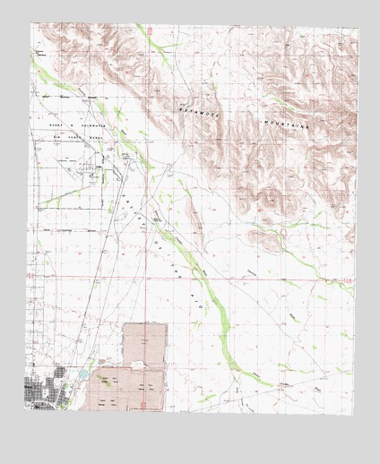
Ajo North, AZ USGS Topographic Map
Click on map above to begin viewing in our Map Viewer.

This topographic map contains these locations and features:
Feature Name Type Latitude Longitude GNIS ID View Map
Ajo Army Air Field (historical)MilitaryN32.4531°W112.8553°2091464View Map
Ajo CemeteryCemeteryN32.3803°W112.8675°2622945View Map
Ajo Country ClubLocaleN32.4509°W112.8515°43159View Map
Ajo First Assembly of GodChurchN32.3803°W112.8731°2623013View Map
Ajo LandfillLocaleN32.3928°W112.8492°2622368View Map
Ajo Recreation CenterParkN32.3776°W112.8596°15255View Map
Batamote MountainsSummitN32.4656°W112.7549°1068View Map
Bud Walker ParkParkN32.3834°W112.8624°15292View Map
ChildsPopulated PlaceN32.4528°W112.8435°2831View Map
Childs RanchLocaleN32.4895°W112.8743°2834View Map
Darby ArroyoValleyN32.3773°W112.7921°3699View Map
Dennison Picnic GroundParkN32.4356°W112.8271°3846View Map
East Dam Tailings PondReservoirN32.3831°W112.8282°4273View Map
Eric Marcus Municipal AirportAirportN32.4521°W112.8604°15254View Map
Full Gospel Fellowship ChurchChurchN32.3911°W112.8715°2623439View Map
GibsonPopulated PlaceN32.3787°W112.8729°5005View Map
Good Shepherd Presbyterian ChurchChurchN32.3772°W112.8661°2623442View Map
KTTZ-FM (Ajo)TowerN32.3931°W112.8715°45165View Map
North Dam Tailings PondReservoirN32.3848°W112.8421°8714View Map
Pima County Sheriff's Office Ajo DistrictBuildingN32.3827°W112.8572°15525View Map
Plaza Shopping CenterLocaleN32.3753°W112.8629°15532View Map
Rio CornezArroyoN32.3945°W112.7993°15545View Map
Sikort Chuapo WashStreamN32.4542°W112.8304°11299View Map
South Dam Tailings PondReservoirN32.3767°W112.8440°11584View Map
Valley of the AjoValleyN32.4251°W112.7674°13170View Map
Well Number OneWellN32.4578°W112.8402°13453View Map

Note: Coordinates in the location and feature list above are referenced to NAD83 datum.


Copyright (C) 2008-2025 Ryan Niemi / Sunset Dynamics ... All Rights Reserved