TopoQuest Logo
Do you find TopoQuest useful?
Help keep TopoQuest running and adding new maps/features by donating!
Bitcoin:  19c7KJd3qBynnjoSw5npx9KScwjBe4ifkT
Litecoin:  LXs6TkuXGGXo1vDsWCkWVdjQX94eUKd6ui
Home View Maps Find Maps Find Places Resources & Links


Agua Nueva, Texas Topographic Map

USGS Map Title: Agua Nueva, TX
USGS Map MRC: 26098H5
DRG (GeoTIFF) Download: o26098h5.tif


Neighboring USGS Topographic Map Quads:


  Alta Vista Ranch SW, TX  
27098A6
 

  Alta Vista Ranch, TX  
27098A5
 

  Palomas Ranch SW, TX  
27098A4
 

  Agua Nueva NW, TX  
26098H6
 

  Agua Nueva, TX  
26098H5
 

  Santa Elena NW, TX  
26098H4
 

  Borregos Ranch, TX  
26098G6
 

  Agua Nueva SE, TX  
26098G5
 

  Santa Elena, TX  
26098G4


Map MRC Location:

N27°
W99°
N27°
W98°
H8 H7 H6 H5 H4 H3 H2 H1
G8 G7 G6 G5 G4 G3 G2 G1
F8 F7 F6 F5 F4 F3 F2 F1
E8 E7 E6 E5 E4 E3 E2 E1
D8 D7 D6 D5 D4 D3 D2 D1
C8 C7 C6 C5 C4 C3 C2 C1
B8 B7 B6 B5 B4 B3 B2 B1
A8 A7 A6 A5 A4 A3 A2 A1
N26°
W99°
N26°
W98°

Agua Nueva, TX USGS 1:24K Topographic Map Preview:
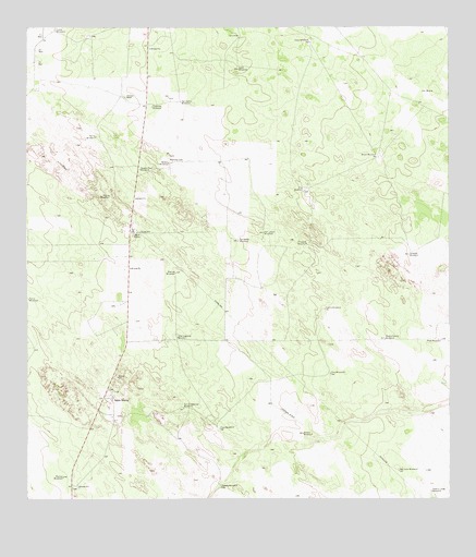
Agua Nueva, TX USGS Topographic Map
Click on map above to begin viewing in our Map Viewer.

This topographic map contains these locations and features:
Feature Name Type Latitude Longitude GNIS ID View Map
Agua NuevaPopulated PlaceN26.9017°W98.6003°1381013View Map
Arroyo WindmillLocaleN26.8923°W98.5434°1329770View Map
Brazil WindmillLocaleN26.9662°W98.5208°1331212View Map
Buena Suerte WindmillLocaleN26.9178°W98.5189°1331533View Map
Chapote WindmillLocaleN26.9431°W98.5422°1332670View Map
Charco Largo WindmillLocaleN26.8773°W98.5056°1332680View Map
Copa WindmillLocaleN26.9967°W98.5406°1333306View Map
Escobedo WindmillLocaleN26.9434°W98.5625°1335494View Map
Huella WindmillLocaleN26.9256°W98.5367°1338226View Map
Loma WindmillLocaleN26.9995°W98.6170°1340361View Map
Manuel WindmillLocaleN26.9356°W98.5811°1340903View Map
Marino WindmillLocaleN26.8809°W98.6150°1340957View Map
Palomas RanchLocaleN26.9817°W98.5959°1343498View Map
Papalote WindmillLocaleN26.9792°W98.5875°1343573View Map
Pita WindmillLocaleN26.9570°W98.5425°1344142View Map
Plato WindmillLocaleN26.9175°W98.5025°1344173View Map
Puesta Del Sol AirportAirportN26.8798°W98.5043°1387034View Map
Ramirez CemeteryCemeteryN26.9650°W98.5825°1344732View Map
Rosita WindmillLocaleN26.9553°W98.6006°1345608View Map
Salada WindmillLocaleN26.9645°W98.5828°1346141View Map
Salado WindmillLocaleN26.8784°W98.5681°1346150View Map
San Carlos WindmillLocaleN26.9806°W98.5789°1346321View Map
San Guadalupe WindmillLocaleN26.8992°W98.5789°1346353View Map
San Juan WindmillLocaleN26.8828°W98.5153°1346411View Map
San Lazaro WindmillLocaleN26.9459°W98.5545°1346419View Map
Sand WindmillLocaleN26.9895°W98.5617°1346550View Map
Serita WindmillLocaleN26.9714°W98.6047°1346902View Map
Soledad WindmillLocaleN26.9400°W98.5120°1347364View Map
Square Tank WindmillLocaleN26.9628°W98.5914°1347772View Map
Taco WindmillLocaleN26.8942°W98.5681°1348197View Map
Toro WindmillLocaleN26.9084°W98.5353°1348655View Map
Tres Lagunas WindmillLocaleN26.9181°W98.5809°1348754View Map

Note: Coordinates in the location and feature list above are referenced to NAD83 datum.


Copyright (C) 2008-2025 Ryan Niemi / Sunset Dynamics ... All Rights Reserved