TopoQuest Logo
Do you find TopoQuest useful?
Help keep TopoQuest running and adding new maps/features by donating!
Bitcoin:  19c7KJd3qBynnjoSw5npx9KScwjBe4ifkT
Litecoin:  LXs6TkuXGGXo1vDsWCkWVdjQX94eUKd6ui
Home View Maps Find Maps Find Places Resources & Links


Altoona, Kansas Topographic Map

USGS Map Title: Altoona, KS
USGS Map MRC: 37095E6
DRG (GeoTIFF) Download: o37095e6.tif


Neighboring USGS Topographic Map Quads:


  Middletown, KS  
37095F7
 

  Buffalo, KS  
37095F6
 

  Vilas, KS  
37095F5
 

  Fredonia, KS  
37095E7
 

  Altoona, KS  
37095E6
 

  Five Mounds, KS  
37095E5
 

  Lafontaine, KS  
37095D7
 

  Neodesha, KS  
37095D6
 

  Morehead, KS  
37095D5


Map MRC Location:

N38°
W96°
N38°
W95°
H8 H7 H6 H5 H4 H3 H2 H1
G8 G7 G6 G5 G4 G3 G2 G1
F8 F7 F6 F5 F4 F3 F2 F1
E8 E7 E6 E5 E4 E3 E2 E1
D8 D7 D6 D5 D4 D3 D2 D1
C8 C7 C6 C5 C4 C3 C2 C1
B8 B7 B6 B5 B4 B3 B2 B1
A8 A7 A6 A5 A4 A3 A2 A1
N37°
W96°
N37°
W95°

Altoona, KS USGS 1:24K Topographic Map Preview:
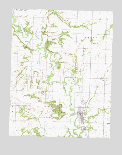
Altoona, KS USGS Topographic Map
Click on map above to begin viewing in our Map Viewer.

This topographic map contains these locations and features:
Feature Name Type Latitude Longitude GNIS ID View Map
AltoonaPopulated PlaceN37.5239°W95.6614°475090View Map
Altoona - Midway Elementary SchoolSchoolN37.5247°W95.6657°474925View Map
Altoona City HallBuildingN37.5233°W95.6624°2693312View Map
Altoona Fire DepartmentBuildingN37.5230°W95.6633°2111099View Map
Altoona Public LibraryBuildingN37.5303°W95.6605°2694807View Map
Altoona Sewer Treatment PlantLocaleN37.5107°W95.6634°2693263View Map
Baker Valley School (historical)SchoolN37.5734°W95.7150°484159View Map
Barnhill BridgeBridgeN37.5542°W95.6972°475091View Map
Big Cedar CreekStreamN37.5092°W95.6655°475094View Map
Camp CaubleLocaleN37.6214°W95.6980°475093View Map
City of AltoonaCivilN37.5251°W95.6616°2393940View Map
Crooked CreekStreamN37.5862°W95.7144°475088View Map
Excelsior School (historical)SchoolN37.5587°W95.6700°484166View Map
Fairview School (historical)SchoolN37.5587°W95.6311°484167View Map
First Baptist ChurchChurchN37.5274°W95.6618°2688961View Map
GuilfordPopulated PlaceN37.5992°W95.7197°484715View Map
Guilford BridgeBridgeN37.5928°W95.7286°475092View Map
Harmony SchoolSchoolN37.5151°W95.6294°475089View Map
Hatler School (historical)SchoolN37.5006°W95.6930°484178View Map
Kelley School (historical)SchoolN37.5376°W95.7019°484182View Map
Little Cedar CreekStreamN37.5156°W95.6541°475095View Map
Olive Branch School (historical)SchoolN37.5009°W95.7430°484194View Map
Omega School (historical)SchoolN37.6001°W95.6605°484195View Map
Township of CedarCivilN37.5154°W95.6883°469660View Map
Township of GuilfordCivilN37.6027°W95.7244°474917View Map
Verdigris Valley Christian FellowshipChurchN37.5304°W95.6603°2689246View Map
Wilson CountyCivilN37.5592°W95.7434°485063View Map
Wilson County Rural Fire District Station 6BuildingN37.5043°W95.7430°2112012View Map

Note: Coordinates in the location and feature list above are referenced to NAD83 datum.


Copyright (C) 2008-2024 Ryan Niemi / Sunset Dynamics ... All Rights Reserved