TopoQuest Logo
Do you find TopoQuest useful?
Help keep TopoQuest running and adding new maps/features by donating!
Bitcoin:  19c7KJd3qBynnjoSw5npx9KScwjBe4ifkT
Litecoin:  LXs6TkuXGGXo1vDsWCkWVdjQX94eUKd6ui
Home View Maps Find Maps Find Places Resources & Links


Bartle, California Topographic Map

USGS Map Title: Bartle, CA
USGS Map MRC: 41121C7
DRG (GeoTIFF) Download: o41121c7.tif


Neighboring USGS Topographic Map Quads:


  Rainbow Mountain, CA  
41121D8
 

  Horse Peak, CA  
41121D7
 

  Snag Hill, CA  
41121D6
 

  Kinyon, CA  
41121C8
 

  Bartle, CA  
41121C7
 

  Hambone, CA  
41121C6
 

  Grizzly Peak, CA  
41121B8
 

  Dead Horse Summit, CA  
41121B7
 

  Pondosa, CA  
41121B6


Map MRC Location:

N42°
W122°
N42°
W121°
H8 H7 H6 H5 H4 H3 H2 H1
G8 G7 G6 G5 G4 G3 G2 G1
F8 F7 F6 F5 F4 F3 F2 F1
E8 E7 E6 E5 E4 E3 E2 E1
D8 D7 D6 D5 D4 D3 D2 D1
C8 C7 C6 C5 C4 C3 C2 C1
B8 B7 B6 B5 B4 B3 B2 B1
A8 A7 A6 A5 A4 A3 A2 A1
N41°
W122°
N41°
W121°

Bartle, CA USGS 1:24K Topographic Map Preview:
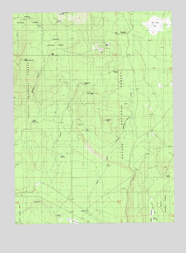
Bartle, CA USGS Topographic Map
Click on map above to begin viewing in our Map Viewer.

This topographic map contains these locations and features:
Feature Name Type Latitude Longitude GNIS ID View Map
Atkins MeadowsFlatN41.2554°W121.7706°256366View Map
BartlePopulated PlaceN41.2577°W121.8211°256562View Map
Bartle CreekStreamN41.2615°W121.8228°256563View Map
Big Sand FlatFlatN41.3665°W121.7611°257003View Map
Buck MountainSummitN41.3747°W121.8351°266495View Map
Buck Mountain SpringSpringN41.3465°W121.8247°257579View Map
Cabin ButteSummitN41.3499°W121.8437°257795View Map
Cold SpringSpringN41.2773°W121.7572°258551View Map
Coney IslandLocaleN41.2563°W121.8383°258640View Map
Curtis MeadowsFlatN41.2515°W121.8319°258996View Map
Dry CreekStreamN41.2532°W121.8308°222633View Map
Four CornersLocaleN41.3099°W121.8583°260294View Map
Little Black Fox MountainSummitN41.3470°W121.8683°262542View Map
McIntosh WellWellN41.2832°W121.8039°263371View Map
McKay CreekStreamN41.2860°W121.8453°263376View Map
McKay SpringsSpringN41.2897°W121.8397°263380View Map
Red Tank SpringSpringN41.3400°W121.7943°265337View Map
Sheepheaven ButteSummitN41.3267°W121.8122°266081View Map
Sheepheaven CreekStreamN41.3209°W121.8335°2743485View Map
Sheepheaven SpringSpringN41.3324°W121.8209°266082View Map
Shirttail CampLocaleN41.3263°W121.8553°276793View Map
Shirttail CanyonValleyN41.3190°W121.8567°266126View Map
Slagger CampLocaleN41.3615°W121.7872°266258View Map
Slagger Camp Forest Service StationLocaleN41.3621°W121.7864°1657879View Map
Slagger SpringSpringN41.3556°W121.8040°266259View Map
Snow Survey CabinLocaleN41.3521°W121.8367°267329View Map
Stillwater ButteSummitN41.3107°W121.8040°267748View Map
Stillwater MeadowsFlatN41.3029°W121.7922°267750View Map
Twin SpringsSpringN41.3052°W121.8197°268549View Map

Note: Coordinates in the location and feature list above are referenced to NAD83 datum.


Copyright (C) 2008-2025 Ryan Niemi / Sunset Dynamics ... All Rights Reserved