TopoQuest Logo
Do you find TopoQuest useful?
Help keep TopoQuest running and adding new maps/features by donating!
Bitcoin:  19c7KJd3qBynnjoSw5npx9KScwjBe4ifkT
Litecoin:  LXs6TkuXGGXo1vDsWCkWVdjQX94eUKd6ui
Home View Maps Find Maps Find Places Resources & Links


Bear Creek Reservoir, Montana Topographic Map

USGS Map Title: Bear Creek Reservoir, MT
USGS Map MRC: 47108C6
DRG (GeoTIFF) Download: o47108c6.tif


Neighboring USGS Topographic Map Quads:


  Griffee Coulee, MT  
47108D7
 

  Sloan Reservoir, MT  
47108D6
 

  Kachia Reservoir, MT  
47108D5
 

  Bohemian Corners, MT  
47108C7
 

  Bear Creek Reservoir, MT  
47108C6
 

  Bear Creek Reservoir SE, MT  
47108C5
 

  Grass Range NE, MT  
47108B7
 

  Teigen NW, MT  
47108B6
 

  Wild Horse Lake, MT  
47108B5


Map MRC Location:

N48°
W109°
N48°
W108°
H8 H7 H6 H5 H4 H3 H2 H1
G8 G7 G6 G5 G4 G3 G2 G1
F8 F7 F6 F5 F4 F3 F2 F1
E8 E7 E6 E5 E4 E3 E2 E1
D8 D7 D6 D5 D4 D3 D2 D1
C8 C7 C6 C5 C4 C3 C2 C1
B8 B7 B6 B5 B4 B3 B2 B1
A8 A7 A6 A5 A4 A3 A2 A1
N47°
W109°
N47°
W108°

Bear Creek Reservoir, MT USGS 1:24K Topographic Map Preview:
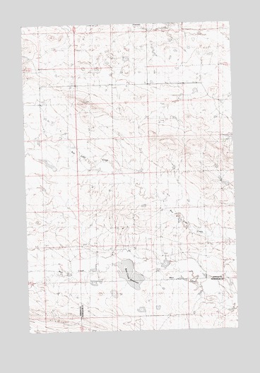
Bear Creek Reservoir, MT USGS Topographic Map
Click on map above to begin viewing in our Map Viewer.

This topographic map contains these locations and features:
Feature Name Type Latitude Longitude GNIS ID View Map
18N23E11DD__01 WellWellN47.3300°W108.7463°822254View Map
18N24E14BAB_01 WellWellN47.3255°W108.6282°822223View Map
18N24E14BB__01 WellWellN47.3250°W108.6340°822222View Map
18N24E29BBD_01 WellWellN47.2944°W108.6924°822006View Map
18N25E07CADB01 WellWellN47.3325°W108.6288°822275View Map
Adams Number 2 DamDamN47.2783°W108.6874°795137View Map
Bear Creek ReservoirReservoirN47.2731°W108.6899°805710View Map
Box Elder School (historical)SchoolN47.3341°W108.7385°1722714View Map
Christensen Post Office (historical)Post OfficeN47.2564°W108.7396°1722805View Map
Cooper Adams Number 1 DamDamN47.2950°W108.7257°797687View Map
Cooper-Adams Number 4 DamDamN47.2716°W108.7074°797686View Map
Cooper-Adams Number 5 DamDamN47.2733°W108.6874°798325View Map
Cooper-Adams Number 6 DamDamN47.2800°W108.6724°797688View Map
Dory Post Office (historical)Post OfficeN47.3580°W108.6849°1722869View Map
Fink Number 2 DamDamN47.3600°W108.6607°797691View Map
Havre Reservoir DamDamN47.3467°W108.6374°796146View Map
Peters DamDamN47.3133°W108.7357°796145View Map
Peters Number 2 DamDamN47.3266°W108.7374°797914View Map
Styer Number 2 DamDamN47.3650°W108.6757°797692View Map
Valley View School (historical)SchoolN47.3430°W108.6832°1722753View Map
Waverly Presbyterian Church (historical)ChurchN47.3208°W108.6432°1722536View Map

Note: Coordinates in the location and feature list above are referenced to NAD83 datum.


Copyright (C) 2008-2025 Ryan Niemi / Sunset Dynamics ... All Rights Reserved