TopoQuest Logo
Do you find TopoQuest useful?
Help keep TopoQuest running and adding new maps/features by donating!
Bitcoin:  19c7KJd3qBynnjoSw5npx9KScwjBe4ifkT
Litecoin:  LXs6TkuXGGXo1vDsWCkWVdjQX94eUKd6ui
Home View Maps Find Maps Find Places Resources & Links


Bjornberg Bridge, Montana Topographic Map

USGS Map Title: Bjornberg Bridge, MT
USGS Map MRC: 48107E2
DRG (GeoTIFF) Download: o48107e2.tif


Neighboring USGS Topographic Map Quads:


  Porcupine Coulee, MT  
48107F3
 

  Genevieve, MT  
48107F2
 

  Papoose Hills, MT  
48107F1
 

  Double S Hill, MT  
48107E3
 

  Bjornberg Bridge, MT  
48107E2
 

  Jones Coulee, MT  
48107E1
 

  Saco, MT  
48107D3
 

  Hinsdale NW, MT  
48107D2
 

  Hinsdale, MT  
48107D1


Map MRC Location:

N49°
W108°
N49°
W107°
H8 H7 H6 H5 H4 H3 H2 H1
G8 G7 G6 G5 G4 G3 G2 G1
F8 F7 F6 F5 F4 F3 F2 F1
E8 E7 E6 E5 E4 E3 E2 E1
D8 D7 D6 D5 D4 D3 D2 D1
C8 C7 C6 C5 C4 C3 C2 C1
B8 B7 B6 B5 B4 B3 B2 B1
A8 A7 A6 A5 A4 A3 A2 A1
N48°
W108°
N48°
W107°

Bjornberg Bridge, MT USGS 1:24K Topographic Map Preview:
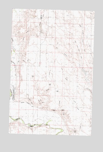
Bjornberg Bridge, MT USGS Topographic Map
Click on map above to begin viewing in our Map Viewer.

This topographic map contains these locations and features:
Feature Name Type Latitude Longitude GNIS ID View Map
33N35E17BCCC01 WellWellN48.6236°W107.1826°1636057View Map
Anderson CouleeValleyN48.5861°W107.2465°800268View Map
Bell CouleeValleyN48.5711°W107.1470°800269View Map
Bjornberg BridgeBridgeN48.5078°W107.2148°800265View Map
Bjornberg Bridge Fishing Access SiteLocaleN48.5078°W107.2165°1744287View Map
Bucher CouleeValleyN48.5320°W107.1987°800260View Map
Burnt Shed CouleeValleyN48.5695°W107.2437°800267View Map
Chesley SloughSwampN48.5433°W107.1787°800270View Map
East Fork Cash CreekStreamN48.5495°W107.1298°806281View Map
Farmer CouleeValleyN48.5033°W107.1556°800258View Map
Farmer SpringSpringN48.5040°W107.1486°800259View Map
Frenchman Creek School (historical)SchoolN48.5758°W107.2415°1721889View Map
Frenchman Irrigation Company CanalCanalN48.5731°W107.2479°800266View Map
McChesney ReservoirReservoirN48.5411°W107.2448°800262View Map
McChesney SpringsSpringN48.5247°W107.1812°800263View Map
Middle Fork Cash CreekStreamN48.5495°W107.1298°806290View Map
Nelson's RanchLocaleN48.5425°W107.2373°774590View Map
North Bench School (historical)SchoolN48.5114°W107.1390°1819584View Map
North SpringSpringN48.5494°W107.1902°800272View Map
Smith CouleeValleyN48.5281°W107.2167°800264View Map
Smoke School (historical)SchoolN48.5467°W107.1823°1819583View Map
Snieder CouleeValleyN48.5131°W107.1670°800256View Map
Snieder SpringSpringN48.5244°W107.1715°800257View Map
Snieder's RanchLocaleN48.5222°W107.1676°776703View Map
Stevens CouleeValleyN48.5283°W107.2029°800261View Map
Stuff School (historical)SchoolN48.5833°W107.1945°1677224View Map
Swanson CouleeStreamN48.5247°W107.2009°799027View Map
Taylor SpringSpringN48.5578°W107.2149°800271View Map
West Cache Creek School (historical)SchoolN48.5903°W107.1473°1677225View Map
West Fork Cash CreekStreamN48.5583°W107.1340°806289View Map

Note: Coordinates in the location and feature list above are referenced to NAD83 datum.


Copyright (C) 2008-2025 Ryan Niemi / Sunset Dynamics ... All Rights Reserved