TopoQuest Logo
Do you find TopoQuest useful?
Help keep TopoQuest running and adding new maps/features by donating!
Bitcoin:  19c7KJd3qBynnjoSw5npx9KScwjBe4ifkT
Litecoin:  LXs6TkuXGGXo1vDsWCkWVdjQX94eUKd6ui
Home View Maps Find Maps Find Places Resources & Links


Blue Hill, Nebraska Topographic Map

USGS Map Title: Blue Hill, NE
USGS Map MRC: 40098C4
DRG (GeoTIFF) Download: o40098c4.tif


Neighboring USGS Topographic Map Quads:


  Roseland, NE  
40098D5
 

  Ayr, NE  
40098D4
 

  Pauline, NE  
40098D3
 

  Bladen, NE  
40098C5
 

  Blue Hill, NE  
40098C4
 

  Lawrence, NE  
40098C3
 

  Red Cloud NE, NE  
40098B5
 

  Cowles, NE  
40098B4
 

  Guide Rock NE, NE  
40098B3


Map MRC Location:

N41°
W99°
N41°
W98°
H8 H7 H6 H5 H4 H3 H2 H1
G8 G7 G6 G5 G4 G3 G2 G1
F8 F7 F6 F5 F4 F3 F2 F1
E8 E7 E6 E5 E4 E3 E2 E1
D8 D7 D6 D5 D4 D3 D2 D1
C8 C7 C6 C5 C4 C3 C2 C1
B8 B7 B6 B5 B4 B3 B2 B1
A8 A7 A6 A5 A4 A3 A2 A1
N40°
W99°
N40°
W98°

Blue Hill, NE USGS 1:24K Topographic Map Preview:
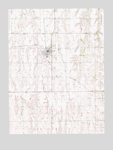
Blue Hill, NE USGS Topographic Map
Click on map above to begin viewing in our Map Viewer.

This topographic map contains these locations and features:
Feature Name Type Latitude Longitude GNIS ID View Map
Agri Co-op ElevatorLocaleN40.3356°W98.4514°1884694View Map
Armstrong DamDamN40.3408°W98.4219°1768063View Map
Armstrong ReservoirReservoirN40.3390°W98.4226°1768064View Map
Ash Hollow Country ClubLocaleN40.3378°W98.4434°836019View Map
Belle AmisHospitalN40.3322°W98.4476°1884686View Map
Blue HillPopulated PlaceN40.3325°W98.4487°827502View Map
Blue HillLocaleN40.3333°W98.4509°1884685View Map
Blue Hill CemeteryCemeteryN40.3345°W98.4362°827503View Map
Blue Hill ClinicHospitalN40.3325°W98.4487°1884693View Map
Blue Hill Dental CenterHospitalN40.3328°W98.4498°1884692View Map
Blue Hill Election Precinct (historical)CivilN40.2706°W98.3967°1928740View Map
Blue Hill Elementary SchoolSchoolN40.3289°W98.4503°1884701View Map
Blue Hill High SchoolSchoolN40.3272°W98.4503°1884700View Map
Blue Hill Police StationBuildingN40.3328°W98.4492°1884691View Map
Blue Hill Post OfficePost OfficeN40.3324°W98.4477°1884688View Map
Blue Hill Public LibraryBuildingN40.3325°W98.4473°1884690View Map
Blue Hill Volunteer Fire and RescueBuildingN40.3328°W98.4481°1884689View Map
Calvary Lutheran ChurchChurchN40.3325°W98.4487°1884695View Map
City of Blue HillCivilN40.3330°W98.4484°2394202View Map
Community CareHospitalN40.3367°W98.4445°1884687View Map
Election District 2CivilN40.3163°W98.4944°1953010View Map
Election District 4CivilN40.3331°W98.4473°1953012View Map
Holy Trinity Catholic ChurchChurchN40.3278°W98.4484°1884696View Map
Saint Paul Lutheran ChurchChurchN40.3328°W98.4473°1884697View Map
Schmidt DamDamN40.3183°W98.4653°1769214View Map
Schmidt ReservoirReservoirN40.3166°W98.4657°1769215View Map
Seeman DamDamN40.2667°W98.4320°1768091View Map
Seeman ReservoirReservoirN40.2671°W98.4313°1768092View Map
Siebrass DamDamN40.2733°W98.4670°1768093View Map
Siebrass ReservoirReservoirN40.2749°W98.4698°1768094View Map
Township of Elm CreekCivilN40.2506°W98.4420°1884621View Map
Township of PotsdamCivilN40.3056°W98.4420°1884623View Map
Trinity CemeteryCemeteryN40.3517°W98.4403°834165View Map
Trinity Lutheran ChurchChurchN40.3347°W98.4470°1884699View Map
United Methodist ChurchChurchN40.3303°W98.4473°1884698View Map
Walker CemeteryCemeteryN40.2881°W98.4259°834427View Map

Note: Coordinates in the location and feature list above are referenced to NAD83 datum.


Copyright (C) 2008-2025 Ryan Niemi / Sunset Dynamics ... All Rights Reserved