TopoQuest Logo
Do you find TopoQuest useful?
Help keep TopoQuest running and adding new maps/features by donating!
Bitcoin:  19c7KJd3qBynnjoSw5npx9KScwjBe4ifkT
Litecoin:  LXs6TkuXGGXo1vDsWCkWVdjQX94eUKd6ui
Home View Maps Find Maps Find Places Resources & Links


Brownfield, Missouri Topographic Map

USGS Map Title: Brownfield, MO
USGS Map MRC: 37092F3
DRG (GeoTIFF) Download: o37092f3.tif


Neighboring USGS Topographic Map Quads:


  Richland, MO  
37092G4
 

  Ozark Springs, MO  
37092G3
 

  Waynesville, MO  
37092G2
 

  Drynob, MO  
37092F4
 

  Brownfield, MO  
37092F3
 

  Bloodland, MO  
37092F2
 

  Drew, MO  
37092E4
 

  Winnipeg, MO  
37092E3
 

  Roby, MO  
37092E2


Map MRC Location:

N38°
W93°
N38°
W92°
H8 H7 H6 H5 H4 H3 H2 H1
G8 G7 G6 G5 G4 G3 G2 G1
F8 F7 F6 F5 F4 F3 F2 F1
E8 E7 E6 E5 E4 E3 E2 E1
D8 D7 D6 D5 D4 D3 D2 D1
C8 C7 C6 C5 C4 C3 C2 C1
B8 B7 B6 B5 B4 B3 B2 B1
A8 A7 A6 A5 A4 A3 A2 A1
N37°
W93°
N37°
W92°

Brownfield, MO USGS 1:24K Topographic Map Preview:
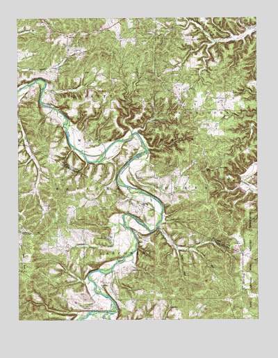
Brownfield, MO USGS Topographic Map
Click on map above to begin viewing in our Map Viewer.

This topographic map contains these locations and features:
Feature Name Type Latitude Longitude GNIS ID View Map
Adam FordPopulated PlaceN37.6284°W92.3288°748558View Map
Belle Fonte School (historical)SchoolN37.7275°W92.3574°753879View Map
Bellefonte (historical)LocaleN37.7278°W92.3538°744638View Map
Bench HollowValleyN37.6637°W92.3018°748782View Map
BrownfieldPopulated PlaceN37.6670°W92.3449°749047View Map
Brownfield CemeteryCemeteryN37.6589°W92.3290°749048View Map
Brownfield Missionary ChurchChurchN37.6617°W92.3738°749049View Map
Brownfield School (historical)SchoolN37.6712°W92.3327°753355View Map
Cantrel HollowValleyN37.6539°W92.2829°749198View Map
Cave Spring School (historical)SchoolN37.7334°W92.2560°753882View Map
Cole Creek Horse TrailTrailN37.6745°W92.3654°753973View Map
Cook CemeteryCemeteryN37.6456°W92.3157°749450View Map
Fairview ChurchChurchN37.7164°W92.2663°749887View Map
Fairview Lookout TowerTowerN37.6875°W92.2763°755177View Map
Fairview SchoolSchoolN37.6875°W92.2702°749892View Map
Fyan (historical)LocaleN37.6731°W92.2954°744650View Map
GreenviewPopulated PlaceN37.6562°W92.2579°750152View Map
Jackson CemeteryCemeteryN37.6392°W92.3282°750481View Map
Killman HollowValleyN37.7403°W92.2724°750602View Map
Land SpringSpringN37.6979°W92.3716°750648View Map
Nelson CreekStreamN37.6284°W92.3291°751276View Map
Nelson SchoolSchoolN37.6300°W92.2966°751279View Map
Nicks CemeteryCemeteryN37.6727°W92.3107°751315View Map
Nicks CemeteryCemeteryN37.6953°W92.3149°751316View Map
Prospect School (historical)SchoolN37.7189°W92.3246°753880View Map
Rollins CemeteryCemeteryN37.7420°W92.3482°751954View Map
Simpson CemeteryCemeteryN37.6295°W92.3415°752170View Map
Simpson School (historical)SchoolN37.6425°W92.3493°746810View Map
Straight HollowValleyN37.6537°W92.2913°752389View Map

Note: Coordinates in the location and feature list above are referenced to NAD83 datum.


Copyright (C) 2008-2024 Ryan Niemi / Sunset Dynamics ... All Rights Reserved