TopoQuest Logo
Do you find TopoQuest useful?
Help keep TopoQuest running and adding new maps/features by donating!
Bitcoin:  19c7KJd3qBynnjoSw5npx9KScwjBe4ifkT
Litecoin:  LXs6TkuXGGXo1vDsWCkWVdjQX94eUKd6ui
Home View Maps Find Maps Find Places Resources & Links


Brush West, Colorado Topographic Map

USGS Map Title: Brush West, CO
USGS Map MRC: 40103C6
DRG (GeoTIFF) Download: o40103c6.tif


Neighboring USGS Topographic Map Quads:


  Peace Valley School, CO  
40103D7
 

  Dead Horse Springs, CO  
40103D6
 

  Antelope Springs, CO  
40103D5
 

  Fort Morgan, CO  
40103C7
 

  Brush West, CO  
40103C6
 

  Brush East, CO  
40103C5
 

  Lamb, CO  
40103B7
 

  Round Top, CO  
40103B6
 

  Miller Ranch, CO  
40103B5


Map MRC Location:

N41°
W104°
N41°
W103°
H8 H7 H6 H5 H4 H3 H2 H1
G8 G7 G6 G5 G4 G3 G2 G1
F8 F7 F6 F5 F4 F3 F2 F1
E8 E7 E6 E5 E4 E3 E2 E1
D8 D7 D6 D5 D4 D3 D2 D1
C8 C7 C6 C5 C4 C3 C2 C1
B8 B7 B6 B5 B4 B3 B2 B1
A8 A7 A6 A5 A4 A3 A2 A1
N40°
W104°
N40°
W103°

Brush West, CO USGS 1:24K Topographic Map Preview:
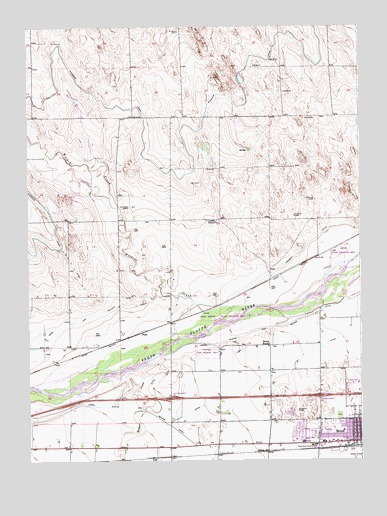
Brush West, CO USGS Topographic Map
Click on map above to begin viewing in our Map Viewer.

This topographic map contains these locations and features:
Feature Name Type Latitude Longitude GNIS ID View Map
Badger CreekStreamN40.2764°W103.7097°182916View Map
Brush City Police DepartmentBuildingN40.2550°W103.6263°2757243View Map
Brush Fire DepartmentBuildingN40.2547°W103.6345°2666919View Map
Brush LateralCanalN40.2547°W103.6505°182923View Map
Brush Memorial CemeteryCemeteryN40.2608°W103.6325°2083373View Map
Brush Post OfficePost OfficeN40.2549°W103.6255°2736038View Map
Bunker Hill Country ClubLocaleN40.2654°W103.6477°2723804View Map
City of BrushCivilN40.2581°W103.6322°2409926View Map
Colwell SchoolSchoolN40.3189°W103.6833°182919View Map
DoddPopulated PlaceN40.2872°W103.7075°182918View Map
East Morgan County HospitalHospitalN40.2557°W103.6495°2695615View Map
Eben Ezer CemeteryCemeteryN40.2544°W103.6435°2083374View Map
Eben Ezer Lutheran Care CenterBuildingN40.2540°W103.6420°182920View Map
Fremont Butte HeliportAirportN40.2639°W103.6969°204242View Map
High Plains Correctional FacilityBuildingN40.2722°W103.6300°2736088View Map
J. L. Brush Memorial CemeteryCemeteryN40.2628°W103.6331°2083375View Map
KJYY-FM (Brush)TowerN40.2608°W103.6380°204092View Map
KKDD-FM (Brush)TowerN40.2608°W103.6380°204091View Map
KKGZ-AM (Brush)TowerN40.2608°W103.6380°203972View Map
LodiPopulated PlaceN40.2511°W103.7038°182917View Map
Lower Platte and Beaver CanalCanalN40.2908°W103.6476°2677366View Map
Morey SchoolSchoolN40.2836°W103.6599°182921View Map
NelsonPopulated PlaceN40.2528°W103.6608°182922View Map
Tremont CanalCanalN40.3080°W103.6505°202918View Map
Upper Platte and Beaver CanalCanalN40.2555°W103.6894°182900View Map
Wildcat CreekStreamN40.2936°W103.6663°182914View Map

Note: Coordinates in the location and feature list above are referenced to NAD83 datum.


Copyright (C) 2008-2025 Ryan Niemi / Sunset Dynamics ... All Rights Reserved