TopoQuest Logo
Do you find TopoQuest useful?
Help keep TopoQuest running and adding new maps/features by donating!
Bitcoin:  19c7KJd3qBynnjoSw5npx9KScwjBe4ifkT
Litecoin:  LXs6TkuXGGXo1vDsWCkWVdjQX94eUKd6ui
Home View Maps Find Maps Find Places Resources & Links


Buck Hill Falls, Pennsylvania Topographic Map

USGS Map Title: Buck Hill Falls, PA
USGS Map MRC: 41075B3
DRG (GeoTIFF) Download: o41075b3.tif


Neighboring USGS Topographic Map Quads:


  Sterling, PA  
41075C4
 

  Newfoundland, PA  
41075C3
 

  Promised Land, PA  
41075C2
 

  Tobyhanna, PA  
41075B4
 

  Buck Hill Falls, PA  
41075B3
 

  Skytop, PA  
41075B2
 

  Pocono Pines, PA  
41075A4
 

  Mount Pocono, PA  
41075A3
 

  East Stroudsburg, PA  
41075A2


Map MRC Location:

N42°
W76°
N42°
W75°
H8 H7 H6 H5 H4 H3 H2 H1
G8 G7 G6 G5 G4 G3 G2 G1
F8 F7 F6 F5 F4 F3 F2 F1
E8 E7 E6 E5 E4 E3 E2 E1
D8 D7 D6 D5 D4 D3 D2 D1
C8 C7 C6 C5 C4 C3 C2 C1
B8 B7 B6 B5 B4 B3 B2 B1
A8 A7 A6 A5 A4 A3 A2 A1
N41°
W76°
N41°
W75°

Buck Hill Falls, PA USGS 1:24K Topographic Map Preview:
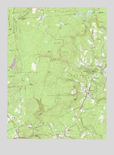
Buck Hill Falls, PA USGS Topographic Map
Click on map above to begin viewing in our Map Viewer.

This topographic map contains these locations and features:
Feature Name Type Latitude Longitude GNIS ID View Map
Barclay White DamDamN41.2270°W75.3182°1208875View Map
Barrett Township Fire Company Station 22BuildingN41.1685°W75.2746°2653544View Map
Barrett Township Police DepartmentBuildingN41.1718°W75.2718°2776898View Map
Barrett Volunteer Ambulance Corps Station 2 MountainhomeBuildingN41.1681°W75.2752°2722271View Map
Birch LakeReservoirN41.1987°W75.2626°1212907View Map
Brodhead Creek SCS Dam 466DamN41.1934°W75.2896°1195333View Map
Buck Hill CreekStreamN41.1956°W75.2566°1170516View Map
Buck Hill DamDamN41.2009°W75.3088°1208901View Map
Buck Hill FallsPopulated PlaceN41.1879°W75.2657°1170517View Map
Buck Hill FallsFallsN41.1948°W75.2685°1201472View Map
Buck Hill Falls Post OfficePost OfficeN41.1918°W75.2708°2773088View Map
Buck Hill Falls Post Office (historical)Post OfficeN41.1879°W75.2657°2027119View Map
Bush MountainSummitN41.2156°W75.3105°1170766View Map
CanadensisPopulated PlaceN41.1920°W75.2513°1192235View Map
Canadensis Post OfficePost OfficeN41.1967°W75.2555°2773092View Map
Chestnut MountainSummitN41.2109°W75.3052°1171736View Map
Coolbaugh Township Volunteer Fire Company Station 25 Wildflower StationBuildingN41.1706°W75.3596°2652958View Map
CovevillePopulated PlaceN41.2123°W75.2680°1172538View Map
CrescoPopulated PlaceN41.1540°W75.2805°1172678View Map
Cresco HeightsSummitN41.1623°W75.2949°1172679View Map
Cresco Post OfficePost OfficeN41.1588°W75.2798°2773107View Map
Cross DamDamN41.2398°W75.3335°1208834View Map
Deer LakeReservoirN41.2037°W75.2821°1212908View Map
Devils Hole CreekStreamN41.1279°W75.3082°1173206View Map
Dresser HillSummitN41.2206°W75.3596°1173469View Map
Dresser LakeReservoirN41.2174°W75.3558°1202941View Map
Geissinger DamDamN41.1704°W75.2782°1208895View Map
Goose Pond RunStreamN41.1879°W75.2513°1175828View Map
Gravel PondReservoirN41.2278°W75.2552°1176009View Map
Griscom CreekStreamN41.1943°W75.2716°1176253View Map
Harriton DamDamN41.1340°W75.3121°1208873View Map
Jamie Lake DamDamN41.2398°W75.2880°1208871View Map
Keeney DamDamN41.2481°W75.3363°1208833View Map
Kistler LedgeBenchN41.2290°W75.3735°1178563View Map
Korner SchoolSchoolN41.1273°W75.3121°1197929View Map
Kresge DamDamN41.1798°W75.2860°1208883View Map
La AnnaPopulated PlaceN41.2476°W75.3343°1178728View Map
Lake CarobethReservoirN41.1957°W75.3680°1195334View Map
Lake in the CloudsReservoirN41.2445°W75.2726°1178769View Map
Lake JamieLakeN41.2423°W75.2873°1177981View Map
Lake JamieReservoirN41.2434°W75.2680°1195392View Map
Lake Jamie DamDamN41.2434°W75.2680°1195391View Map
Lake-In-The-Clouds DamDamN41.2468°W75.2680°1195397View Map
Lakes in the Clouds DamDamN41.2465°W75.2685°1208825View Map
Laurel RunStreamN41.2181°W75.2652°1178993View Map
Leavitt BranchStreamN41.1959°W75.2574°1198158View Map
Middle Branch Brodhead CreekStreamN41.1956°W75.2563°1181002View Map
Middle MountainSummitN41.2365°W75.2771°1181037View Map
Mill Creek DamDamN41.1684°W75.2996°1208872View Map
Mount GodfreySummitN41.1740°W75.2899°1175772View Map
Mount Pocono Golf CourseLocaleN41.1279°W75.3663°1206882View Map
Mount Pocono Post OfficePost OfficeN41.1309°W75.3617°2772852View Map
Mount WismerSummitN41.2365°W75.2527°1191625View Map
MountainhomePopulated PlaceN41.1737°W75.2710°1181968View Map
Mountainhome Census Designated PlaceCensusN41.1779°W75.2633°2389521View Map
Mountainhome Post OfficePost OfficeN41.1783°W75.2702°2773218View Map
Mountainhome SchoolSchoolN41.1829°W75.2646°1181969View Map
Mushroom FarmsPopulated PlaceN41.1468°W75.3544°1212561View Map
Naus and Newlyn DamDamN41.1934°W75.3696°1195335View Map
Onawa LakeReservoirN41.1704°W75.2782°1202910View Map
PA-446 DamDamN41.2451°W75.3302°1208818View Map
Paradise CrossingPopulated PlaceN41.1279°W75.3402°1204357View Map
Pocono Country PlacePopulated PlaceN41.1906°W75.3621°1212905View Map
Pocono Farms EastPopulated PlaceN41.1598°W75.3471°1212906View Map
Pocono Mission SchoolSchoolN41.1337°W75.2977°1184150View Map
Pocono Mountain Regional Emergency Medical Services Station 11 TobyhannaBuildingN41.1468°W75.3740°2722270View Map
Pocono Mountain Volunteer Fire Company Station 32BuildingN41.1314°W75.3645°2653300View Map
Pocono Mountains Municipal AirportAirportN41.1386°W75.3749°1194178View Map
Pocono Plateau LakeReservoirN41.2344°W75.3049°1184156View Map
Pocono PlayhousePopulated PlaceN41.1751°W75.2738°1184157View Map
Rattlesnake CreekStreamN41.1704°W75.2738°1184668View Map
Rocky Hill Ultralight FlightparkAirportN41.1487°W75.2746°2442841View Map
Saint Anns ChurchChurchN41.1929°W75.2555°1185780View Map
Schane DamDamN41.2376°W75.3607°1208885View Map
Seven Pines MountainSummitN41.1576°W75.3149°1187262View Map
Seventeenmile CreekStreamN41.2390°W75.3605°1187273View Map
Shaffers KnobSummitN41.2084°W75.3241°1187330View Map
Spruce Mountain RunStreamN41.2429°W75.2913°1212880View Map
Spruce Mountain RunStreamN41.2229°W75.2685°1188337View Map
State Game Lands Number 221ParkN41.1629°W75.3077°1188494View Map
Tank CreekStreamN41.1323°W75.3310°1189258View Map
Taylor PondReservoirN41.2418°W75.3363°1195385View Map
Taylor Pond DamDamN41.2418°W75.3363°1195386View Map
The Devils HoleBayN41.1493°W75.3346°1189399View Map
Tobyhanna State ParkParkN41.2390°W75.3724°1190999View Map
Turkey KnollSummitN41.1890°W75.3241°1189943View Map
Westbrook DamDamN41.1704°W75.2782°1208893View Map
Yankee RunStreamN41.1312°W75.3288°1191858View Map

Note: Coordinates in the location and feature list above are referenced to NAD83 datum.


Copyright (C) 2008-2024 Ryan Niemi / Sunset Dynamics ... All Rights Reserved