TopoQuest Logo
Do you find TopoQuest useful?
Help keep TopoQuest running and adding new maps/features by donating!
Bitcoin:  19c7KJd3qBynnjoSw5npx9KScwjBe4ifkT
Litecoin:  LXs6TkuXGGXo1vDsWCkWVdjQX94eUKd6ui
Home View Maps Find Maps Find Places Resources & Links


Chase Lake, Maine Topographic Map

USGS Map Title: Chase Lake, ME
USGS Map MRC: 46069D1
DRG (GeoTIFF) Download: o46069d1.tif


Neighboring USGS Topographic Map Quads:


  Third Musquacook Lake, ME  
46069E2
 

  Fifth Musquacook Lake, ME  
46069E1
 

  Mooseleuk Lake, ME  
46068E8
 

  Spider Lake, ME  
46069D2
 

  Chase Lake, ME  
46069D1
 

  Mooseleuk Mountain, ME  
46068D8
 

  Haymock Lake, ME  
46069C2
 

  Beetle Mountain, ME  
46069C1
 

  Millinocket Lake West, ME  
46068C8


Map MRC Location:

N47°
W70°
N47°
W69°
H8 H7 H6 H5 H4 H3 H2 H1
G8 G7 G6 G5 G4 G3 G2 G1
F8 F7 F6 F5 F4 F3 F2 F1
E8 E7 E6 E5 E4 E3 E2 E1
D8 D7 D6 D5 D4 D3 D2 D1
C8 C7 C6 C5 C4 C3 C2 C1
B8 B7 B6 B5 B4 B3 B2 B1
A8 A7 A6 A5 A4 A3 A2 A1
N46°
W70°
N46°
W69°

Chase Lake, ME USGS 1:24K Topographic Map Preview:
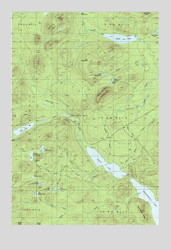
Chase Lake, ME USGS Topographic Map
Click on map above to begin viewing in our Map Viewer.

This topographic map contains these locations and features:
Feature Name Type Latitude Longitude GNIS ID View Map
Atkins BrookStreamN46.4078°W69.0320°561333View Map
Bluffer BrookStreamN46.3934°W69.0175°562622View Map
Chase BrookStreamN46.4112°W69.0426°563868View Map
Chase LakeLakeN46.4111°W69.0451°563880View Map
Currier BrookStreamN46.4103°W69.0476°564674View Map
East Branch Atkins BrookStreamN46.4259°W69.0201°565528View Map
Echo BrookStreamN46.4400°W69.0806°565766View Map
Echo LakeLakeN46.4314°W69.1146°565770View Map
Echo RidgeRidgeN46.4395°W69.1176°565775View Map
Fifth Currier BrookStreamN46.4073°W69.0776°566136View Map
Fifth Currier PondLakeN46.3964°W69.0900°566137View Map
First Currier BrookStreamN46.4064°W69.0737°566171View Map
First Currier PondLakeN46.4185°W69.0989°566172View Map
Fourth Currier PondLakeN46.3993°W69.1010°566481View Map
Island PondLakeN46.4845°W69.0320°568695View Map
Island Pond BrookStreamN46.4861°W69.0462°568698View Map
Little Bluffer BrookStreamN46.3842°W69.0753°569696View Map
Little Bluffer PondLakeN46.3930°W69.1034°569697View Map
Little Hudson PondLakeN46.4883°W69.0020°569833View Map
Little Ragged MountainSummitN46.4720°W69.0584°569992View Map
Little Ragged PondLakeN46.4634°W69.0473°569993View Map
Munsungan BrookStreamN46.4203°W69.0612°571986View Map
Munsungan RidgeRidgeN46.3817°W69.0125°571990View Map
North Branch Echo BrookStreamN46.4298°W69.1220°572272View Map
Norway BrookStreamN46.3898°W69.0017°572505View Map
Peaked MountainSummitN46.4959°W69.0835°573102View Map
Ragged BrookStreamN46.4628°W69.0001°573961View Map
Ragged MountainSummitN46.4523°W69.0479°573969View Map
Ragged PondLakeN46.4601°W69.0398°573971View Map
Second Currier BrookStreamN46.4073°W69.0776°575187View Map
Second Currier PondLakeN46.4155°W69.1078°575188View Map
Sewall Deadwater PondLakeN46.4393°W69.0766°575253View Map
Sixth Currier PondLakeN46.3962°W69.0845°575511View Map
South Branch Echo BrookStreamN46.4275°W69.1203°575780View Map
T9 R10 WELSCivilN46.4447°W69.0180°1987368View Map
Third Currier PondLakeN46.4034°W69.1057°576949View Map
Thirtyfoot FallsFallsN46.4125°W69.1048°576973View Map
West Branch Atkins BrookStreamN46.4256°W69.0198°578034View Map

Note: Coordinates in the location and feature list above are referenced to NAD83 datum.


Copyright (C) 2008-2024 Ryan Niemi / Sunset Dynamics ... All Rights Reserved