TopoQuest Logo
Do you find TopoQuest useful?
Help keep TopoQuest running and adding new maps/features by donating!
Bitcoin:  19c7KJd3qBynnjoSw5npx9KScwjBe4ifkT
Litecoin:  LXs6TkuXGGXo1vDsWCkWVdjQX94eUKd6ui
Home View Maps Find Maps Find Places Resources & Links


Cobert Mesa North, Colorado Topographic Map

USGS Map Title: Cobert Mesa North, CO
USGS Map MRC: 37103A5
DRG (GeoTIFF) Download: o37103a5.tif


Neighboring USGS Topographic Map Quads:


  Miners Peak, CO  
37103B6
 

  Tobe, CO  
37103B5
 

  Dalerose Mesa, CO  
37103B4
 

  Pine Canyon, CO  
37103A6
 

  Cobert Mesa North, CO  
37103A5
 

  Jesus Canyon, CO  
37103A4
 

  Cross L Ranch, NM  
36103H6
 

  Cobert Mesa South, NM  
36103H5
 

  Travesser Park, NM  
36103H4


Map MRC Location:

N38°
W104°
N38°
W103°
H8 H7 H6 H5 H4 H3 H2 H1
G8 G7 G6 G5 G4 G3 G2 G1
F8 F7 F6 F5 F4 F3 F2 F1
E8 E7 E6 E5 E4 E3 E2 E1
D8 D7 D6 D5 D4 D3 D2 D1
C8 C7 C6 C5 C4 C3 C2 C1
B8 B7 B6 B5 B4 B3 B2 B1
A8 A7 A6 A5 A4 A3 A2 A1
N37°
W104°
N37°
W103°

Cobert Mesa North, CO USGS 1:24K Topographic Map Preview:
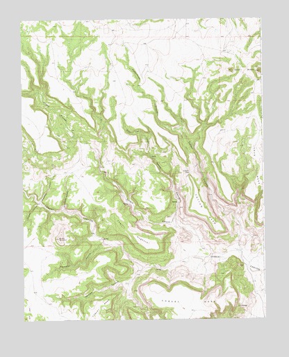
Cobert Mesa North, CO USGS Topographic Map
Click on map above to begin viewing in our Map Viewer.

This topographic map contains these locations and features:
Feature Name Type Latitude Longitude GNIS ID View Map
Brushy MountainSummitN37.0337°W103.6066°196304View Map
Cheney CanyonValleyN37.0483°W103.6162°196292View Map
Cobert MesaSummitN37.0089°W103.5297°203877View Map
Cotton CanyonValleyN37.0288°W103.5104°196308View Map
Cotton GapGapN37.0611°W103.5388°196301View Map
Cotton MesaSummitN37.0581°W103.5369°196302View Map
Escondito CanyonValleyN37.0323°W103.5830°2791059View Map
Flathead CanyonValleyN37.0493°W103.6160°196297View Map
Gotera CanyonValleyN37.0249°W103.5275°196295View Map
Gotera RinconValleyN37.0666°W103.5850°196293View Map
Honeymoon CanyonValleyN37.0792°W103.5419°196300View Map
Jesus MesaSummitN37.0750°W103.5033°203878View Map
Mesa de MayaSummitN37.1034°W103.5019°196243View Map
Phillips CanyonValleyN37.0219°W103.5629°196306View Map
Rodriques CanyonValleyN37.0456°W103.6040°196298View Map
Seven L ButtesSummitN37.1034°W103.5019°203879View Map
Spring CanyonValleyN37.0421°W103.5462°196307View Map
Steel Trap CanyonValleyN37.0681°W103.5589°196299View Map
The HogbackRidgeN37.0367°W103.5699°196305View Map

Note: Coordinates in the location and feature list above are referenced to NAD83 datum.


Copyright (C) 2008-2025 Ryan Niemi / Sunset Dynamics ... All Rights Reserved