TopoQuest Logo
Do you find TopoQuest useful?
Help keep TopoQuest running and adding new maps/features by donating!
Bitcoin:  19c7KJd3qBynnjoSw5npx9KScwjBe4ifkT
Litecoin:  LXs6TkuXGGXo1vDsWCkWVdjQX94eUKd6ui
Home View Maps Find Maps Find Places Resources & Links


Crosby, North Dakota Topographic Map

USGS Map Title: Crosby, ND
USGS Map MRC: 48103H3
DRG (GeoTIFF) Download: o48103h3.tif


Neighboring USGS Topographic Map Quads:


  Ambrose, ND  
48103H4
 

  Crosby, ND  
48103H3
 

  Paulson, ND  
48103H2
 

  Crosby SW, ND  
48103G4
 

  Crosby SE, ND  
48103G3
 

  Noonan SW, ND  
48103G2


Map MRC Location:

N49°
W104°
N49°
W103°
H8 H7 H6 H5 H4 H3 H2 H1
G8 G7 G6 G5 G4 G3 G2 G1
F8 F7 F6 F5 F4 F3 F2 F1
E8 E7 E6 E5 E4 E3 E2 E1
D8 D7 D6 D5 D4 D3 D2 D1
C8 C7 C6 C5 C4 C3 C2 C1
B8 B7 B6 B5 B4 B3 B2 B1
A8 A7 A6 A5 A4 A3 A2 A1
N48°
W104°
N48°
W103°

Crosby, ND USGS 1:24K Topographic Map Preview:
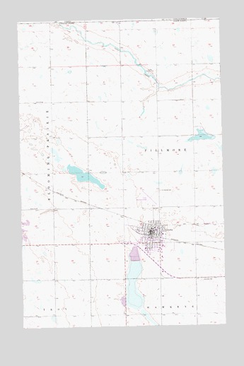
Crosby, ND USGS Topographic Map
Click on map above to begin viewing in our Map Viewer.

This topographic map contains these locations and features:
Feature Name Type Latitude Longitude GNIS ID View Map
City of CrosbyCivilN48.9164°W103.2970°1035981View Map
Concordia CemeteryCemeteryN48.8936°W103.2649°1028433View Map
CrosbyPopulated PlaceN48.9142°W103.2949°1028544View Map
Crosby City HallBuildingN48.9130°W103.2961°2744106View Map
Crosby Country ClubLocaleN48.9781°W103.2955°1028545View Map
Crosby Fire DepartmentBuildingN48.9131°W103.2963°2637685View Map
Crosby Municipal AirportAirportN48.9243°W103.2940°1033006View Map
Crosby Police DepartmentBuildingN48.9134°W103.2970°2734336View Map
Crosby Post OfficePost OfficeN48.9141°W103.2946°2741949View Map
Divide County Ambulance ServiceBuildingN48.9131°W103.2962°2658777View Map
Divide County CourthouseBuildingN48.9155°W103.2943°2743404View Map
Divide County Elementary SchoolSchoolN48.9140°W103.2925°2747659View Map
Divide County High SchoolSchoolN48.9076°W103.2889°2747660View Map
Divide County Museum and Pioneer VillageBuildingN48.9093°W103.3028°2748906View Map
Divide County Public LibraryBuildingN48.9140°W103.2929°2745434View Map
Divide County Sheriff's OfficeBuildingN48.9157°W103.2941°2734363View Map
Good Samaritan Society-CrosbyBuildingN48.9061°W103.2893°2748692View Map
Long Creek DamDamN48.9734°W103.2971°1033219View Map
Saint Luke's HospitalHospitalN48.9067°W103.2990°1031203View Map
Saint Patricks CemeteryCemeteryN48.9303°W103.2894°1031255View Map
School Number 2SchoolN48.9670°W103.3610°1031732View Map
School Number 4SchoolN48.9236°W103.3657°1031955View Map
Township of FillmoreCivilN48.9479°W103.2669°1759389View Map
Troy FieldAirportN48.8795°W103.3724°2646264View Map

Note: Coordinates in the location and feature list above are referenced to NAD83 datum.


Copyright (C) 2008-2025 Ryan Niemi / Sunset Dynamics ... All Rights Reserved