TopoQuest Logo
Do you find TopoQuest useful?
Help keep TopoQuest running and adding new maps/features by donating!
Bitcoin:  19c7KJd3qBynnjoSw5npx9KScwjBe4ifkT
Litecoin:  LXs6TkuXGGXo1vDsWCkWVdjQX94eUKd6ui
Home View Maps Find Maps Find Places Resources & Links


Elkhart North, Kansas Topographic Map

USGS Map Title: Elkhart North, KS
USGS Map MRC: 37101A8
DRG (GeoTIFF) Download: o37101a8.tif


Neighboring USGS Topographic Map Quads:


  Midway NE, CO  
37102B1
 

  Elkhart NW, KS  
37101B8
 

  Elkhart NE, KS  
37101B7
 

  Midway SE, CO  
37102A1
 

  Elkhart North, KS  
37101A8
 

  Wilburton, KS  
37101A7
 

  Sturgis, OK  
36102H1
 

  Elkhart South, KS  
36101H8
 

  Eva NE, OK  
36101H7


Map MRC Location:

N38°
W102°
N38°
W101°
H8 H7 H6 H5 H4 H3 H2 H1
G8 G7 G6 G5 G4 G3 G2 G1
F8 F7 F6 F5 F4 F3 F2 F1
E8 E7 E6 E5 E4 E3 E2 E1
D8 D7 D6 D5 D4 D3 D2 D1
C8 C7 C6 C5 C4 C3 C2 C1
B8 B7 B6 B5 B4 B3 B2 B1
A8 A7 A6 A5 A4 A3 A2 A1
N37°
W102°
N37°
W101°

Elkhart North, KS USGS 1:24K Topographic Map Preview:
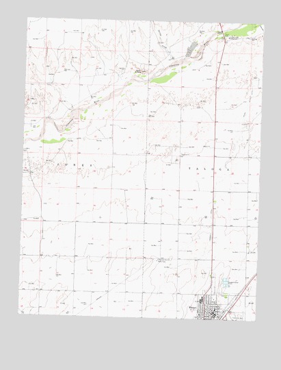
Elkhart North, KS USGS Topographic Map
Click on map above to begin viewing in our Map Viewer.

This topographic map contains these locations and features:
Feature Name Type Latitude Longitude GNIS ID View Map
Bible Baptist ChurchChurchN37.0006°W101.9019°2688821View Map
Church of ChristChurchN37.0030°W101.9007°2688855View Map
Church of GodChurchN37.0037°W101.8997°2688869View Map
Cimarron River CampgroundLocaleN37.1189°W101.8935°485086View Map
Cimarron River Picnic GroundParkN37.1195°W101.8960°485132View Map
City of ElkhartCivilN37.0038°W101.8942°2394655View Map
College Green PastureFlatN37.0889°W101.9241°485130View Map
East Headquarters PastureFlatN37.0445°W101.8907°485126View Map
ElkhartPopulated PlaceN37.0081°W101.8902°485090View Map
Elkhart CemeteryCemeteryN37.0095°W101.8904°2739738View Map
Elkhart Church of the NazareneChurchN37.0039°W101.8988°2690380View Map
Elkhart City HallBuildingN37.0022°W101.8985°2693333View Map
Elkhart Elementary SchoolSchoolN37.0040°W101.8974°485123View Map
Elkhart High SchoolSchoolN37.0084°W101.9047°485124View Map
Elkhart Middle SchoolSchoolN37.0073°W101.9048°485125View Map
Elkhart Post OfficePost OfficeN37.0035°W101.8994°2693704View Map
Elkhart Senior Citizens CenterBuildingN37.0016°W101.8985°2692974View Map
Elkhart United Methodist ChurchChurchN37.0049°W101.8971°2689402View Map
Elkhart Volunteer Fire DepartmentBuildingN37.0025°W101.8997°2111288View Map
Elkhart Wastewater PlantLocaleN37.0156°W101.8925°2693430View Map
Elkhart-Morton County AirportAirportN37.0022°W101.8837°485089View Map
First Baptist ChurchChurchN37.0126°W101.9015°2688945View Map
First Christian ChurchChurchN37.0010°W101.8983°2688985View Map
Happy DitchCanalN37.0500°W101.9004°485091View Map
Moore PastureFlatN37.0250°W101.9629°485120View Map
Morton County Civic CenterBuildingN37.0020°W101.8881°2692951View Map
Morton County Elkhart Fire DepartmentBuildingN37.0025°W101.8998°2111649View Map
Morton County Emergency Medical ServicesBuildingN37.0006°W101.8969°2696481View Map
Morton County FairgroundsLocaleN37.0023°W101.8860°485122View Map
Morton County Health DepartmentBuildingN37.0018°W101.8955°2695039View Map
Morton County Historical SocietyBuildingN37.0038°W101.8882°2694234View Map
Morton County HospitalHospitalN37.0020°W101.9054°2499158View Map
Morton County LibraryBuildingN37.0022°W101.8994°2694661View Map
Morton Wildlife AreaParkN37.1139°W101.9129°485131View Map
Pasture Number ThirtyfiveFlatN37.0528°W101.8866°485129View Map
Pasture Number ThirtyfourFlatN37.0695°W101.9393°485134View Map
Pasture Number ThirtynineFlatN37.0056°W101.9754°485121View Map
Pike and San Isabel National Forests Cimarron National Grassland StationBuildingN37.0486°W101.8988°485127View Map
Point of RocksCliffN37.1039°W101.9388°485087View Map
Point PastureFlatN37.1056°W101.9629°485133View Map
Point Rock Alternative SchoolSchoolN37.0018°W101.8975°2427232View Map
Township of JonesCivilN37.0600°W101.9888°485088View Map
Township of TalogaCivilN37.0603°W101.8812°485093View Map
United States Department of Agriculture National Forest Services ElkhartBuildingN37.0058°W101.8869°2504258View Map
West Headquarters PastureFlatN37.0514°W101.9088°485128View Map

Note: Coordinates in the location and feature list above are referenced to NAD83 datum.


Copyright (C) 2008-2024 Ryan Niemi / Sunset Dynamics ... All Rights Reserved