TopoQuest Logo
Do you find TopoQuest useful?
Help keep TopoQuest running and adding new maps/features by donating!
Bitcoin:  19c7KJd3qBynnjoSw5npx9KScwjBe4ifkT
Litecoin:  LXs6TkuXGGXo1vDsWCkWVdjQX94eUKd6ui
Home View Maps Find Maps Find Places Resources & Links


Farmington West, Illinois Topographic Map

USGS Map Title: Farmington West, IL
USGS Map MRC: 40090F1
DRG (GeoTIFF) Download: o40090f1.tif


Neighboring USGS Topographic Map Quads:


  Maquon, IL  
40090G2
 

  Yates City, IL  
40090G1
 

  Elmwood, IL  
40089G8
 

  Fairview, IL  
40090F2
 

  Farmington West, IL  
40090F1
 

  Farmington East, IL  
40089F8
 

  Fiatt, IL  
40090E2
 

  Canton, IL  
40090E1
 

  Banner, IL  
40089E8


Map MRC Location:

N41°
W91°
N41°
W90°
H8 H7 H6 H5 H4 H3 H2 H1
G8 G7 G6 G5 G4 G3 G2 G1
F8 F7 F6 F5 F4 F3 F2 F1
E8 E7 E6 E5 E4 E3 E2 E1
D8 D7 D6 D5 D4 D3 D2 D1
C8 C7 C6 C5 C4 C3 C2 C1
B8 B7 B6 B5 B4 B3 B2 B1
A8 A7 A6 A5 A4 A3 A2 A1
N40°
W91°
N40°
W90°

Farmington West, IL USGS 1:24K Topographic Map Preview:
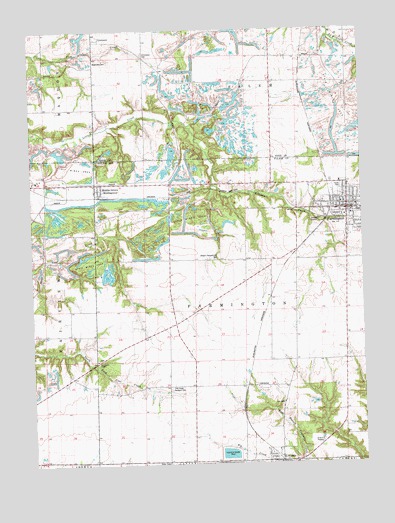
Farmington West, IL USGS Topographic Map
Click on map above to begin viewing in our Map Viewer.

This topographic map contains these locations and features:
Feature Name Type Latitude Longitude GNIS ID View Map
Alden Mine Number 5MineN40.7086°W90.0143°1719428View Map
Alden Mine Number 6MineN40.6461°W90.0426°1719429View Map
Bear School (historical)SchoolN40.7345°W90.0340°1719585View Map
Blakeslee CemeteryCemeteryN40.7410°W90.1004°404549View Map
Chapman Middle SchoolSchoolN40.6975°W90.0012°1802208View Map
City of FarmingtonCivilN40.6972°W90.0033°2394746View Map
Clair School (historical)SchoolN40.6842°W90.0437°1719440View Map
Coal Creek CemeteryCemeteryN40.6466°W90.0732°406298View Map
Copperas Creek Fire Protection District Norris UnitBuildingN40.6251°W90.0326°2640867View Map
Cottonwood School (historical)SchoolN40.6550°W90.0065°1719443View Map
Cox School (historical)SchoolN40.7348°W90.0057°1719621View Map
FarmingtonPopulated PlaceN40.6981°W90.0059°408290View Map
Farmington City HallBuildingN40.6986°W90.0040°1866510View Map
Farmington Police DepartmentBuildingN40.6986°W90.0043°2756767View Map
Farmington Post OfficePost OfficeN40.6984°W90.0066°1866511View Map
Farmington Post OfficePost OfficeN40.6984°W90.0065°2040129View Map
Farmington Public LibraryBuildingN40.6981°W90.0023°1802160View Map
First Baptist ChurchChurchN40.7000°W90.0065°1866512View Map
First Methodist Episcopal ChurchChurchN40.6270°W90.0318°1802168View Map
First Methodist Episcopal ChurchChurchN40.7000°W90.0079°1866513View Map
First Presbyterian ChurchChurchN40.6995°W90.0021°1866514View Map
Forty AcresPopulated PlaceN40.6795°W90.0243°1719517View Map
GilchristPopulated PlaceN40.6473°W90.0398°422736View Map
Harris Elementary SchoolSchoolN40.6981°W90.0096°1802221View Map
Hill CemeteryCemeteryN40.6425°W90.0310°410253View Map
Liberty School (historical)SchoolN40.6986°W90.0779°1719462View Map
Maplewood Mine Number 1MineN40.6950°W90.0198°1719465View Map
Maplewood Mine Number 2MineN40.6761°W90.0382°1719466View Map
MiddlegrovePopulated PlaceN40.7045°W90.0996°413503View Map
Middlegrove Post OfficePost OfficeN40.7031°W90.0993°1802162View Map
Midland Employee LakeReservoirN40.7287°W90.0489°1691513View Map
Midland Employee Lake DamDamN40.7267°W90.0518°1691512View Map
National MineMineN40.7014°W90.0754°1719474View Map
New Gilchrist School (historical)SchoolN40.6478°W90.0362°1802234View Map
NorrisPopulated PlaceN40.6259°W90.0321°414554View Map
Norris Grade School (historical)SchoolN40.6259°W90.0312°1802235View Map
Norris Post OfficePost OfficeN40.6259°W90.0343°1802169View Map
Oak Ridge CemeteryCemeteryN40.6964°W90.0096°1773353View Map
Oakland School (historical)SchoolN40.7278°W90.1212°1719680View Map
Pease Hill School (historical)SchoolN40.7345°W90.0618°1719682View Map
Pleasant Hill CemeteryCemeteryN40.6841°W90.0555°405966View Map
Providence ChapelChurchN40.6550°W90.1010°416249View Map
Providence Chapel CemeteryCemeteryN40.6555°W90.1008°1773360View Map
Rescue 1100 Farmington Community Fire Protection DistrictBuildingN40.6986°W90.0028°2040127View Map
Retreat School (historical)SchoolN40.6478°W90.0837°1719489View Map
Saint Matthews Catholic ChurchChurchN40.6967°W90.0043°1802161View Map
Shad Hill School (historical)SchoolN40.6673°W90.0712°1719497View Map
Smith School (historical)SchoolN40.6548°W90.1210°1719501View Map
Township of FarmingtonCivilN40.6693°W90.0446°428993View Map
UniontownPopulated PlaceN40.7475°W90.0987°423267View Map
Uniontown CemeteryCemeteryN40.7431°W90.0821°420145View Map
United Methodist ChurchChurchN40.6998°W90.0079°2040132View Map
Village of NorrisCivilN40.6258°W90.0320°2399505View Map
Washington School (historical)SchoolN40.6439°W90.0476°1719512View Map

Note: Coordinates in the location and feature list above are referenced to NAD83 datum.


Copyright (C) 2008-2025 Ryan Niemi / Sunset Dynamics ... All Rights Reserved