TopoQuest Logo
Do you find TopoQuest useful?
Help keep TopoQuest running and adding new maps/features by donating!
Bitcoin:  19c7KJd3qBynnjoSw5npx9KScwjBe4ifkT
Litecoin:  LXs6TkuXGGXo1vDsWCkWVdjQX94eUKd6ui
Home View Maps Find Maps Find Places Resources & Links


Florence, Kansas Topographic Map

USGS Map Title: Florence, KS
USGS Map MRC: 38096B8
DRG (GeoTIFF) Download: o38096b8.tif


Neighboring USGS Topographic Map Quads:


  Marion, KS  
38097C1
 

  Lincolnville SW, KS  
38096C8
 

  Cedar Point, KS  
38096C7
 

  Peabody, KS  
38097B1
 

  Florence, KS  
38096B8
 

  Wonsevu, KS  
38096B7
 

  Peabody SE, KS  
38097A1
 

  Burns, KS  
38096A8
 

  Florence SE, KS  
38096A7


Map MRC Location:

N39°
W97°
N39°
W96°
H8 H7 H6 H5 H4 H3 H2 H1
G8 G7 G6 G5 G4 G3 G2 G1
F8 F7 F6 F5 F4 F3 F2 F1
E8 E7 E6 E5 E4 E3 E2 E1
D8 D7 D6 D5 D4 D3 D2 D1
C8 C7 C6 C5 C4 C3 C2 C1
B8 B7 B6 B5 B4 B3 B2 B1
A8 A7 A6 A5 A4 A3 A2 A1
N38°
W97°
N38°
W96°

Florence, KS USGS 1:24K Topographic Map Preview:
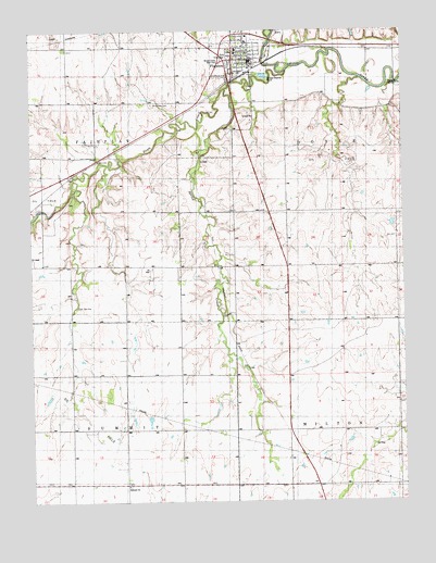
Florence, KS USGS Topographic Map
Click on map above to begin viewing in our Map Viewer.

This topographic map contains these locations and features:
Feature Name Type Latitude Longitude GNIS ID View Map
Allison CemeteryCemeteryN38.2239°W96.9331°477787View Map
City of FlorenceCivilN38.2432°W96.9293°485574View Map
Coyne SpringSpringN38.2222°W96.9522°482943View Map
Doyle CreekStreamN38.2395°W96.9139°477786View Map
Fairplay School (historical)SchoolN38.2095°W96.9961°482953View Map
FlorencePopulated PlaceN38.2445°W96.9281°477372View Map
Florence Christian ChurchChurchN38.2425°W96.9314°2689970View Map
Florence City HallBuildingN38.2430°W96.9266°2693157View Map
Florence Elementary SchoolSchoolN38.2406°W96.9311°480813View Map
Florence Fire DepartmentBuildingN38.2427°W96.9266°2111316View Map
Florence Police DepartmentBuildingN38.2429°W96.9265°2503836View Map
Florence Post OfficePost OfficeN38.2404°W96.9259°2693718View Map
Florence Public LibraryBuildingN38.2412°W96.9258°2694641View Map
Florence United Methodist ChurchChurchN38.2426°W96.9285°2689971View Map
Florence Wastewater PlantLocaleN38.2385°W96.9218°2693439View Map
Grandview ParkParkN38.2378°W96.9339°477789View Map
Hampson (historical)LocaleN38.1720°W96.9342°482964View Map
Harvey HouseBuildingN38.2399°W96.9284°2694320View Map
Holy Family Catholic ChurchChurchN38.2459°W96.9285°2689972View Map
Lee SpringSpringN38.1767°W96.9850°477784View Map
Marion County Emergency Medical ServicesBuildingN38.2431°W96.9266°2696548View Map
Moses Shane Memorial ParkParkN38.2425°W96.9364°484310View Map
Mount Calvary CemeteryCemeteryN38.2303°W96.9592°477788View Map
Round Top School (historical)SchoolN38.1925°W96.8770°482995View Map
Santa Fe School (historical)SchoolN38.1872°W96.9625°482997View Map
School Number 51 (historical)SchoolN38.1500°W96.9695°482999View Map
Spring CreekStreamN38.2345°W96.9345°477785View Map
Spring Valley School (historical)SchoolN38.1875°W96.9231°483006View Map
Summit ChurchChurchN38.1292°W96.9686°477783View Map
Team Marketing Alliance Grain Elevator Number 13LocaleN38.2375°W96.9291°2695398View Map
Township of DoyleCivilN38.2217°W96.8899°477381View Map
Township of FairplayCivilN38.2341°W96.9898°477371View Map
Township of MiltonCivilN38.1292°W96.8863°477790View Map
Township of SummitCivilN38.1297°W96.9871°477782View Map

Note: Coordinates in the location and feature list above are referenced to NAD83 datum.


Copyright (C) 2008-2025 Ryan Niemi / Sunset Dynamics ... All Rights Reserved