TopoQuest Logo
Do you find TopoQuest useful?
Help keep TopoQuest running and adding new maps/features by donating!
Bitcoin:  19c7KJd3qBynnjoSw5npx9KScwjBe4ifkT
Litecoin:  LXs6TkuXGGXo1vDsWCkWVdjQX94eUKd6ui
Home View Maps Find Maps Find Places Resources & Links


Florid, Illinois Topographic Map

USGS Map Title: Florid, IL
USGS Map MRC: 41089B3
DRG (GeoTIFF) Download: o41089b3.tif


Neighboring USGS Topographic Map Quads:


  Princeton South, IL  
41089C4
 

  Depue, IL  
41089C3
 

  Spring Valley, IL  
41089C2
 

  Putnam, IL  
41089B4
 

  Florid, IL  
41089B3
 

  McNabb, IL  
41089B2
 

  Lacon, IL  
41089A4
 

  Henry, IL  
41089A3
 

  Varna, IL  
41089A2


Map MRC Location:

N42°
W90°
N42°
W89°
H8 H7 H6 H5 H4 H3 H2 H1
G8 G7 G6 G5 G4 G3 G2 G1
F8 F7 F6 F5 F4 F3 F2 F1
E8 E7 E6 E5 E4 E3 E2 E1
D8 D7 D6 D5 D4 D3 D2 D1
C8 C7 C6 C5 C4 C3 C2 C1
B8 B7 B6 B5 B4 B3 B2 B1
A8 A7 A6 A5 A4 A3 A2 A1
N41°
W90°
N41°
W89°

Florid, IL USGS 1:24K Topographic Map Preview:
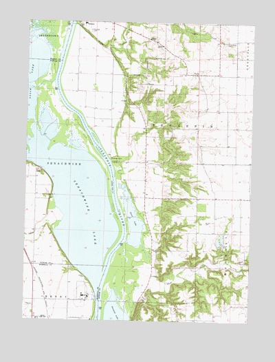
Florid, IL USGS Topographic Map
Click on map above to begin viewing in our Map Viewer.

This topographic map contains these locations and features:
Feature Name Type Latitude Longitude GNIS ID View Map
Big Bureau CreekStreamN41.2481°W89.3743°422178View Map
Clear CreekStreamN41.1392°W89.3243°406211View Map
Coffee CreekStreamN41.2489°W89.3493°406326View Map
Durley School (historical)SchoolN41.2470°W89.3190°1719780View Map
Fish N Fun LakeReservoirN41.1588°W89.2668°1692497View Map
Fish N Fun Lake DamDamN41.1567°W89.2684°1692496View Map
FloridPopulated PlaceN41.2286°W89.2809°408472View Map
Florid CemeteryCemeteryN41.2273°W89.2820°1953542View Map
Florid CemeteryCemeteryN41.2273°W89.2823°1967958View Map
Harrison School (historical)SchoolN41.1331°W89.3598°1719784View Map
Indian SpringPopulated PlaceN41.1811°W89.3604°1719782View Map
Lake Senachwine Conservation AreaParkN41.1995°W89.3606°1820612View Map
Little Sister Seaplane Base (historical)AirportN41.2000°W89.3501°427366View Map
Maple Grove School (historical)SchoolN41.2359°W89.2598°1719779View Map
Murphy CemeteryCemeteryN41.1661°W89.2748°414246View Map
Poole CreekStreamN41.1278°W89.3168°416015View Map
Poole School (historical)SchoolN41.1442°W89.3040°1719775View Map
Putnam CountyCivilN41.2045°W89.2858°424279View Map
Putnam County Elementary School-Hennepin BuildingSchoolN41.2495°W89.3431°1820614View Map
Riverside CemeteryCemeteryN41.2464°W89.3401°416717View Map
Sand Prairie School (historical)SchoolN41.1917°W89.3095°1719777View Map
Senachwine CreekStreamN41.1978°W89.3737°418204View Map
Senachwine LakeLakeN41.1891°W89.3565°418205View Map
Sprinkleburg School (historical)SchoolN41.1764°W89.2695°1719776View Map
Strawn School (historical)SchoolN41.2056°W89.2587°1719778View Map
Swan LakeLakeN41.1628°W89.3135°419456View Map
Township of HennepinCivilN41.2233°W89.3036°429127View Map
UndercliffPopulated PlaceN41.1878°W89.3662°1719781View Map
Union Grove CemeteryCemeteryN41.2414°W89.2648°420073View Map
Village of HennepinCivilN41.2424°W89.3254°2398489View Map
Walnut GrovePopulated PlaceN41.1767°W89.3609°1719783View Map

Note: Coordinates in the location and feature list above are referenced to NAD83 datum.


Copyright (C) 2008-2025 Ryan Niemi / Sunset Dynamics ... All Rights Reserved