TopoQuest Logo
Do you find TopoQuest useful?
Help keep TopoQuest running and adding new maps/features by donating!
Bitcoin:  19c7KJd3qBynnjoSw5npx9KScwjBe4ifkT
Litecoin:  LXs6TkuXGGXo1vDsWCkWVdjQX94eUKd6ui
Home View Maps Find Maps Find Places Resources & Links


Frenchville, Maine Topographic Map

USGS Map Title: Frenchville, ME
USGS Map MRC: 47068C4
DRG (GeoTIFF) Download: o47068c4.tif


Neighboring USGS Topographic Map Quads:


  Fort Kent North, ME  
47068C5
 

  Frenchville, ME  
47068C4
 

  Madawaska, ME  
47068C3
 

  Fort Kent South, ME  
47068B5
 

  Daigle, ME  
47068B4
 

  Saint Agatha, ME  
47068B3


Map MRC Location:

N48°
W69°
N48°
W68°
H8 H7 H6 H5 H4 H3 H2 H1
G8 G7 G6 G5 G4 G3 G2 G1
F8 F7 F6 F5 F4 F3 F2 F1
E8 E7 E6 E5 E4 E3 E2 E1
D8 D7 D6 D5 D4 D3 D2 D1
C8 C7 C6 C5 C4 C3 C2 C1
B8 B7 B6 B5 B4 B3 B2 B1
A8 A7 A6 A5 A4 A3 A2 A1
N47°
W69°
N47°
W68°

Frenchville, ME USGS 1:24K Topographic Map Preview:
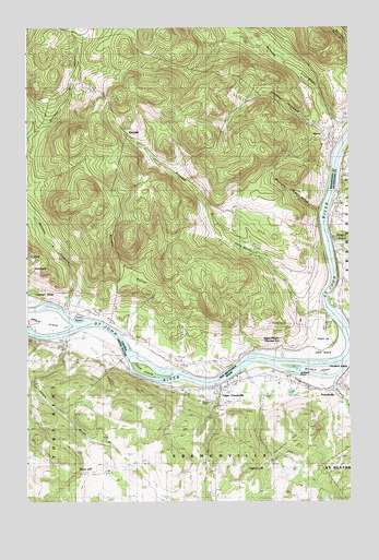
Frenchville, ME USGS Topographic Map
Click on map above to begin viewing in our Map Viewer.

This topographic map contains these locations and features:
Feature Name Type Latitude Longitude GNIS ID View Map
Burgoin BrookStreamN47.2834°W68.3789°563204View Map
Daigle BrookStreamN47.2937°W68.4856°564739View Map
Dickey BrookStreamN47.2812°W68.4259°565092View Map
Dr Levesque Elementary SchoolSchoolN47.2785°W68.4278°2738010View Map
FrenchvillePopulated PlaceN47.2809°W68.3798°566583View Map
Frenchville Fire DepartmentBuildingN47.2791°W68.3829°2553057View Map
Frenchville Post OfficePost OfficeN47.2836°W68.4125°1910370View Map
Frenchville Snowmobile ClubLocaleN47.2681°W68.3931°1910371View Map
Gagnon BrookStreamN47.3192°W68.3817°566658View Map
Gagnon HillSummitN47.2587°W68.4164°566660View Map
Gilman SidingLocaleN47.3295°W68.3798°566804View Map
Glass HillSummitN47.2584°W68.4828°566826View Map
Grant SchoolSchoolN47.2595°W68.4648°567061View Map
Green Water Tank Historical Museum and CabooseLocaleN47.2803°W68.3909°1910388View Map
Jefferson SchoolSchoolN47.2587°W68.4364°568786View Map
Levesque IslandIslandN47.2845°W68.3981°569494View Map
Lincoln SchoolSchoolN47.2820°W68.4531°569617View Map
Michaud IslandIslandN47.2842°W68.3834°571204View Map
Saint John Valley Technology Center SchoolSchoolN47.2777°W68.4241°2738009View Map
Saint Luce CemeteryCemeteryN47.2788°W68.4261°2678684View Map
Saint Luce ChurchChurchN47.2792°W68.4267°1910612View Map
Saint Luce StationLocaleN47.2800°W68.4278°574739View Map
Town of FrenchvilleCivilN47.2735°W68.3994°582483View Map
Upper FrenchvillePopulated PlaceN47.2800°W68.4245°577609View Map
Upper Frenchville Post OfficePost OfficeN47.2800°W68.4217°1910677View Map
Valley Emergency Medical ServicesBuildingN47.3042°W68.3787°2666794View Map
Washington SchoolSchoolN47.2923°W68.4862°577869View Map

Note: Coordinates in the location and feature list above are referenced to NAD83 datum.


Copyright (C) 2008-2025 Ryan Niemi / Sunset Dynamics ... All Rights Reserved