TopoQuest Logo
Do you find TopoQuest useful?
Help keep TopoQuest running and adding new maps/features by donating!
Bitcoin:  19c7KJd3qBynnjoSw5npx9KScwjBe4ifkT
Litecoin:  LXs6TkuXGGXo1vDsWCkWVdjQX94eUKd6ui
Home View Maps Find Maps Find Places Resources & Links


Kaweah, California Topographic Map

USGS Map Title: Kaweah, CA
USGS Map MRC: 36118D8
DRG (GeoTIFF) Download: o36118d8.tif


Neighboring USGS Topographic Map Quads:


  Auckland, CA  
36119E1
 

  Shadequarter Mountain, CA  
36118E8
 

  Giant Forest, CA  
36118E7
 

  Woodlake, CA  
36119D1
 

  Kaweah, CA  
36118D8
 

  Case Mountain, CA  
36118D7
 

  Rocky Hill, CA  
36119C1
 

  Chickencoop Canyon, CA  
36118C8
 

  Dennison Peak, CA  
36118C7


Map MRC Location:

N37°
W119°
N37°
W118°
H8 H7 H6 H5 H4 H3 H2 H1
G8 G7 G6 G5 G4 G3 G2 G1
F8 F7 F6 F5 F4 F3 F2 F1
E8 E7 E6 E5 E4 E3 E2 E1
D8 D7 D6 D5 D4 D3 D2 D1
C8 C7 C6 C5 C4 C3 C2 C1
B8 B7 B6 B5 B4 B3 B2 B1
A8 A7 A6 A5 A4 A3 A2 A1
N36°
W119°
N36°
W118°

Kaweah, CA USGS 1:24K Topographic Map Preview:
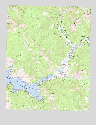
Kaweah, CA USGS Topographic Map
Click on map above to begin viewing in our Map Viewer.

This topographic map contains these locations and features:
Feature Name Type Latitude Longitude GNIS ID View Map
Barton MountainSummitN36.4527°W118.9320°1934907View Map
Blossom PeakSummitN36.4239°W118.8890°269920View Map
Cherokee FlatFlatN36.3922°W118.8993°270398View Map
Comb RocksSummitN36.4774°W118.9010°270572View Map
Department of Forestry and Fire Protection Three Rivers UnitBuildingN36.4281°W118.9130°2624311View Map
Greasy CreekStreamN36.4280°W118.9909°271419View Map
Horse CreekStreamN36.3858°W118.9434°271643View Map
Horse Creek Recreation AreaParkN36.3905°W118.9557°1667589View Map
KaweahPopulated PlaceN36.4697°W118.9184°1660826View Map
Kaweah Recreation AreaParkN36.3952°W118.9887°1667593View Map
Lake KaweahReservoirN36.4056°W118.9733°255512View Map
Lake Kaweah Boat PatrolBuildingN36.4070°W118.9962°2755854View Map
Lake Kaweah Recreation AreaParkN36.4044°W118.9743°1835525View Map
Lemon HillSummitN36.4066°W118.9968°1667597View Map
Mankins CreekStreamN36.4563°W118.9095°272325View Map
Mankins FlatFlatN36.4916°W118.9615°272326View Map
North Fork Kaweah RiverStreamN36.4474°W118.9023°272688View Map
Shepherd PeakSummitN36.4913°W118.8781°273673View Map
South Fork Kaweah RiverStreamN36.4236°W118.9195°1655019View Map
Sulphur RidgeRidgeN36.4774°W118.9829°273947View Map
Tharps PeakSummitN36.3952°W118.9323°274080View Map
Three RiversPopulated PlaceN36.4388°W118.9045°1661569View Map
Three Rivers AmbulanceBuildingN36.4281°W118.9129°2662248View Map
Three Rivers Census Designated PlaceCensusN36.4319°W118.8806°2409316View Map
Three Rivers Elementary SchoolSchoolN36.4433°W118.9029°1835540View Map
Three Rivers Golf CourseLocaleN36.4291°W118.9159°1654842View Map
Three Rivers Post OfficePost OfficeN36.4274°W118.9148°1835541View Map
Three Rivers Public CemeteryCemeteryN36.4216°W118.9047°2773307View Map
Tulare County Fire Department Battalion 1 Three Rivers Station 14BuildingN36.4321°W118.9095°2624441View Map
Union SchoolSchoolN36.4427°W118.9026°274274View Map
Washburn CoveBasinN36.4613°W118.8848°274387View Map

Note: Coordinates in the location and feature list above are referenced to NAD83 datum.


Copyright (C) 2008-2025 Ryan Niemi / Sunset Dynamics ... All Rights Reserved