TopoQuest Logo
Do you find TopoQuest useful?
Help keep TopoQuest running and adding new maps/features by donating!
Bitcoin:  19c7KJd3qBynnjoSw5npx9KScwjBe4ifkT
Litecoin:  LXs6TkuXGGXo1vDsWCkWVdjQX94eUKd6ui
Home View Maps Find Maps Find Places Resources & Links


Kingsburg, South Dakota Topographic Map

USGS Map Title: Kingsburg, SD
USGS Map MRC: 42097H8
DRG (GeoTIFF) Download: o42097h8.tif


Neighboring USGS Topographic Map Quads:


  Avon, SD  
43098A1
 

  Haucks Lake, SD  
43097A8
 

  Tripp SE, SD  
43097A7
 

  Niobrara NE, SD  
42098H1
 

  Kingsburg, SD  
42097H8
 

  Tyndall, SD  
42097H7
 

  Niobrara, NE  
42098G1
 

  Springfield, SD  
42097G8
 

  Santee, NE  
42097G7


Map MRC Location:

N43°
W98°
N43°
W97°
H8 H7 H6 H5 H4 H3 H2 H1
G8 G7 G6 G5 G4 G3 G2 G1
F8 F7 F6 F5 F4 F3 F2 F1
E8 E7 E6 E5 E4 E3 E2 E1
D8 D7 D6 D5 D4 D3 D2 D1
C8 C7 C6 C5 C4 C3 C2 C1
B8 B7 B6 B5 B4 B3 B2 B1
A8 A7 A6 A5 A4 A3 A2 A1
N42°
W98°
N42°
W97°

Kingsburg, SD USGS 1:24K Topographic Map Preview:
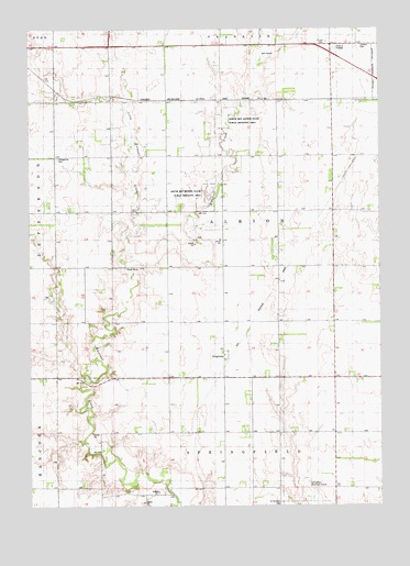
Kingsburg, SD USGS Topographic Map
Click on map above to begin viewing in our Map Viewer.

This topographic map contains these locations and features:
Feature Name Type Latitude Longitude GNIS ID View Map
Albion SchoolSchoolN42.9447°W97.9320°1253606View Map
Bon Homme CountyCivilN42.9884°W97.8847°1266997View Map
Evan Church (historical)ChurchN42.9672°W97.9901°1264424View Map
Evangelical CemeteryCemeteryN42.9664°W97.9903°1266516View Map
KingsburgPopulated PlaceN42.9144°W97.9312°1261027View Map
Little Emanuel CreekStreamN42.9392°W97.9653°1256162View Map
North Bon Homme State Public Shooting AreaParkN42.9761°W97.9306°1256729View Map
Saint Leo CemeteryCemeteryN42.9967°W97.8934°1257655View Map
Sattler CemeteryCemeteryN42.9806°W97.9762°2773563View Map
School Number 31 (historical)SchoolN42.9381°W97.9156°1264431View Map
School Number 32 (historical)SchoolN42.9369°W97.9817°1264426View Map
School Number 33 (historical)SchoolN42.8944°W97.9323°1264427View Map
School Number 34 (historical)SchoolN42.9061°W97.9126°1264432View Map
School Number 60 (historical)SchoolN42.8944°W97.9698°1264428View Map
School Number 75 (historical)SchoolN42.9672°W97.9712°1264425View Map
School Number 76 (historical)SchoolN42.9672°W97.9345°1264429View Map
School Number 77 (historical)SchoolN42.9658°W97.8928°1264430View Map
South Bon Homme State Public Shooting AreaParkN42.9561°W97.9362°1258163View Map
Springfield Municipal AirportAirportN42.8779°W97.9004°1259299View Map
Township of AlbionCivilN42.9519°W97.9315°1269075View Map
Township of Springfield (historical)CivilN42.8944°W97.9212°1269067View Map
Tyndall CemeteryCemeteryN42.9953°W97.8828°1258682View Map
Unorganized Territory of Southwest Bon HommeCivilN42.8859°W97.9893°1267581View Map

Note: Coordinates in the location and feature list above are referenced to NAD83 datum.


Copyright (C) 2008-2025 Ryan Niemi / Sunset Dynamics ... All Rights Reserved