TopoQuest Logo
Do you find TopoQuest useful?
Help keep TopoQuest running and adding new maps/features by donating!
Bitcoin:  19c7KJd3qBynnjoSw5npx9KScwjBe4ifkT
Litecoin:  LXs6TkuXGGXo1vDsWCkWVdjQX94eUKd6ui
Home View Maps Find Maps Find Places Resources & Links


Kious Spring, Nevada Topographic Map

USGS Map Title: Kious Spring, NV
USGS Map MRC: 38114H2
DRG (GeoTIFF) Download: o38114h2.tif


Neighboring USGS Topographic Map Quads:


  Windy Peak, NV  
39114A3
 

  Lehman Caves, NV  
39114A2
 

  Baker, NV  
39114A1
 

  Wheeler Peak, NV  
38114H3
 

  Kious Spring, NV  
38114H2
 

  Garrison, UT  
38114H1
 

  Minerva Canyon, NV  
38114G3
 

  Arch Canyon, NV  
38114G2
 

  Needle Point Spring, UT  
38114G1


Map MRC Location:

N39°
W115°
N39°
W114°
H8 H7 H6 H5 H4 H3 H2 H1
G8 G7 G6 G5 G4 G3 G2 G1
F8 F7 F6 F5 F4 F3 F2 F1
E8 E7 E6 E5 E4 E3 E2 E1
D8 D7 D6 D5 D4 D3 D2 D1
C8 C7 C6 C5 C4 C3 C2 C1
B8 B7 B6 B5 B4 B3 B2 B1
A8 A7 A6 A5 A4 A3 A2 A1
N38°
W115°
N38°
W114°

Kious Spring, NV USGS 1:24K Topographic Map Preview:
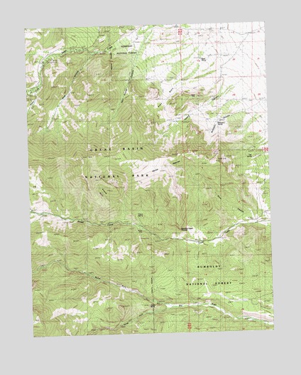
Kious Spring, NV USGS Topographic Map
Click on map above to begin viewing in our Map Viewer.

This topographic map contains these locations and features:
Feature Name Type Latitude Longitude GNIS ID View Map
Baker Creek Forest Service Administrative SiteLocaleN38.9983°W114.1914°863947View Map
Baker Creek Forest Service Recreation SiteLocaleN38.9869°W114.2397°863949View Map
Bonita MineMineN38.9166°W114.1914°854716View Map
Camp BonitaLocaleN38.9166°W114.1914°853530View Map
Can Young CanyonValleyN38.9989°W114.1841°839301View Map
Castle ButteSummitN38.8860°W114.1896°849193View Map
Cave CanyonValleyN38.9185°W114.1344°839365View Map
Clay SpringSpringN38.9457°W114.1345°845131View Map
Granite BasinBasinN38.9330°W114.2130°840742View Map
Horse HeavenBasinN38.9416°W114.1817°841096View Map
Kious BasinBasinN38.9694°W114.1794°841496View Map
Kious SpringSpringN38.9855°W114.1596°841497View Map
Mahogany SpringSpringN38.9594°W114.1521°841908View Map
North Fork Big WashStreamN38.8852°W114.1769°860755View Map
Pole CanyonValleyN38.9893°W114.2145°842912View Map
Pole CreekStreamN38.9897°W114.2133°850987View Map
Poljack MineMineN38.9697°W114.1628°849189View Map
Rudolphs CanyonValleyN38.9638°W114.1367°849190View Map
Snake Creek Forest Service Recreation SiteLocaleN38.9213°W114.2283°863950View Map
Snake Mining DistrictCivilN38.9497°W114.2253°853531View Map
South Fork Baker CreekStreamN38.9755°W114.2469°862465View Map
South Fork Big WashStreamN38.8855°W114.1767°861461View Map
Standing Snake PinnaclePillarN38.9169°W114.1728°849192View Map
Tilford SpringSpringN38.9231°W114.1948°849191View Map
Timber CreekStreamN38.9747°W114.2453°861733View Map
Young CanyonValleyN38.9748°W114.1423°845071View Map

Note: Coordinates in the location and feature list above are referenced to NAD83 datum.


Copyright (C) 2008-2024 Ryan Niemi / Sunset Dynamics ... All Rights Reserved