TopoQuest Logo
Do you find TopoQuest useful?
Help keep TopoQuest running and adding new maps/features by donating!
Bitcoin:  19c7KJd3qBynnjoSw5npx9KScwjBe4ifkT
Litecoin:  LXs6TkuXGGXo1vDsWCkWVdjQX94eUKd6ui
Home View Maps Find Maps Find Places Resources & Links


Knickerbocker, Texas Topographic Map

USGS Map Title: Knickerbocker, TX
USGS Map MRC: 31100C5
DRG (GeoTIFF) Download: o31100c5.tif


Neighboring USGS Topographic Map Quads:


  Knickerbocker NW, TX  
31100D6
 

  Twin Buttes, TX  
31100D5
 

  San Angelo South, TX  
31100D4
 

  Tankersley, TX  
31100C6
 

  Knickerbocker, TX  
31100C5
 

  Pecan Station, TX  
31100C4
 

  Hulldale NW, TX  
31100B6
 

  Cold Creek Spring, TX  
31100B5
 

  Christoval, TX  
31100B4


Map MRC Location:

N32°
W101°
N32°
W100°
H8 H7 H6 H5 H4 H3 H2 H1
G8 G7 G6 G5 G4 G3 G2 G1
F8 F7 F6 F5 F4 F3 F2 F1
E8 E7 E6 E5 E4 E3 E2 E1
D8 D7 D6 D5 D4 D3 D2 D1
C8 C7 C6 C5 C4 C3 C2 C1
B8 B7 B6 B5 B4 B3 B2 B1
A8 A7 A6 A5 A4 A3 A2 A1
N31°
W101°
N31°
W100°

Knickerbocker, TX USGS 1:24K Topographic Map Preview:
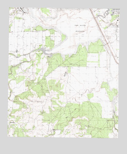
Knickerbocker, TX USGS Topographic Map
Click on map above to begin viewing in our Map Viewer.

This topographic map contains these locations and features:
Feature Name Type Latitude Longitude GNIS ID View Map
Boys Ranch West TexasLocaleN31.3321°W100.6168°1352793View Map
Dove CreekStreamN31.3313°W100.6012°1356218View Map
Ducote AirparkAirportN31.3628°W100.6093°1387452View Map
Fry DamDamN31.3228°W100.6068°1860424View Map
Fry ReservoirReservoirN31.3205°W100.6130°1860425View Map
Ketchum SpringSpringN31.2566°W100.5723°1360607View Map
KnickerbockerPopulated PlaceN31.2666°W100.6232°1360716View Map
Knickerbocker Post OfficePost OfficeN31.2708°W100.6241°2732118View Map
Lake NasworthyLakeN31.3736°W100.5031°1889725View Map
Negro CrossingPopulated PlaceN31.3538°W100.5368°1380238View Map
Ripple DamDamN31.3272°W100.6146°1860426View Map
Rock SloughGutN31.3718°W100.5076°1366695View Map
San Angelo Airport PoliceBuildingN31.3576°W100.5030°2750294View Map
San Angelo Army Air Field (historical)MilitaryN31.3578°W100.5008°2096202View Map
San Angelo Fire Department Station 8BuildingN31.3674°W100.5011°2551309View Map
San Angelo Police Department Lake Police DivisionBuildingN31.3592°W100.5047°2750722View Map
San Angelo Regional Airport/Mathis FieldAirportN31.3573°W100.5030°1387453View Map
Spring CreekStreamN31.3302°W100.6045°1368975View Map
Twin Buttes ReservoirReservoirN31.3462°W100.5399°1370341View Map
United States Border Patrol StationBuildingN31.3632°W100.5025°2750820View Map
XQZ LakeReservoirN31.3111°W100.5608°1889724View Map
XQZ Lake DamDamN31.3135°W100.5587°1860428View Map
XQZ RanchLocaleN31.2524°W100.5743°1371995View Map

Note: Coordinates in the location and feature list above are referenced to NAD83 datum.


Copyright (C) 2008-2024 Ryan Niemi / Sunset Dynamics ... All Rights Reserved