TopoQuest Logo
Do you find TopoQuest useful?
Help keep TopoQuest running and adding new maps/features by donating!
Bitcoin:  19c7KJd3qBynnjoSw5npx9KScwjBe4ifkT
Litecoin:  LXs6TkuXGGXo1vDsWCkWVdjQX94eUKd6ui
Home View Maps Find Maps Find Places Resources & Links


Lake Medora, Michigan Topographic Map

USGS Map Title: Lake Medora, MI
USGS Map MRC: 47087D8
DRG (GeoTIFF) Download: o47087d8.tif


Neighboring USGS Topographic Map Quads:


  Delaware, MI  
47088D1
 

  Lake Medora, MI  
47087D8
 

  Fort Wilkins, MI  
47087D7
 

  Deer Lake, MI  
47088C1
 

  Point Isabelle, MI  
47087C8


Map MRC Location:

N48°
W88°
N48°
W87°
H8 H7 H6 H5 H4 H3 H2 H1
G8 G7 G6 G5 G4 G3 G2 G1
F8 F7 F6 F5 F4 F3 F2 F1
E8 E7 E6 E5 E4 E3 E2 E1
D8 D7 D6 D5 D4 D3 D2 D1
C8 C7 C6 C5 C4 C3 C2 C1
B8 B7 B6 B5 B4 B3 B2 B1
A8 A7 A6 A5 A4 A3 A2 A1
N47°
W88°
N47°
W87°

Lake Medora, MI USGS 1:24K Topographic Map Preview:
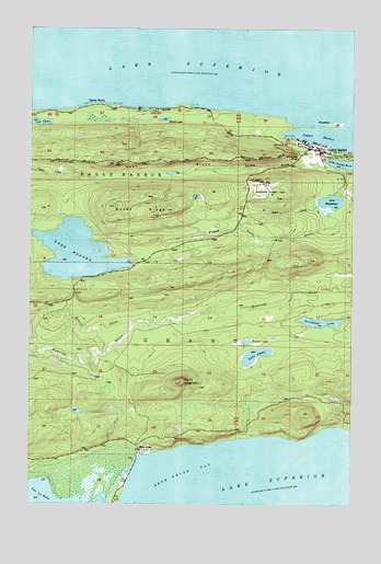
Lake Medora, MI USGS Topographic Map
Click on map above to begin viewing in our Map Viewer.

This topographic map contains these locations and features:
Feature Name Type Latitude Longitude GNIS ID View Map
Aetna CreekStreamN47.4538°W87.8879°619860View Map
Bete GrisePopulated PlaceN47.3888°W87.9551°621195View Map
Breakfast LakeLakeN47.4230°W87.8875°621911View Map
Brockway NoseSummitN47.4671°W87.8984°622020View Map
Copper HarborPopulated PlaceN47.4688°W87.8884°623809View Map
Copper Harbor CemeteryCemeteryN47.4672°W87.8957°2112226View Map
Copper Harbor Census Designated PlaceCensusN47.4704°W87.8750°2628662View Map
Copper Harbor Fire DepartmentBuildingN47.4661°W87.8881°2626718View Map
Copper Harbor MarineLocaleN47.4713°W87.8968°1618232View Map
Copper Harbor Post OfficePost OfficeN47.4677°W87.8884°2112234View Map
Copper Harbor SchoolSchoolN47.4681°W87.8892°2112230View Map
Dans PointCapeN47.4802°W87.9746°624306View Map
French Annie CreekStreamN47.4507°W87.8829°626475View Map
Garden BrookStreamN47.4641°W87.8843°626631View Map
Grant Township Town HallBuildingN47.4681°W87.8889°2112232View Map
Hebard ParkParkN47.4782°W87.9526°1617987View Map
Keweenaw County ParkParkN47.4566°W87.9079°629644View Map
Keweenaw Mountain Lodge Golf CourseLocaleN47.4583°W87.9139°2112202View Map
Lake AddieLakeN47.4141°W87.9124°619838View Map
Lake Fanny Hooe Resort and CampgroundLocaleN47.4658°W87.8864°2112200View Map
Lake GlazonLakeN47.4751°W87.9979°626866View Map
Lake ManganeseLakeN47.4547°W87.8834°631380View Map
Lake MedoraLakeN47.4409°W87.9819°632072View Map
Manganese FallsFallsN47.4600°W87.8783°2112201View Map
Meadow LakeLakeN47.4177°W87.9162°632050View Map
Medora RiverStreamN47.4227°W87.9609°632071View Map
Mount HoughtonSummitN47.4071°W87.9418°628676View Map
Mudd LakeLakeN47.4759°W87.9483°633088View Map
North Piech LighthouseLocaleN47.3755°W87.9684°1618230View Map
Porters IslandIslandN47.4749°W87.8832°1618000View Map
Rocky RidgeRidgeN47.4523°W87.9471°636103View Map
Township of GrantCivilN47.3982°W87.8855°1626381View Map
West BluffCliffN47.4646°W87.9451°1616019View Map

Note: Coordinates in the location and feature list above are referenced to NAD83 datum.


Copyright (C) 2008-2025 Ryan Niemi / Sunset Dynamics ... All Rights Reserved