TopoQuest Logo
Do you find TopoQuest useful?
Help keep TopoQuest running and adding new maps/features by donating!
Bitcoin:  19c7KJd3qBynnjoSw5npx9KScwjBe4ifkT
Litecoin:  LXs6TkuXGGXo1vDsWCkWVdjQX94eUKd6ui
Home View Maps Find Maps Find Places Resources & Links


Laneburg, Arkansas Topographic Map

USGS Map Title: Laneburg, AR
USGS Map MRC: 33093F3
DRG (GeoTIFF) Download: o33093f3.tif


Neighboring USGS Topographic Map Quads:


  Prescott West, AR  
33093G4
 

  Prescott East, AR  
33093G3
 

  Whelen Springs, AR  
33093G2
 

  Emmet, AR  
33093F4
 

  Laneburg, AR  
33093F3
 

  Bluff City, AR  
33093F2
 

  Bodcaw, AR  
33093E4
 

  Willisville, AR  
33093E3
 

  Waterloo, AR  
33093E2


Map MRC Location:

N34°
W94°
N34°
W93°
H8 H7 H6 H5 H4 H3 H2 H1
G8 G7 G6 G5 G4 G3 G2 G1
F8 F7 F6 F5 F4 F3 F2 F1
E8 E7 E6 E5 E4 E3 E2 E1
D8 D7 D6 D5 D4 D3 D2 D1
C8 C7 C6 C5 C4 C3 C2 C1
B8 B7 B6 B5 B4 B3 B2 B1
A8 A7 A6 A5 A4 A3 A2 A1
N33°
W94°
N33°
W93°

Laneburg, AR USGS 1:24K Topographic Map Preview:
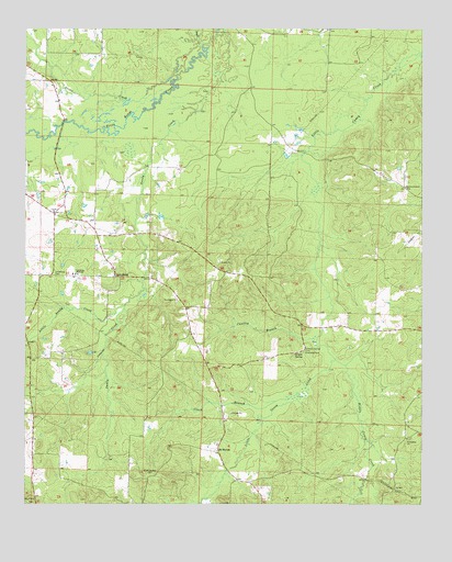
Laneburg, AR USGS Topographic Map
Click on map above to begin viewing in our Map Viewer.

This topographic map contains these locations and features:
Feature Name Type Latitude Longitude GNIS ID View Map
Bluff Springs CemeteryCemeteryN33.6332°W93.3374°46777View Map
Cantley BranchStreamN33.6684°W93.2846°47453View Map
Clark BranchStreamN33.6526°W93.2921°47797View Map
Friendship ChurchChurchN33.6421°W93.2546°49259View Map
LaneburgPopulated PlaceN33.6851°W93.3468°77443View Map
Laneburg CemeteryCemeteryN33.6851°W93.3654°50980View Map
Laneburg High SchoolSchoolN33.6854°W93.3596°50981View Map
Laneburg Volunteer Fire Department Station 1BuildingN33.6756°W93.3245°2116699View Map
Laneburg Volunteer Fire Department Station 2BuildingN33.6629°W93.3598°2116700View Map
Little Sandy CreekStreamN33.6771°W93.3438°51326View Map
Middle Caney CreekStreamN33.6632°W93.2777°51926View Map
Mount Canaan Church (historical)ChurchN33.7498°W93.2888°60371View Map
Mount MoriahPopulated PlaceN33.6387°W93.3143°57128View Map
Mount Moriah United Methodist ChurchChurchN33.6407°W93.3146°60372View Map
Nevada CountyCivilN33.6640°W93.3071°69169View Map
New Mount Moriah (historical)Populated PlaceN33.6307°W93.3043°60377View Map
New Salem ChurchChurchN33.6787°W93.3277°52737View Map
Onion CreekStreamN33.7379°W93.3279°53052View Map
Rocky Mound School (historical)SchoolN33.6829°W93.2946°60389View Map
Salem School (historical)SchoolN33.6943°W93.3277°60391View Map
Sandy CreekStreamN33.7496°W93.3127°54575View Map
Serepta SpringSpringN33.6648°W93.2879°54673View Map
Serepta Spring CemeteryCemeteryN33.6657°W93.2868°54674View Map
Serepta Springs (historical)Populated PlaceN33.6654°W93.2877°60392View Map
Sewer CreekStreamN33.7459°W93.3199°78318View Map
Thomasville School (historical)SchoolN33.7490°W93.3682°60395View Map
Township of GeorgiaCivilN33.6885°W93.2632°68902View Map
United ChurchChurchN33.7018°W93.3660°55839View Map
Westmoreland CemeteryCemeteryN33.7076°W93.2549°56206View Map
Westmoreland Church (historical)ChurchN33.7082°W93.2557°60399View Map

Note: Coordinates in the location and feature list above are referenced to NAD83 datum.


Copyright (C) 2008-2025 Ryan Niemi / Sunset Dynamics ... All Rights Reserved