TopoQuest Logo
Do you find TopoQuest useful?
Help keep TopoQuest running and adding new maps/features by donating!
Bitcoin:  19c7KJd3qBynnjoSw5npx9KScwjBe4ifkT
Litecoin:  LXs6TkuXGGXo1vDsWCkWVdjQX94eUKd6ui
Home View Maps Find Maps Find Places Resources & Links


Letitia, Oklahoma Topographic Map

USGS Map Title: Letitia, OK
USGS Map MRC: 34098E2
DRG (GeoTIFF) Download: o34098e2.tif


Neighboring USGS Topographic Map Quads:


  Arbuckle Hill, OK  
34098F3
 

  Sterling, OK  
34098F2
 

  Denton, OK  
34098F1
 

  Ninemile Creek, OK  
34098E3
 

  Letitia, OK  
34098E2
 

  Nellie, OK  
34098E1
 

  Walters NE, OK  
34098D3
 

  Temple NW, OK  
34098D2
 

  Empire City, OK  
34098D1


Map MRC Location:

N35°
W99°
N35°
W98°
H8 H7 H6 H5 H4 H3 H2 H1
G8 G7 G6 G5 G4 G3 G2 G1
F8 F7 F6 F5 F4 F3 F2 F1
E8 E7 E6 E5 E4 E3 E2 E1
D8 D7 D6 D5 D4 D3 D2 D1
C8 C7 C6 C5 C4 C3 C2 C1
B8 B7 B6 B5 B4 B3 B2 B1
A8 A7 A6 A5 A4 A3 A2 A1
N34°
W99°
N34°
W98°

Letitia, OK USGS 1:24K Topographic Map Preview:
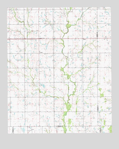
Letitia, OK USGS Topographic Map
Click on map above to begin viewing in our Map Viewer.

This topographic map contains these locations and features:
Feature Name Type Latitude Longitude GNIS ID View Map
Armstrong CreekStreamN34.6045°W98.1773°1089702View Map
Ash Grove School (historical)SchoolN34.5792°W98.1945°1101207View Map
Beaver Bend School (historical)SchoolN34.6237°W98.2470°1101208View Map
BethelPopulated PlaceN34.5942°W98.1592°1100208View Map
Bethel Road Volunteer Fire DepartmentBuildingN34.5500°W98.1593°2658608View Map
Dry Beaver CreekStreamN34.5231°W98.1775°1092207View Map
Fairview School (historical)SchoolN34.6226°W98.1845°1101213View Map
HulenPopulated PlaceN34.5040°W98.2214°1100515View Map
Hulen ChurchChurchN34.5067°W98.2245°1101119View Map
Hulen Volunteer Fire DepartmentBuildingN34.5074°W98.2273°2658278View Map
KMGZ-FM (Lawton)TowerN34.5948°W98.2134°1102807View Map
LetitiaPopulated PlaceN34.5795°W98.2117°1100575View Map
Letitia Community CemeteryCemeteryN34.5823°W98.2112°2708443View Map
Messing School (historical)SchoolN34.5801°W98.2475°1101222View Map
Ninemile Beaver CreekStreamN34.6245°W98.1737°1095881View Map
Oknoname 031031 DamDamN34.5334°W98.2303°1753555View Map
Oknoname 031031 ReservoirReservoirN34.5328°W98.2316°1753556View Map
Oknoname 031032 DamDamN34.5384°W98.2403°1753557View Map
Oknoname 031032 ReservoirReservoirN34.5381°W98.2401°1753558View Map
Oknoname 031034 DamDamN34.5701°W98.2103°1753561View Map
Oknoname 031034 ReservoirReservoirN34.5709°W98.2110°1753562View Map
Oknoname 031035 DamDamN34.5684°W98.2103°1753563View Map
Oknoname 031035 ReservoirReservoirN34.5684°W98.2103°1753564View Map
Oknoname 031055 ReservoirReservoirN34.5867°W98.2037°1753600View Map
Oknoname 031056 DamDamN34.5867°W98.2037°1753599View Map
Oknoname 031057 DamDamN34.5884°W98.2037°1753601View Map
Oknoname 031057 ReservoirReservoirN34.5887°W98.2051°1753602View Map
Pleasant Valley Community House (historical)LocaleN34.5365°W98.2117°1101227View Map
Pumpkin CenterLocaleN34.5940°W98.2120°1096955View Map
Rock Creek Church (historical)ChurchN34.5354°W98.1250°1101231View Map
Township of HulenCivilN34.5504°W98.2197°2413527View Map
Township of HulenCivilN34.5501°W98.2295°1825354View Map

Note: Coordinates in the location and feature list above are referenced to NAD83 datum.


Copyright (C) 2008-2025 Ryan Niemi / Sunset Dynamics ... All Rights Reserved