TopoQuest Logo
Do you find TopoQuest useful?
Help keep TopoQuest running and adding new maps/features by donating!
Bitcoin:  19c7KJd3qBynnjoSw5npx9KScwjBe4ifkT
Litecoin:  LXs6TkuXGGXo1vDsWCkWVdjQX94eUKd6ui
Home View Maps Find Maps Find Places Resources & Links


Logan, Montana Topographic Map

USGS Map Title: Logan, MT
USGS Map MRC: 45111H4
DRG (GeoTIFF) Download: o45111h4.tif


Neighboring USGS Topographic Map Quads:


  Plunket Lake, MT  
46111A5
 

  Lombard, MT  
46111A4
 

  Roy Gulch, MT  
46111A3
 

  Three Forks, MT  
45111H5
 

  Logan, MT  
45111H4
 

  Nixon Gulch, MT  
45111H3
 

  Three Forks SE, MT  
45111G5
 

  Manhattan SW, MT  
45111G4
 

  Manhattan, MT  
45111G3


Map MRC Location:

N46°
W112°
N46°
W111°
H8 H7 H6 H5 H4 H3 H2 H1
G8 G7 G6 G5 G4 G3 G2 G1
F8 F7 F6 F5 F4 F3 F2 F1
E8 E7 E6 E5 E4 E3 E2 E1
D8 D7 D6 D5 D4 D3 D2 D1
C8 C7 C6 C5 C4 C3 C2 C1
B8 B7 B6 B5 B4 B3 B2 B1
A8 A7 A6 A5 A4 A3 A2 A1
N45°
W112°
N45°
W111°

Logan, MT USGS 1:24K Topographic Map Preview:
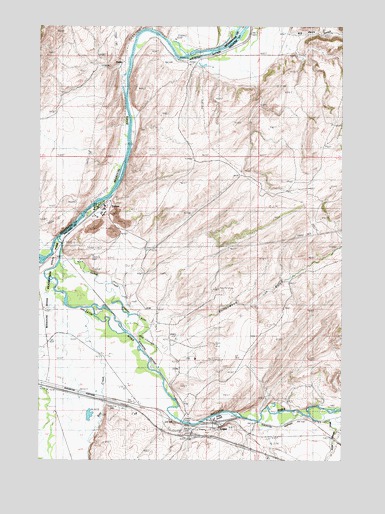
Logan, MT USGS Topographic Map
Click on map above to begin viewing in our Map Viewer.

This topographic map contains these locations and features:
Feature Name Type Latitude Longitude GNIS ID View Map
02N02E09CBDA01 WellWellN45.9394°W111.4894°813473View Map
02N02E15BCDB01 WellWellN45.9266°W111.4702°813396View Map
02N02E17DDCC01 WellWellN45.9188°W111.4983°813357View Map
02N02E20DAC_01 WellWellN45.9080°W111.4983°813278View Map
02N02E20DDCB01 WellWellN45.9049°W111.4986°813241View Map
02N02E21ACDB01 WellWellN45.9122°W111.4802°813323View Map
02N02E22CCC_01 WellWellN45.9052°W111.4719°813247View Map
02N02E27CADD01 WellWellN45.8938°W111.4636°813162View Map
02N02E27CBC_01 WellWellN45.8944°W111.4722°813170View Map
02N02E27CDDC01 WellWellN45.8897°W111.4644°813119View Map
02N02E27DCA_01 WellWellN45.8924°W111.4589°813142View Map
02N02E27DCA_02 WellWellN45.8924°W111.4589°813143View Map
02N02E27DCB_01 WellWellN45.8924°W111.4608°813144View Map
02N02E28BC__01 WellWellN45.8985°W111.4908°813195View Map
02N02E28BCD_01 WellWellN45.8983°W111.4908°813193View Map
02N02E28CADC01 WellWellN45.8933°W111.4847°813154View Map
02N02E28CADC02 WellWellN45.8933°W111.4847°813155View Map
02N02E28CADC03 WellWellN45.8933°W111.4847°813156View Map
02N02E28CADC04 WellWellN45.8933°W111.4847°813157View Map
02N02E28CBDD01 WellWellN45.8958°W111.4894°813177View Map
02N02E29AD__01 WellWellN45.8985°W111.4958°813196View Map
02N02E29DD__01 WellWellN45.8908°W111.4794°813127View Map
02N02E32AAAA01 WellWellN45.8885°W111.4952°813114View Map
02N02E32AAAA02 WellWellN45.8885°W111.4952°813115View Map
02N02E35AB__01 WellWellN45.8877°W111.4391°813096View Map
02N02E35AB__02 WellWellN45.8877°W111.4391°813097View Map
02N02E35AD__01 WellWellN45.8841°W111.4339°813062View Map
02N02E35AD__02 WellWellN45.8841°W111.4339°813063View Map
02N02E35ADDA01 WellWellN45.8835°W111.4319°813057View Map
02N02E35BBB_01 WellWellN45.8880°W111.4508°813101View Map
02N02E35DB__01 WellWellN45.8805°W111.4391°813027View Map
02N02E35DCD_01 WellWellN45.8752°W111.4383°812984View Map
02N02E36BA__01 WellWellN45.8877°W111.4236°813094View Map
02N02E36BB__01 WellWellN45.8877°W111.4289°813095View Map
02N02E36BC__01 WellWellN45.8841°W111.4289°813061View Map
02N02E36BCAA01 WellWellN45.8852°W111.4275°813079View Map
02N03E31CD__01 SpringSpringN45.8772°W111.4025°813007View Map
02N03E32AC__01 SpringSpringN45.8844°W111.3766°813070View Map
Big Davis GulchValleyN45.9974°W111.3955°768775View Map
CarpenterPopulated PlaceN45.8913°W111.4644°769612View Map
Cottonwood GulchValleyN45.9094°W111.4444°770194View Map
Cress SpringsSpringN45.9402°W111.4619°1743653View Map
EustisPopulated PlaceN45.9897°W111.4666°771251View Map
Gallatin (historical)Populated PlaceN45.9277°W111.4980°1743875View Map
Gallatin (historical)LocaleN45.9277°W111.4980°1743876View Map
Gallatin Post Office (historical)Post OfficeN45.9277°W111.4980°1743792View Map
Gallatin RiverStreamN45.9386°W111.4935°771688View Map
Green RanchLocaleN45.9524°W111.3989°771969View Map
Headwaters CemeteryCemeteryN45.9277°W111.4994°1743531View Map
Interchange 283CrossingN45.8819°W111.4380°1737976View Map
LoganPopulated PlaceN45.8844°W111.4275°773548View Map
Logan (historical)LocaleN45.8844°W111.4275°1743861View Map
Logan BridgeBridgeN45.8860°W111.4419°1737903View Map
Logan CemeteryCemeteryN45.8880°W111.4719°773549View Map
Logan Census Designated PlaceCensusN45.8843°W111.4235°2583825View Map
Logan Post Office (historical)Post OfficeN45.8844°W111.4275°1743801View Map
Logan School (historical)SchoolN45.8844°W111.4275°1743497View Map
Missouri Headwaters CampgroundLocaleN45.9327°W111.4930°1737966View Map
Missouri River Headwaters State ParkParkN45.9208°W111.4980°807061View Map
Moncrete (historical)LocaleN45.8908°W111.4641°1743853View Map
Northern Pacific Railroad BridgeBridgeN45.8860°W111.4336°1737935View Map
Rea (historical)LocaleN45.8916°W111.4722°1743844View Map
Rekap (historical)LocaleN45.9902°W111.4425°1743840View Map
Rey CreekStreamN45.9116°W111.4689°775732View Map
Sinton (historical)LocaleN45.8833°W111.4314°1743835View Map
Spring CreekStreamN45.9327°W111.4916°806320View Map
Three Forks DivisionCivilN45.9022°W111.4625°1940727View Map
TridentLocaleN45.9474°W111.4766°1743674View Map
TridentPopulated PlaceN45.9474°W111.4766°777760View Map
Trident BridgeBridgeN45.9374°W111.4911°1737887View Map
Trident Post Office (historical)Post OfficeN45.9474°W111.4766°1743814View Map
Trident School (historical)SchoolN45.9485°W111.4716°1738051View Map
Warm Springs CanalCanalN45.8866°W111.3830°806310View Map

Note: Coordinates in the location and feature list above are referenced to NAD83 datum.


Copyright (C) 2008-2024 Ryan Niemi / Sunset Dynamics ... All Rights Reserved