TopoQuest Logo
Do you find TopoQuest useful?
Help keep TopoQuest running and adding new maps/features by donating!
Bitcoin:  19c7KJd3qBynnjoSw5npx9KScwjBe4ifkT
Litecoin:  LXs6TkuXGGXo1vDsWCkWVdjQX94eUKd6ui
Home View Maps Find Maps Find Places Resources & Links


Luzerne NW, Michigan Topographic Map

USGS Map Title: Luzerne NW, MI
USGS Map MRC: 44084F4
DRG (GeoTIFF) Download: o44084f4.tif


Neighboring USGS Topographic Map Quads:


  K P Lake, MI  
44084G5
 

  Lovells, MI  
44084G4
 

  Comstock Hills, MI  
44084G3
 

  Wakeley Lake, MI  
44084F5
 

  Luzerne NW, MI  
44084F4
 

  Red Oak, MI  
44084F3
 

  Roscommon North, MI  
44084E5
 

  Eldorado, MI  
44084E4
 

  Luzerne, MI  
44084E3


Map MRC Location:

N45°
W85°
N45°
W84°
H8 H7 H6 H5 H4 H3 H2 H1
G8 G7 G6 G5 G4 G3 G2 G1
F8 F7 F6 F5 F4 F3 F2 F1
E8 E7 E6 E5 E4 E3 E2 E1
D8 D7 D6 D5 D4 D3 D2 D1
C8 C7 C6 C5 C4 C3 C2 C1
B8 B7 B6 B5 B4 B3 B2 B1
A8 A7 A6 A5 A4 A3 A2 A1
N44°
W85°
N44°
W84°

Luzerne NW, MI USGS 1:24K Topographic Map Preview:
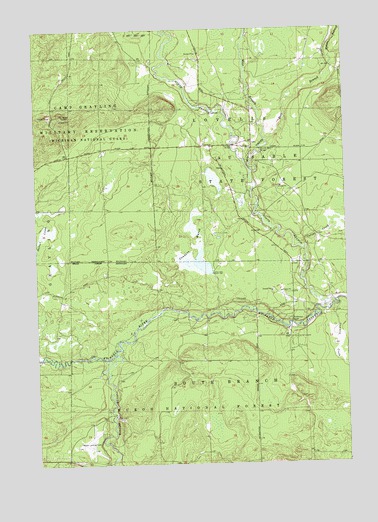
Luzerne NW, MI USGS Topographic Map
Click on map above to begin viewing in our Map Viewer.

This topographic map contains these locations and features:
Feature Name Type Latitude Longitude GNIS ID View Map
Bald HillSummitN44.7256°W84.4884°1619075View Map
Big CreekStreamN44.7089°W84.4122°1619189View Map
Blonde Dam BridgeBridgeN44.7156°W84.4089°1623246View Map
Carter CreekStreamN44.6875°W84.3911°1619443View Map
Conners MarshSwampN44.6832°W84.4374°1619561View Map
Conners Marsh FloodingLocaleN44.6820°W84.4178°1622892View Map
East Branch Big CreekStreamN44.7181°W84.4064°1619799View Map
Gammey CreekStreamN44.6695°W84.3792°1619993View Map
Kelleys AirportAirportN44.6317°W84.4777°1623937View Map
Kelloggs BridgeBridgeN44.7167°W84.4197°1623460View Map
McMasters BridgeBridgeN44.6650°W84.3972°1623509View Map
Middle Branch Big CreekStreamN44.7392°W84.3797°1620808View Map
North Branch Au Sable RiverStreamN44.6706°W84.3809°1621022View Map
Rainbow Bend Forest CampgroundLocaleN44.6697°W84.4178°1622891View Map
South Branch Au Sable RiverStreamN44.6564°W84.4684°1621679View Map
West Branch Big CreekStreamN44.7181°W84.4064°1622092View Map
White Pine CampgroundLocaleN44.6564°W84.4756°1622896View Map
White Pine Canoe CampLocaleN44.6522°W84.4672°2498782View Map

Note: Coordinates in the location and feature list above are referenced to NAD83 datum.


Copyright (C) 2008-2024 Ryan Niemi / Sunset Dynamics ... All Rights Reserved